Monhegan Island Harbor Inlet
| Monhegan Island, Maine United States | |
| 43° 45' 34.92'', -69° 19' 50.89'' | |
| Monhegan Island |


You might also consider...


About
Introduction:
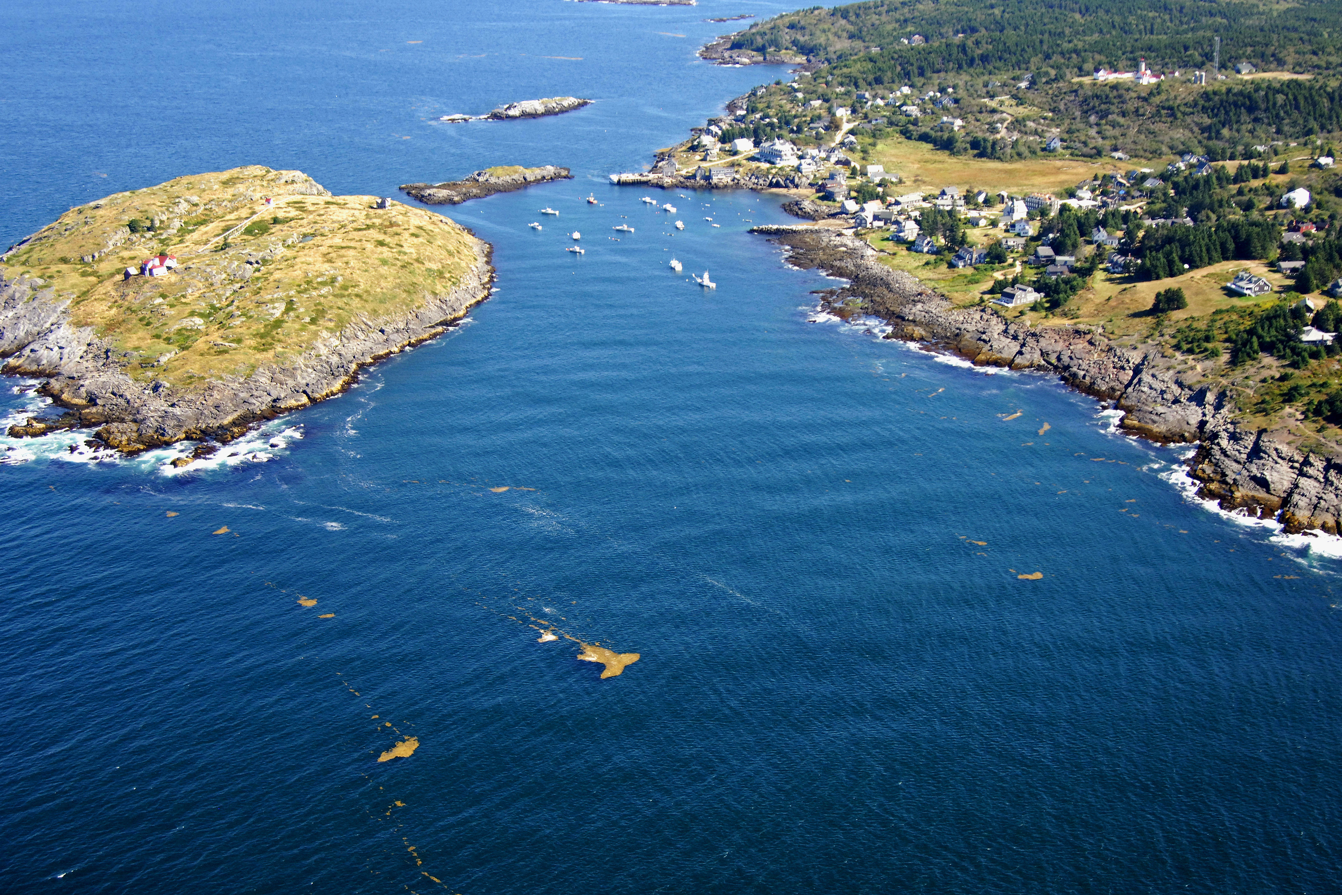
Considered a small artist colony by many, rugged and remote Monhegan Island has a permanent population of only 60 people. Situated some 10 miles off the coast of Maine, the island is today a picturesque summer haven for artists and vacationers. A small harbor is popular for anchoring out and has an open inlet to the ocean.
Monhegan Island is about 30 miles southwest of Vinalhaven Island and 45 miles east of Portland. The image above is a view from the southwest looking northeast over Monhegan Harbor. To the left (west) is Manana Island, while to the right (east) is Monhegan Island itself. The top portion of the image just beyond Manana Island is Deadman Cove.
There are few facilities on the island, and locals take pride in the relative remoteness and rugged nature of the island. That said, boaters sometimes have a difficult time finding a place to tie up for the night. Not because there are hundred of people line up for a slip, but rather visitors are relatively few and so are slips and moorings.
There is a pier at the harbor waterfront, but tie-ups are limited to 30 minutes, and you have to stay on the boat while it is tied up. You can purchase diesel fuel at the town dock, but make sure you come to Monhegan with your water tanks topped off; there is no potable water down on the waterfront.
If youd prefer to tie op offshore for the evening, you must arrange a tie up from the harbormaster, who is generally wandering around the waterfront somewhere. You may be able to reach him via VHF, but generally you have to try and find him ashore.
History:
It is believed that the first visitors to Monhegan Island were possibly Vikings, and evidence of this has been found in the form of Nordic carvings found on Manana Island. Later to arrive were fisherman from all parts of Europe, who used the area as an outpost for their operations. Native Americans gave the island its name, which means Island of the Sea.
The first settlement was established in 1619. Seventy years later, Baron Castine captured the English settlement for the French. Castine and Castine Harbor, Maine still bear his name.
Navigating the Water:
Use NOAA Chart 13301.
Monhegan Island is generally approached from the southwest via the Atlantic Ocean in order to arrive in the protected town harbor and waterfront. From the Atlantic Ocean, first set a course for flashing red buoy 14M, which is located at an approximate waypoint of N43 45.301 W69 22.465.
Once you have picked up flashing red buoy 14M, set a course of about 099 degrees magnetic for around 2.4 miles until you arrive at Monhegan Harbor. Depths are 51 to 94 feet, but shallow to 15 to 24 feet at the town waterfront.
If you are adventurous and the weather is calm, some boaters anchor just north of the town harbor in Deadmans Cove, but youll have to have a long anchor rode and let out lots of scope. The holding is supposedly very good, but again, its not recommended in all but the calmest weather.
Local Notices to Mariners:
Local Notices to Mariners are available online from the U.S. Coast Guard.