Calcasieu Pass Inlet
| Louisiana United States | |
| 29° 45' 38.88'', -93° 20' 36.95'' |


You might also consider...


About
Introduction:
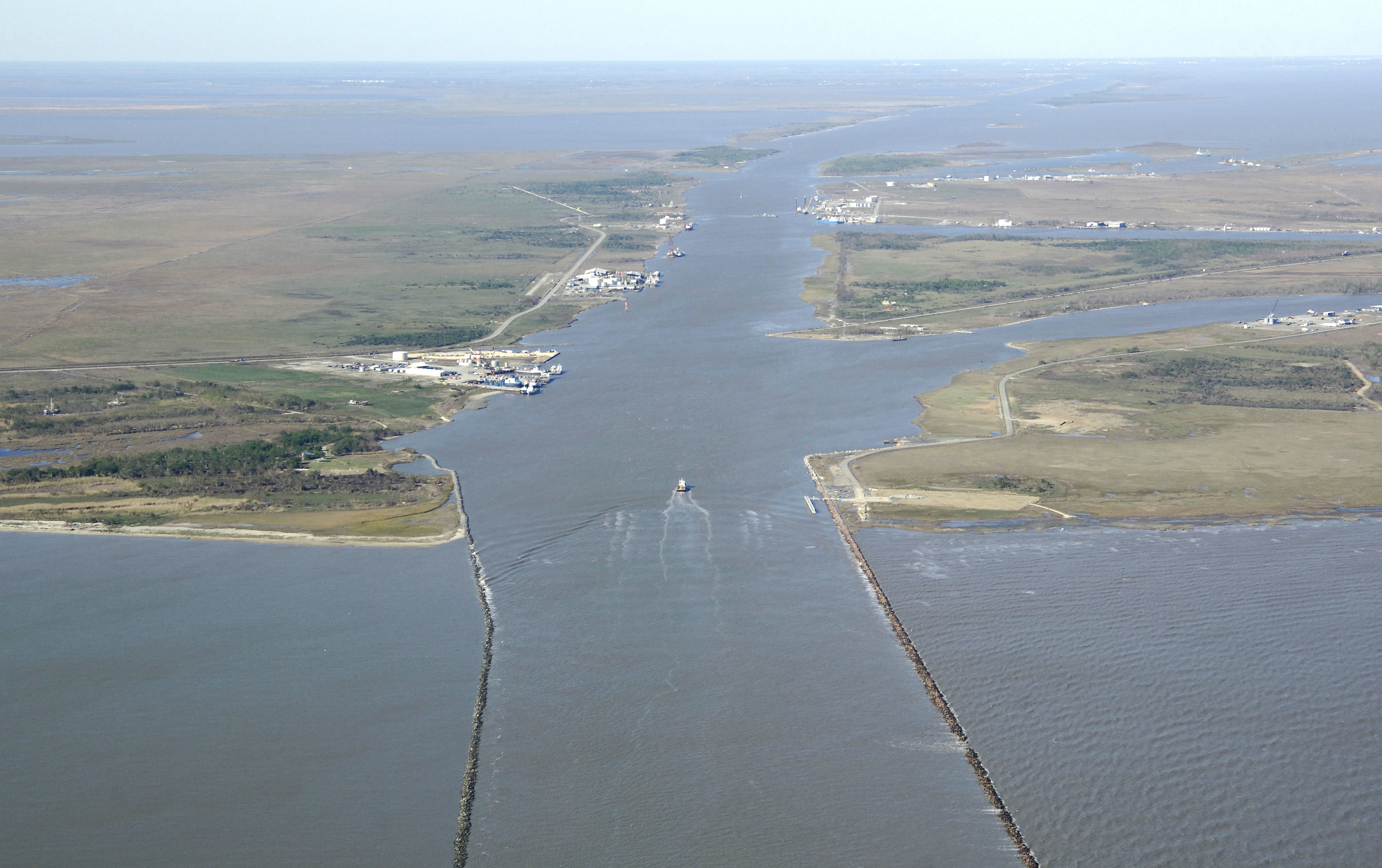
The Clacasieu Pass Inlet a deep-water all-weather inlet on the Gulf Coast of Louisiana used by petroleum and commercial fishing boats to reach points north around Calasieu Lake and also to pick up the Gulf Coast Intracoastal Waterway for passages farther east or west. The Clacasieu Pass Inlet is 31 miles south of Lake Charles and 83 miles southwest of Lafayette.
Navigating the Water:
The Calcasieu River Channel is entered from the Gulf of Mexico via an approach from the south. Although the Calcasieu Ship Channel starts at flashing Morse (A) buoy CC, most recreational boaters approaching from the east or west can set a course toward the area around waypoint 29 40.344W 93 19.753N, which should allow you to intercept green nun buoy 33 and red nun buoy 34 about six miles off the Calcasieu breakwaters.
Once you have arrived at green nun buoy 33 and red nun buoy 34, set a course of about 347 degrees magnetic for about 4.7 miles until you spot flashing green 41 and flashing red 42 on the west and east breakwaters, respectively.
Inside the inlet you can follow the ship channel north for 23 miles to the junction of the Gulf Intracoastal Waterway with the Calcasieu Ship Channel near west of Choupique Island. Be well prepared - marinas and service are limited in the part of the Gulf Coast, with the nearest real facilities being many miles away near Sabine and Port Neches to the west.
Local Notices to Mariners:
See our Local Notices to Mariners blog for updates on the latest conditions and advisories for this area.