The Narrows South Inlet
| St. Petersburg, Florida United States | |
| 27° 50' 0.96'', -82° 49' 49.08'' | |
| Indian Rocks Beach |


You might also consider...


About
Local Notices to Mariners:
Local Notices to Mariners are available online from the U.S. Coast Guard.
Introduction:
Located just south of the town of Indian Shores, The Narrows is a long narrow stretch of water that leads north from Boca Ciega Bay to Clearwater Sound; a distance of about 4.5 miles. Along the way are a variety of good marine facilities and two bascule bridges to clear.
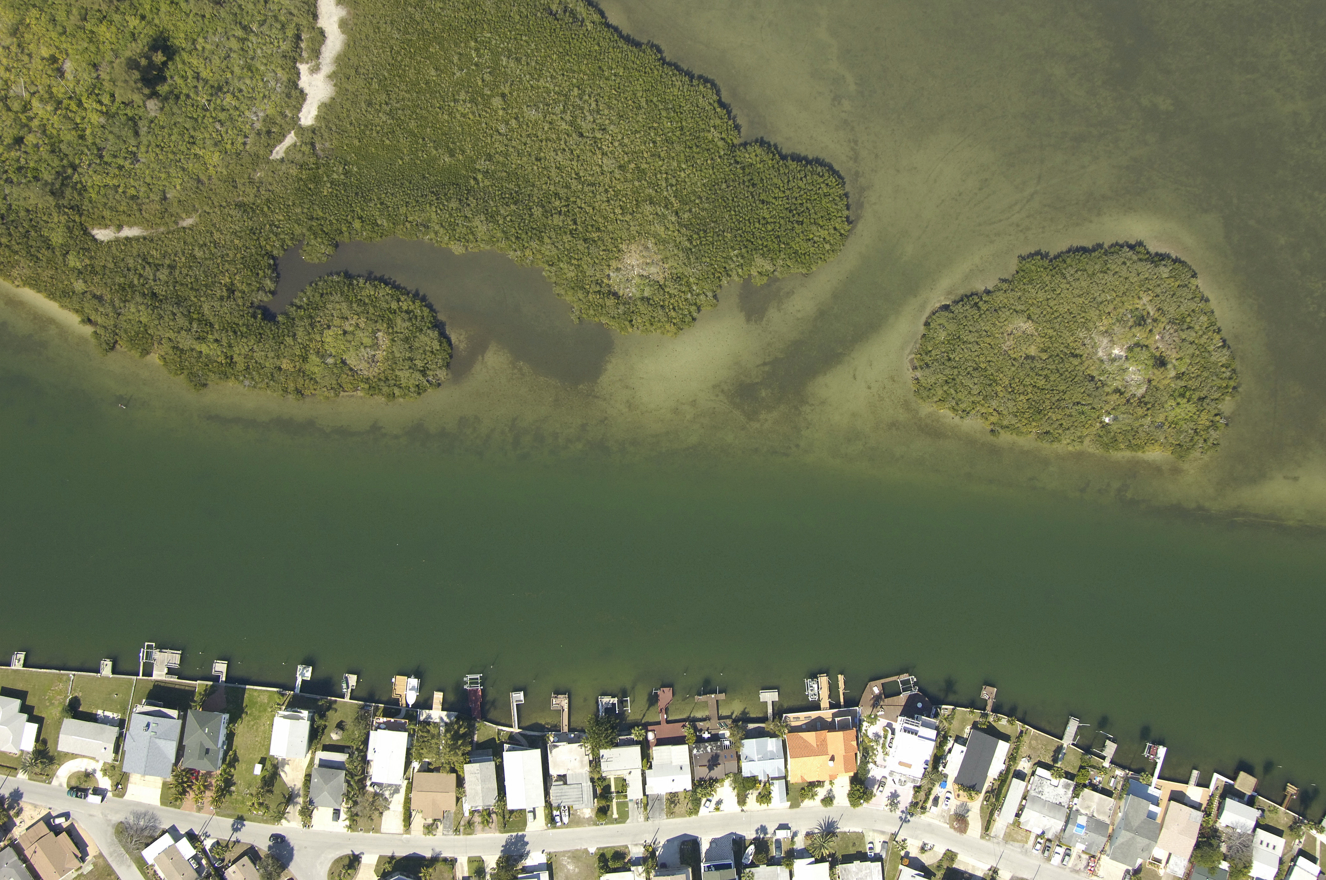
The image above is a view from the southeast looking northwest over the southern entrance to The Narrows. Conch Key is the little island on the right (northeast) side of the channel with Punkin Key lying to the left (west). The clearly marked channel is visible, starting with green daybeacon 25 and red daybeacon 26 toward the bottom of the image.
Navigating the Water:
Use NOAA Chart 11411.
Contrary to its real name, The Narrows is fairly wide and deep, making for easy travel for boaters. Average depths are more than six feet, and the passage is well marked with many daybeacons and alternating fixed lights.
Approaching from the south near Gulf Intracoastal Waterway Mile 125, green daybeacon 1 and flashing red 2 mark the beginning of the approach channel into The Narrows just south of Conch Key. Once you have cleared these marks, proceed to the northwest to pick up green daybeacon 3, red daybeacon 4, flashing green 5, red daybeacon 6, and green daybeacon 7 a little farther on. Once you have cleared green daybeacon 7, the channel opens up into a long stretch that heads off to the north.