Saco River Inlet
| Biddeford, Maine United States | |
| 43° 27' 38.88'', -70° 21' 51.11'' | |
| Saco River at Camp Ellis |


You might also consider...


About
Introduction:
The Saco River leads to the twin towns of Biddeford and Saco, which both lie five miles upstream. Located off of Saco Bay and Wood Island Harbor, the Saco area is a popular area for cruisers who want to explore Wood Island, The Pool and Biddeford-Saco.
The Saco River empties into Saco Bay about 15 miles southwest of Portland and 10 miles northeast of Kennebunkport. The town of Biddeford is located about 4.5 miles upstream from the Saco River Inlet.
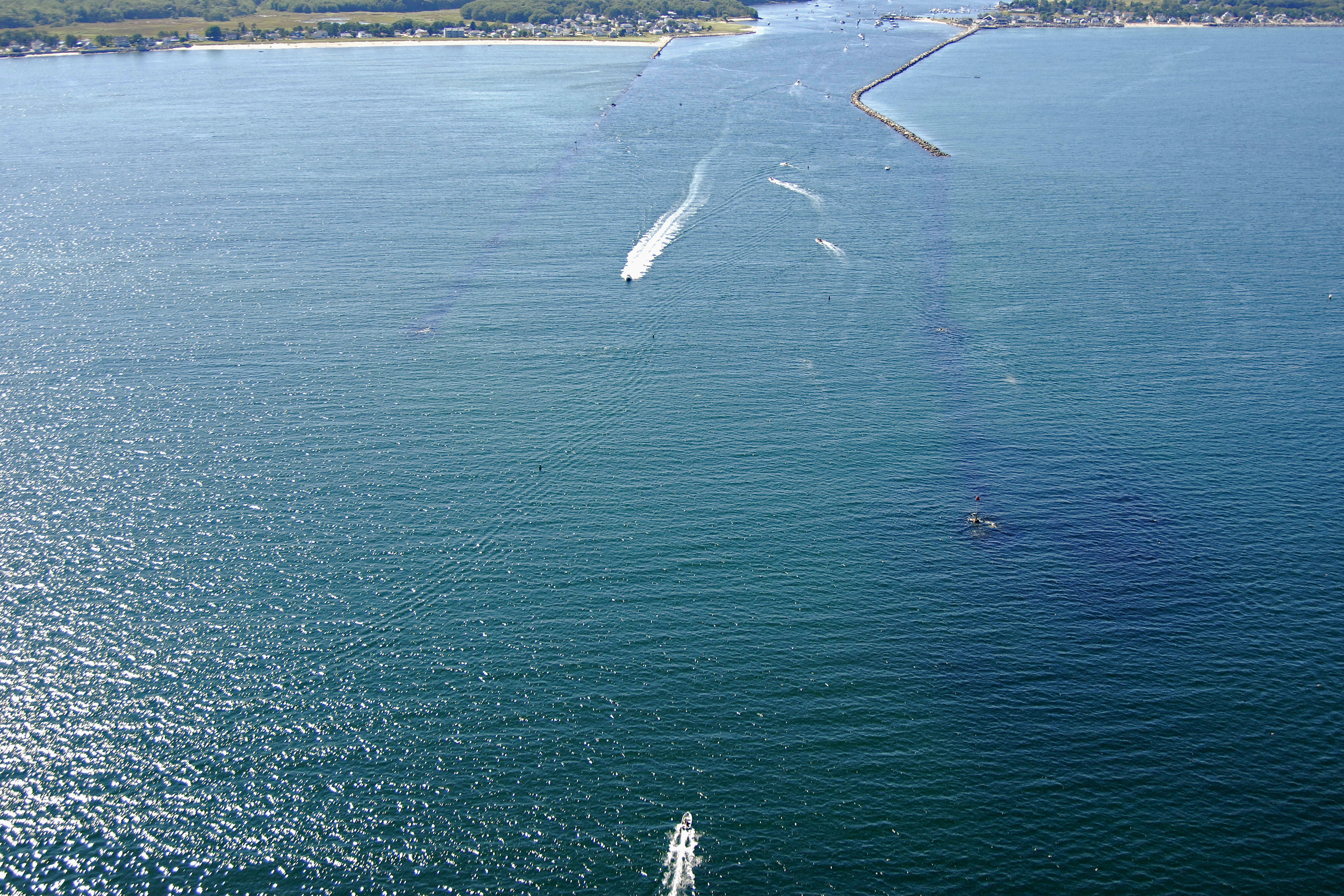
The image above is a view from the east looking west over the jettied entrance to the Saco River at Saco Bay. The piece of land on the left (south) side of the inlet is Freddy Beach, and just across the river to the right (north), Ferry Beach is visible.
Navigating the Water:
Use NOAA Chart 13287.
The Saco River Inlet is reached via an approach from the east through Saco Bay. Arriving from offshore, first set a course for red and white buoy SA, which is located at an approximate waypoint of N43 29.722 W70 20.299. Coincidentally, this will place you between green can buoy 1 and red nun buoy 2.
From red and white buoy SA, set and follow a new course of about 269 degrees magnetic for approximately eight-tenths of a mile until you reach flashing red buoy 4 near the eastern ends of the partially submerged Saco River jetties. A closer examination of the image above shows these jetties and the navigational aids that mark them.
Once you have successfully navigated to flashing red buoy 4, you should be able to see a long line of red and green buoys and daybeacons that mark the locations of the submerged portions of the old jetties. Past flashing red buoy 4, you will encounter the following aids to navigation, in order: red daybeacon 4A, green can buoy 5. green daybeacon 5A, red nun buoy 6, red nun buoy 6B, and then green daybeacon 5B.
When you arrive at red nun buoy 6B, set a course of approximately 282 degrees magnetic for about seven-tenths of a mile, which will lead you directly to green can buoy 7. As the channel proceeds northwestward toward the town of Biddeford, the channel tends to favor the southern and southwestern side of the river.
The town of Biddeford is about 4.5 miles upstream from where the Saco River empties into Saco Bay, and is the location of the only transient facilities in the area: Rumerys Boatyard. Rumerys Boatyard holds a couple of slips aside for transient guests (be sure to call ahead for reservations), and also has a 35-ton lift for haul-outs and related repairs.
Local Notices to Mariners:
Local Notices to Mariners are available online from the U.S. Coast Guard.
Helpful Links:
Biddeford-Saco Calendar of Events
Biddeford-Saco Chamber of Commerce and Industry
Portland International Jetport