Ponce de Leon Cut North Inlet
| Ponce, Florida United States | |
| 29° 4' 46.2'', -80° 56' 39.83'' | |
| New Smyrna Beach |
You might also consider...


About
Introduction:
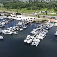
Located on Floridas East Coast at Intracoastal Waterway (ICW) Mile Marker 840 about 13 miles south of Daytona Beach and 48 miles north-northwest of Cape Canaveral, the Ponce de Leon Cut is a man-made land cut originally dug to avoid the hazardous shoals of the Ponce de Leon Inlet, which lies just to the east. The image above is a view from the northeast looking southwest over the opening to the Ponce de Leon Cut Inlet where it branches off the Matanzas River at ICW Mile 840. Closer inspection shows the series of daybeacons placed to guide boaters south into the cut.
Navigating the Water:
Use NOAA Chart 11485.
Depths in the cut range from four to six feet, and the only real obstacle to navigation are the strong currents that can run through the cut at times. From the ICW north of Live Oak Point, pick up flashing green 1 on the Matanzas River just north of the Ponce de Leon Cut. Once you have picked up flashing green 1, set a course to the southwest and intercept green nun buoy 3 and red daybeacon 2 (keep in mind that a turn to port here will take you south to the Ponce de Leon Inlet, not the ICW).
About a half-mile farther downstream, flashing red 4 marks the southward bend in the channel, and is also the location of ICW Mile 840. Red daybeacon 6 is a little farther on, and then the cut runs straight for about two miles until it reaches flashing red 10, where the channel bends east toward its reunion with the Matanzas River.
Most of the marinas are located to the southeast of the Matanzas River after it breaks off at the Ponce de Leon Cut near flashing green 1.
Local Notices to Mariners:
Local Notices to Mariners are available online from the U.S. Coast Guard.


