Essex Bay Inlet
| Essex, Massachusetts United States | |
| 42° 39' 38.88'', -70° 43' 21.01'' | |
| Annisquam Harbor |


You might also consider...


About
Local Notices to Mariners:
Local Notices to Mariners are available online from the U.S. Coast Guard.
Introduction:
Essex Bay is located off Ipswich Bay on the southern end of Bigelow Bight west of Cape Ann. Essex Bay is five miles west of Rockport, 12 miles south of Newburyport and 30 miles northeast of Boston (as the crow flies). Essex Bay is primarily a gunkholing (exploring and anchoring) experience for shoal-draft cruisers (four feet maximum). If youre unsure of your ability to navigate the inlet, just dont try it; the risk outweighs the gain inside.
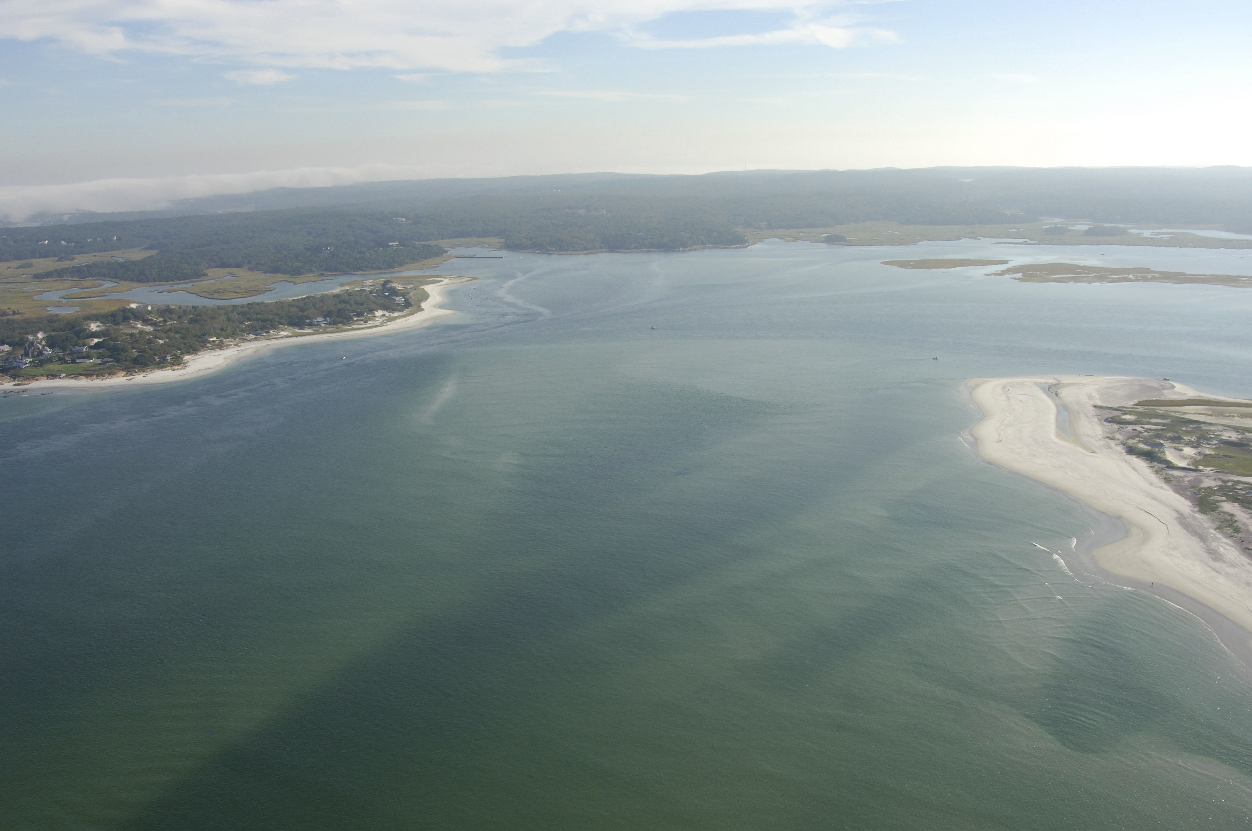
The image above is a view from the northeast looking southwest over the entrance to Essex Bay. To the right (north) is the southern tip of Castle Neck, while to the left (south) is the northern tip of Coffins Beach. After entry, a passage to the right will carry you up the extremely shallow (dinghy exploration only) Castle Neck River. If you bear off to the left (south), you will meet up with the Essex River, which requires local knowledge and a shoal-draft boat.
Navigating the Water:
Use NOAA Chart 13274.
Essex Bay is approached from the south via an entrance channel from Ipswich Bay. Coming in from the north or east, first set a course for flashing green bell buoy 1, which is located about one mile northeast of the Essex Bay Inlet at waypoint N42 40.85 W70 42.25. Once you have safely reached flashing green bell buoy 1, head toward the southwest to meet up with the Essex Bay Inlet entrance.
Though most of the inlet area has depths of seven to 23 feet in many places, the channel itself is constantly shifting and aids to navigation are not charted, as they are moved frequently to reflect current conditions. That said, the Coast Guard is not able to tend to the inlet on a weekly basis and conditions may have changed since they last adjusted the buoys.
Once inside the inlet, green daybeacon 7 appears to port and marks the passage up the Essex River toward the town of Essex (about five miles away), though only small powerboats that draw less then three feet can make the trip. Past the green daybeacon at the Essex Bay entrance you can favor the south side of the channel and feel (sharp eye on the depth sounder) your way west up to Tommy Island where the Essex River officially begins, and then continue west to Cross Island and Conomo Point where a large mooring field is available (some private).
Off to starboard on entry is the Castleneck River, which runs behind its geographical land-based namesake, Castle Neck. This area is strictly for Dinghy exploration as depths are very shoal at its southern end.