Boston Harbor Inlet

You might also consider...

About
Introduction:
Boston is a diverse area, both in boating terms and as a city. Boating areas in Boston are literally spread all over the map. To the north is Winthrop, Snake Island and Belle Isle. Dorchester Bay is to the south and has four marinas near Pleasure Bay and several more south past Columbia Point into the Neponsett River. Also to the south is the Weymouth Fore River where about 16 marinas can be found. As with any large boating area, dont just show up at your destination and assume that they will have space available. Always call ahead and make reservations.
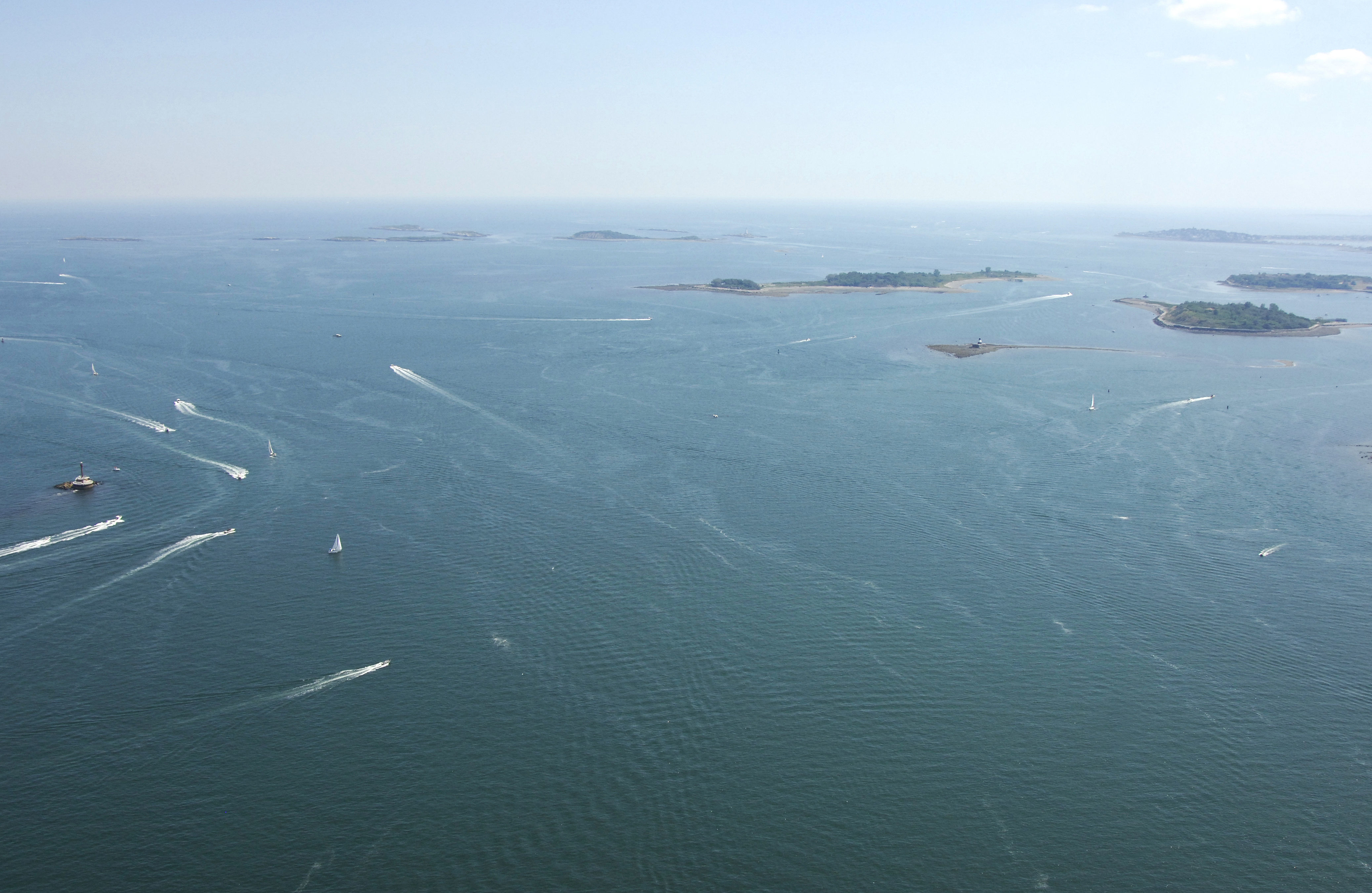
The image above is a view from the east looking west over the entrance to Boston at President Roads, which is the main channel into Boston-proper. The small tip of land off to the left-hand (south) side of the image is the northern end of Long Island (some times referred to as Long Island Head), while the southern tip of Deer Island can be seen off to the right. Farther off in the upper-right-hand portion of the image is Bostons Logan International Airport. Farther still is Downtown Boston, which can be identified by the tall buildings on the horizon.
History:
Boston originally developed as a center for Puritan life and eventually became known as the birthplace of the American Revolution because of the Boston Tea Party, an event that led to further aggressions between the Colonies and Great Britain.
Navigating the Water:
Use NOAA Chart 13270.
Although the approach to Boston begins many miles offshore, we will discuss the primary entrance through the North Channel, which starts just northeast of Deer Island. Approaching from the Atlantic, first pick up red and white Morse (A) buoy NC, which is located near waypoint N42 22.530 W70 54.297. Once you have successfully navigated to Morse (A) NC, set a course of about 248 degrees magnetic for .8 mile to intercept flashing green buoy 1A and flashing red buoy 2.
Having successfully picked up the North Channel Entrance, you can now follow a long line of red or green buoys into the President Roads area (your choice, either side is fine), but we will is the green side of the channel here. From the aforementioned flashing green 1A, set a course to the southwest to pick up flashing green buoy 3, and then follow in flashing green buoy 5, and finally, flashing green buoy 9.
At this point, the route turns into the President Roads Channel at flashing green buoy PR. Once you have picked up flashing green buoy PR, set an approximate course of 264 degrees magnetic for about 2.1 miles to pick up flashing green buoy 1, which will start you into Boston Harbor-proper about a mile east-southeast of Fort Independence.
Various other area sof Boston are discussed in detail throughout our Massachusetts Harbor inlet coverage. These include Dorchester Bay, Weymouth Fore River, Neponsett River and Town River Bay. Marina facilities, navigation suggestions and Local Notices to Mariners are included with each informational page.
Local Notices to Mariners:
Local Notices to Mariners are available online from the U.S. Coast Guard.