Moosabec Reach West Inlet
| Jonesport, Maine United States | |
| 44° 31' 17.4'', -67° 38' 45.61'' | |
| Eastern Harbor |


You might also consider...


About
Introduction:
Moosabec Reach and the town of Jonesport are located on the far Down East Maine Coast about 38 miles northeast of Mount Desert Island and 35 miles southwest of the United States/Canadian border. Moosabec Reach allows east-west travel from Seguin Passag to Outer Goose Island.
Lying on the north side of Moosabec Reach is the town of Jonesport, which has a limited amount of marina and marine service locations, but plenty of places with transient moorings and areas to drop the hook. Many of the seafood and lobster restaurant have temporary dockage available while you eat at their establishment.
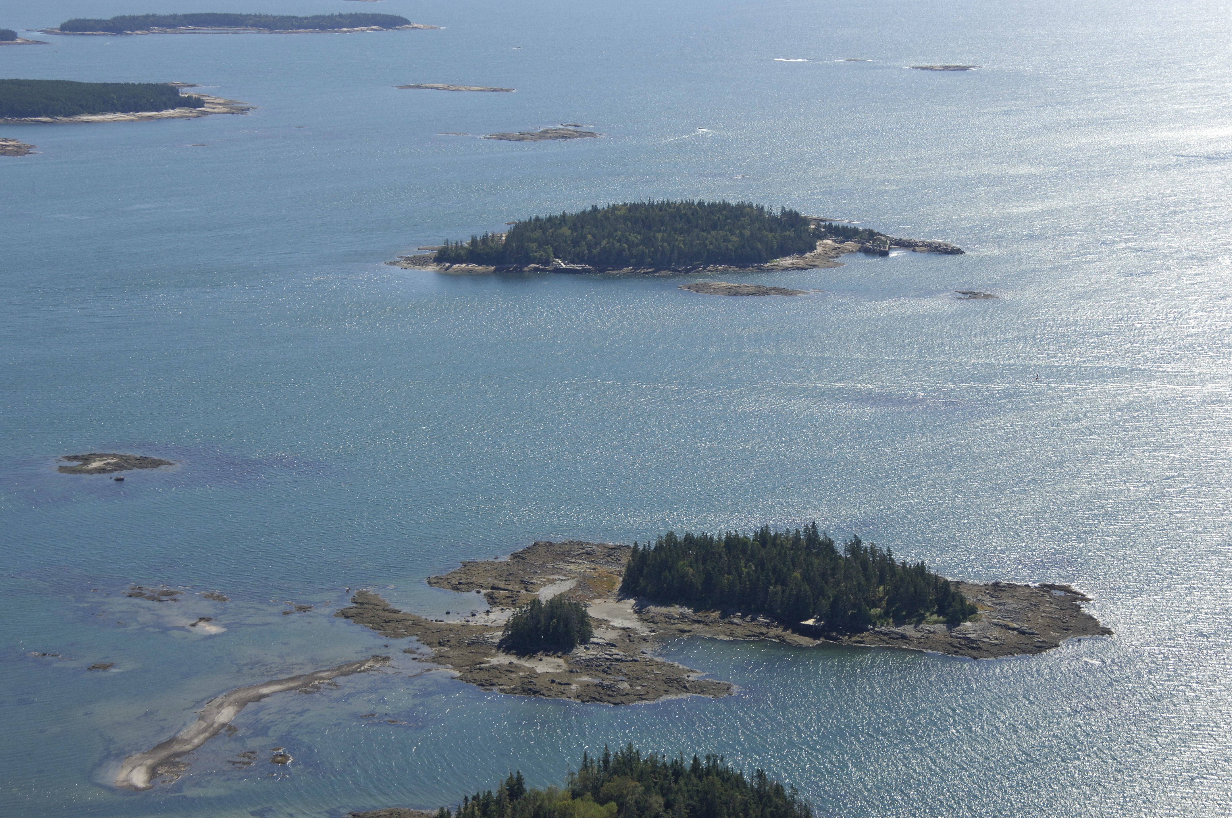
The image above is a view from the west looking east over the western entrance to Moosabec Reach. The first island on the right (south) portion of the image is Hardwood Island, while a little farther up on the same side are Pomp and Norton islands. The first island off to the left (north) is Outer Goose Island and is followed by Doyle Island. Jonesport is the developed area on the left (north) side of Moosabec Reach, and the 39-foot fixed vertical clearance Beals Island Bridge is visible crossing the waterway at this point.
Navigating the Water:
Use NOAA Chart 13326.
Though simpler and less complicated than the eastern approach, the western approach does have a few areas that require attention. Specifically, there are a few rock ledges on the entrance channel that while marked, can catch some boaters off guard. Also keep in mind that the buoys on this side of Moosabec Reach are reversed - leave greens to starboard and reds to port.
To start the approach to the western end of Moosabec Reach, first set a course for green can 25, which is located north of Shabbit island at an approximate waypoint of N44 30.425 W67 41.171. Once you have safely navigated to green can 25, set a new course of about 062 degrees magnetic for approximately .7 miles to pick up green can buoy 23, which marks the location of Shabbit Island Ledge.
Past green can buoy 23, you will set a new course toward the northeast to intercept flashing red bell buoy 22 at Fessenden Ledge. This is the last of any specific rocks ledges on the approach. From flashing red bell buoy 22, set a new course of about 095 degrees magnetic for approximately 1.3 miles. Along the way, you will pass green can buoy 21 and red nun buoy 20.
Once you have cleared green can 21 and red nun buoy 20, continue east. If your overhead clearance is less than 40 feet, you can pass safely under the Beals Island Bridge and on to the east side of Jonesport.
Local Notices to Mariners:
Local Notices to Mariners are available online from the U.S. Coast Guard.