South River Inlet
| Maryland United States | |
| 38° 54' 3.6'', -76° 28' 31.81'' | |
| South River |


You might also consider...


About
Introduction:
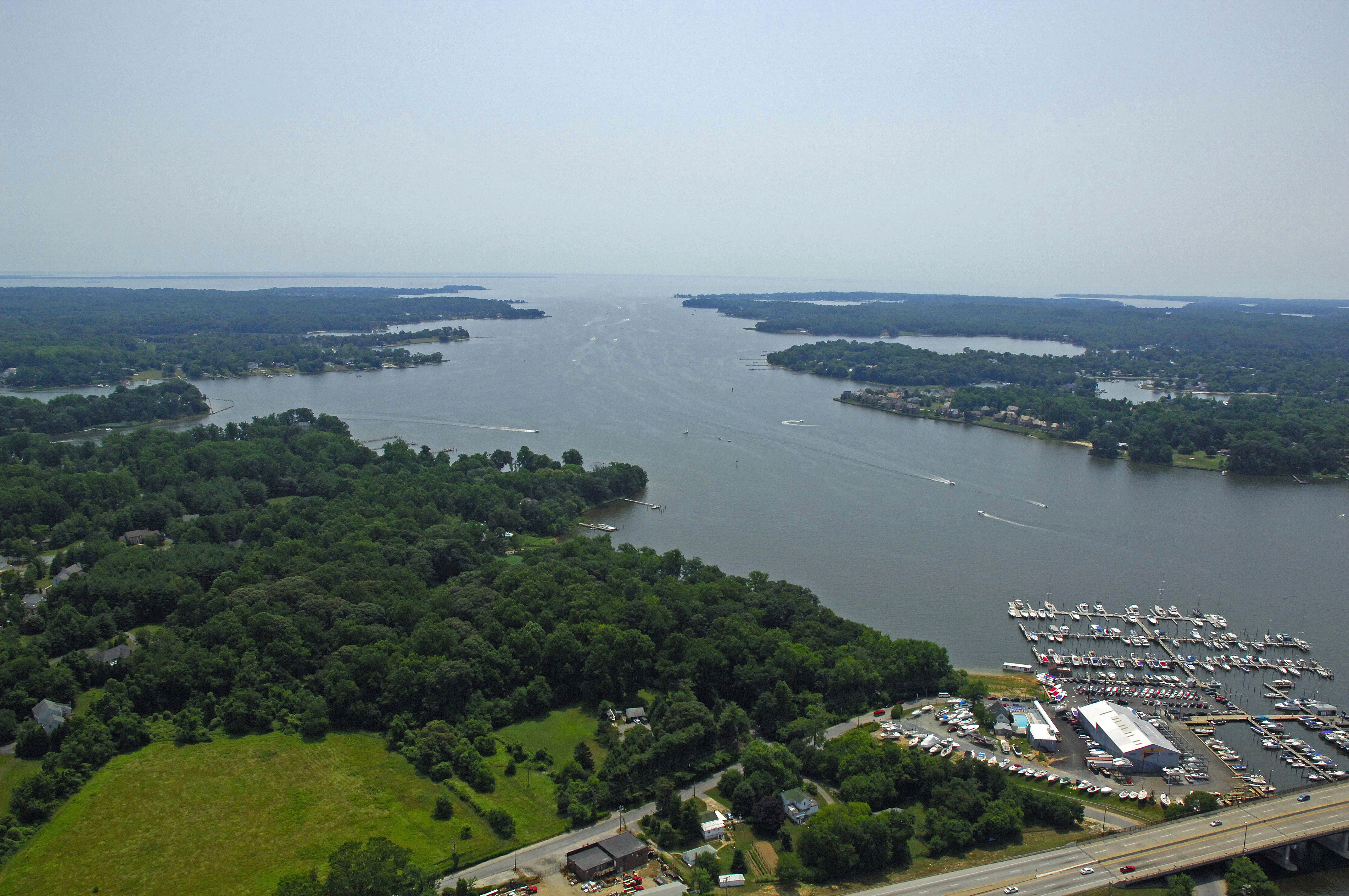
The South River is a major boating area on Marylands Western shore about five miles south of downtown Annapolis and 14 miles south of Kent Island Narrows. There are plenty of marinas and possibilities for exploration here with popular destinations such as Selby Bay, Harness Creek, Glebe bay and Beards Creek. The largest concentration of marinas is picture above in the Selby Bay area.
The image above is a view from the east looking west over the southern portion of the entrance to the South River. Off to the left (south) is the Selby Bay area, which has a large concentration of marinas and marine repair facilities. In the center of the image is Turkey Island and Turkey Point, which extends out from the right (north) end of the island. Outside of the image to the right (north) is Thomas Point, which marks the northern boundary of the entry into the South River.
Navigating the Water:
Use NOAA Chart 12270
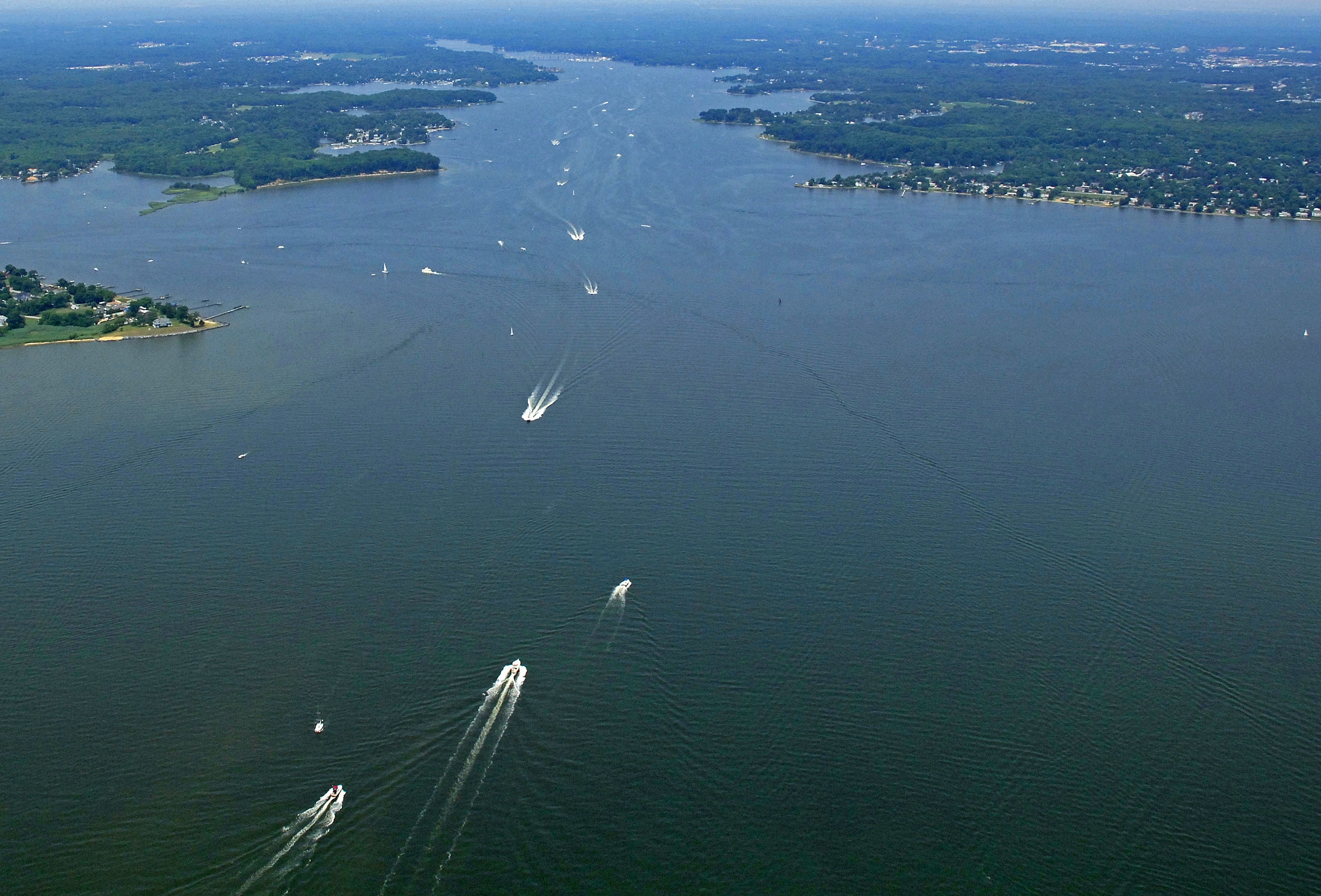
From the Chesapeake Bay, you can make two approaches into the South River area: From the north around Thomas Point, or from the south past the West River and Saunders Point. The entry to the South River is deep and wide, but there are a couple of spots that can put you in trouble if you dont mind some specific marks correctly. Well discuss these problem areas below.
[b]Northerly Approach:[/b]
Approaching from the north, the Thomas Point Shoal Lighthouse (one of the most photographed lighthouses in the world) stands out on the end of a very long shoal that extends southeast from, as the name suggests, Thomas Point. You can cut the light on the inside (to the west) if you draw less that four feet, but if there has been a strong northwest wind over an extended period, play it safe and honor the light, leaving it to starboard as you pass south.
Once you have cleared the Thomas Point Lighthouse, set an approximate course of 288 degrees magnetic for about two miles until you intercept flashing red 4 just south of Marshy Point. (Do not cut this mark too close - give it plenty of distance). Your next step upriver is to clear the narrows between Turkey Point and a shoal that slides south from Cherrytree Cove on the north side of the river. Green daybeacon 5 marks the shoal at Turkey Point on the south side of the channel and flashing red 6 marks the north side of the narrow passage.
[b]Southerly Approach[/b]
If you are approaching from the south as you move up the Bay, first set a course for glashing green buoy 1, which is locate just east of the West River, and then set a new course for flashing red 4 at the mouth to the South River. (Do not cut this mark too close - give it plenty of distance). Your next step upriver is to clear the narrows between Turkey Point and a shoal that slides south from Cherrytree Cove on the north side of the river. Green daybeacon 5 marks the shoal at Turkey Point on the south side of the channel and flashing red 6 marks the north side of the narrow passage.
From here, the river is marked by a series of nun buoys and lighted aids, most of which mark steel shoals that encroach on the main river channel. Also keep in mind that many areas of the river are 6-knot/No-Wake zones, and they are strictly, repeat strictly enforced by local law enforcement.
Local Notices to Mariners:
Local Notices to Mariners are available online from the U.S. Coast Guard.