


Chesapeake Bay Bridge Tunnel
Chesapeake, Virginia United States
Marinas near Chesapeake Bay Bridge Tunnel
| Name | Reviews | Max LOA | VHF | Dock Depth | Gas / Diesel | Lift / Crane | Wifi | Amps |
|---|---|---|---|---|---|---|---|---|
| Lynnhaven Seafood Marina | - | 0.0' | - | Low 0.0 mHigh 0.0' | - | - | - | - |
| Bubbas Crab House and Marina | - | 0.0' | - | Low 0.0'High 0.0' | - | - | - | - |
| Chicks Oyster Bar Marina | - | 0.0' | - | Low 0.0'High 0.0' | - | - | - | - |
| Lynnhaven Municipal Marina | - | - | - | - | GNearbyDNearby | - | - | 30 |
| Lynnhaven Marine | - | 0.0' | 16 | Low 0.0'High 0.0' | GYesDYes | - | - | - |
| The Marina at Marina Shores | 42.0' | - | Low 20.0'High 0.0' | - | - | 30/50 | ||
| Long Bay Pointe Marina | 0.0' | 16 | Low 0.0 mHigh 0.0' | GYesDYes | - | - | - | |
| Little Creek Marina | 145.0' | 16 | - | - | - | - | 30/50 | |
| Bay Point Marina | 180.0' | 16 | Low 6.0' | - | - | - | ||
| The Port at East Beach Marina | 0.0' | - | Low 0.0'High 0.0' | - | - | - | - | |
| Pelicans' Nest Marina | - | - | - | - | GYesDYes | - | - | |
| Morningstar Marinas | Little Creek | 126.0' | 66 | Low 9.0' | G$5.99/galD$5.949/gal | - | 30, 50 | ||
| Cobb's Marina | 0.0' | 16 | Low 0.0 mHigh 0.0' | - | - | - | - | |
| JEB Little Creek Cove Marina | 46.0' | 12 | - | GNearbyDNearby | LNearby | 20-50 | ||
| Southall Landings Marina | - | 0.0' | 16 | Low 0.0 mHigh 0.0' | - | - | - |
History:
In 1956, the Virginia General Assembly authorized the exploration of the construction of a fixed crossing at the mouth of the Chesapeake Bay. Results of the study indicated a crossing was feasible and recommended a series of bridges and tunnels. In the summer of 1960, the Chesapeake Bay Ferry Commission sold $200 million in revenue bonds to private investors. Money collected by future tolls were pledged to pay the principal and interest on these bonds.
No local, state or federal tax money was used in the construction of the project. In April 1964 - just 42 months after construction began - the bridge-tunnel opened to traffic and ferry service was discontinued. To date, over 90 million commercial and passenger vehicles have used the bridge/tunnel complex.
In order to meet future traffic demands and provide for a safer crossing, construction of a parallel crossing project began in summer 1995, and opened to four-lane traffic on April 19, 1999. No less challenging than construction of the original span, this project once again drew focus to a remarkable achievement in engineering and construction.
[i]Portions Courtesy Chesapeake Bay Bridge Tunnel[/i]
Introduction:
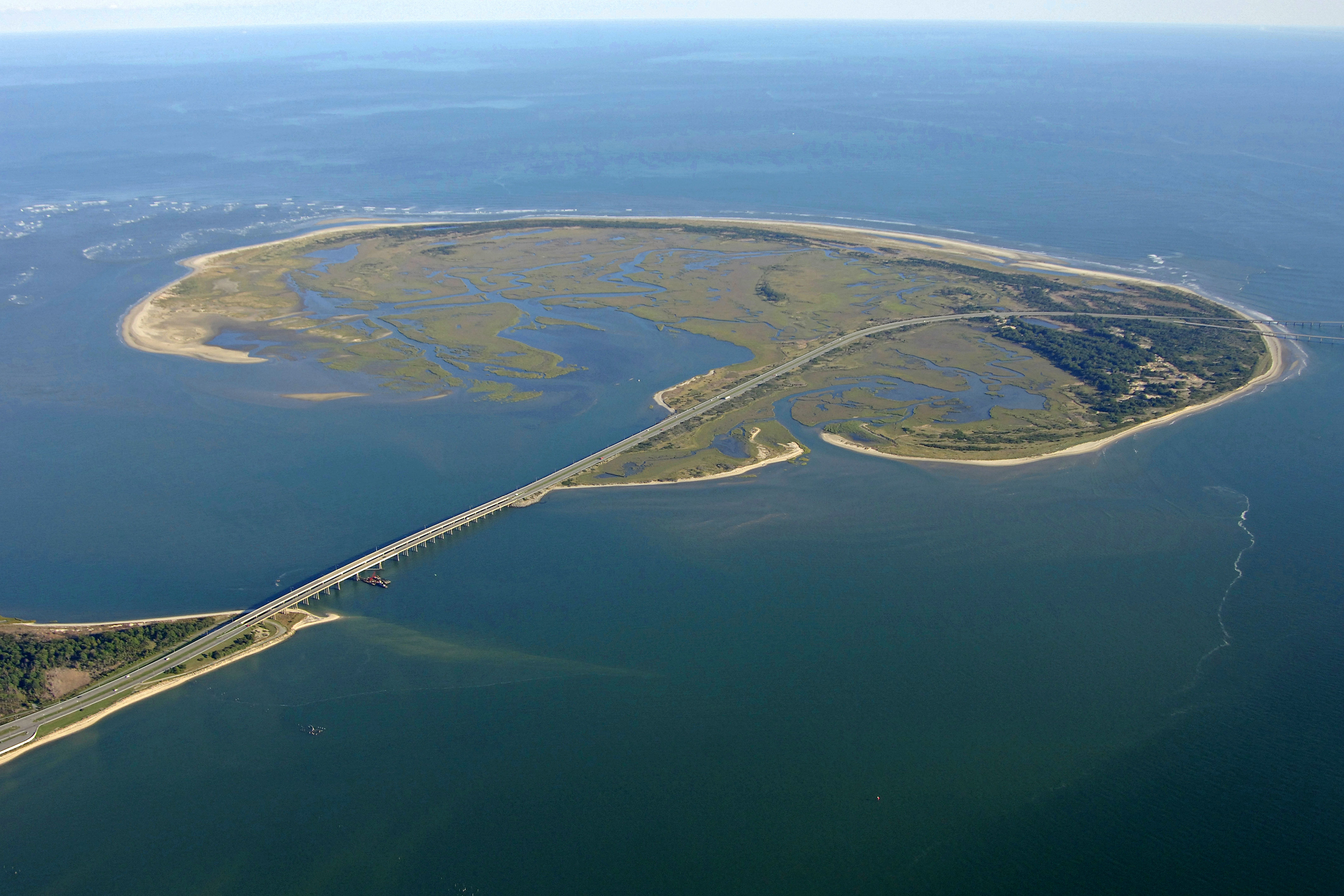
The Chesapeake Bay Bridge Tunnel is a four-lane 20-mile-long vehicular toll crossing located at the mouth of the Chesapeake Bay where it empties into the Atlantic Ocean. The facility carries U.S. Route 13, the main north-south highway on Virginia's Eastern Shore, and provides the only direct link between the lower Virginia Eastern Shore and Chesapeake, VA.
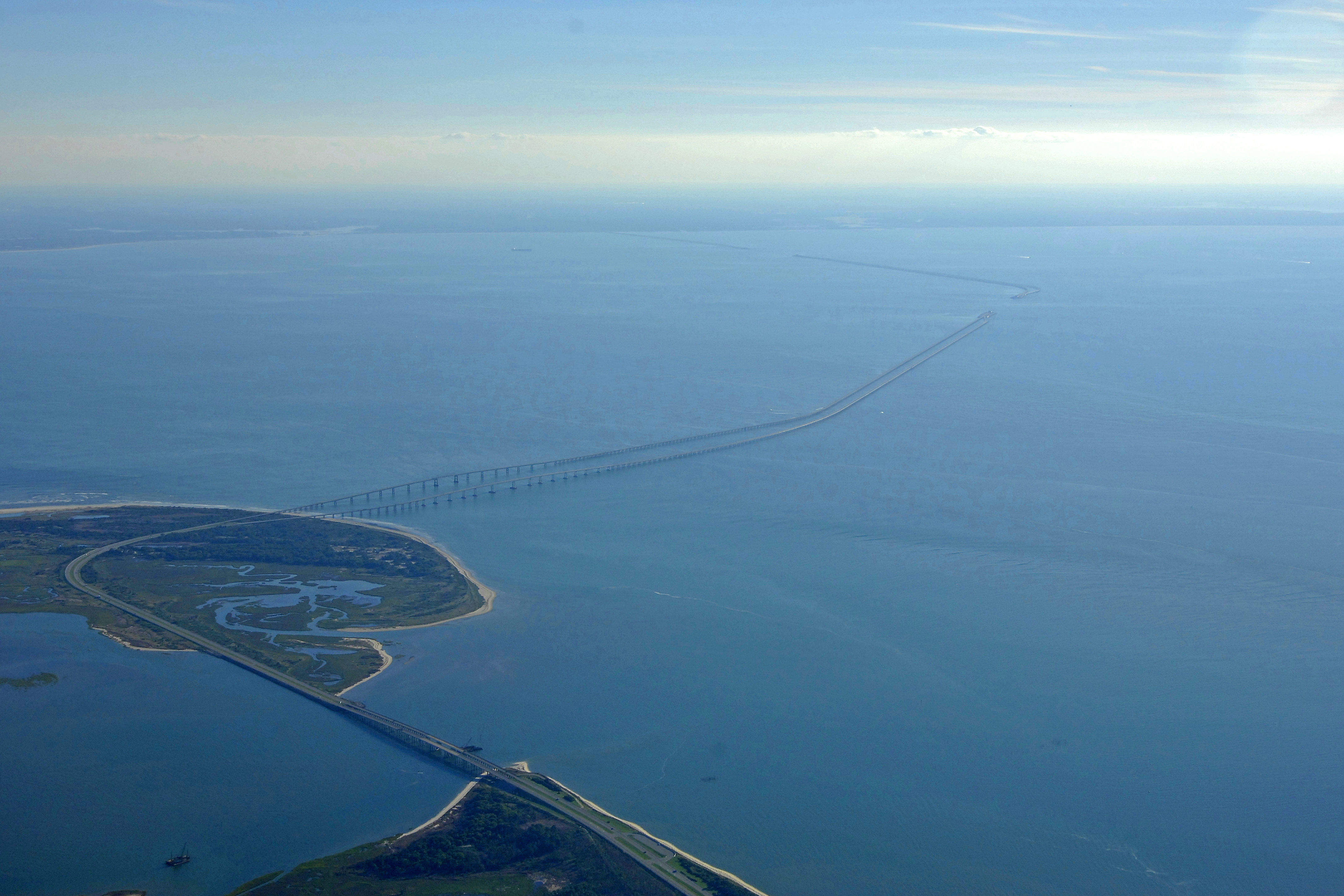
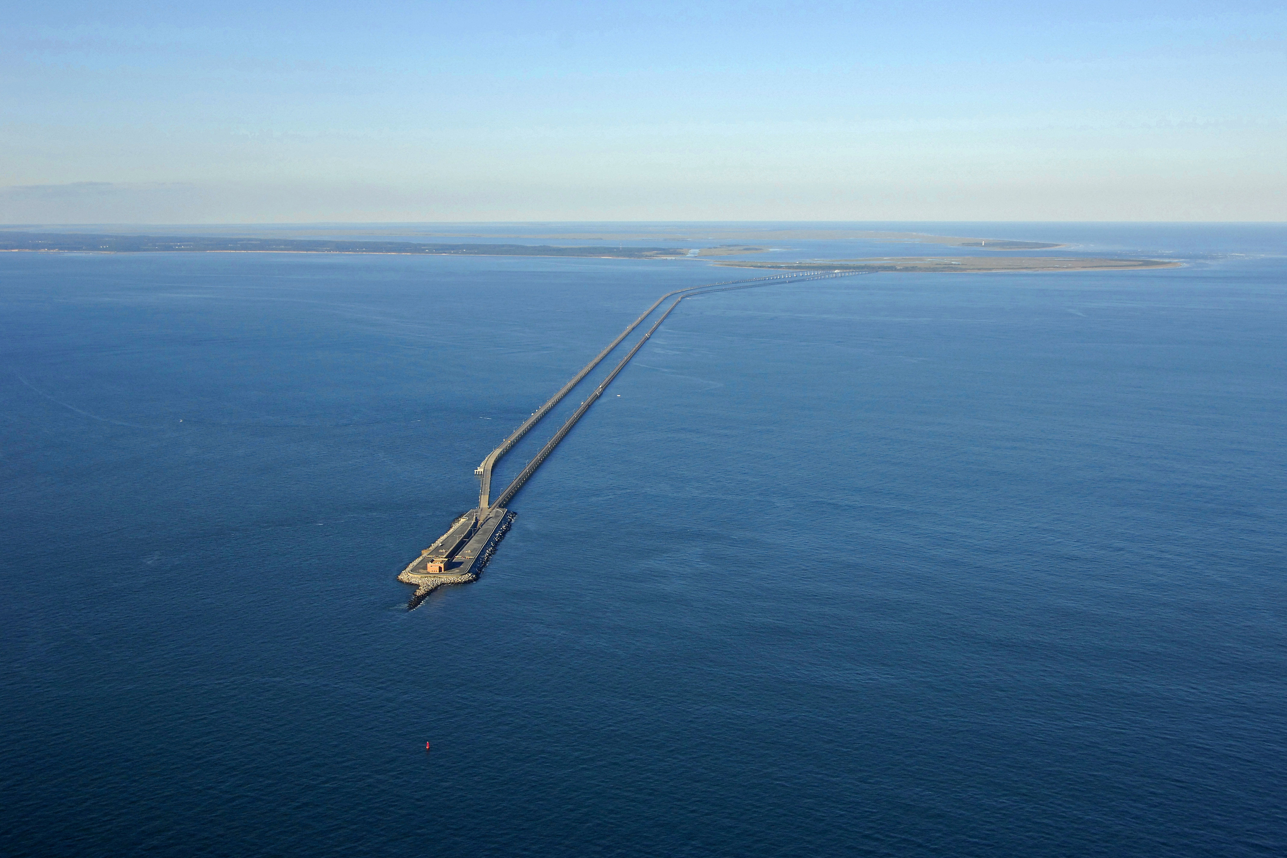
From shore to shore, the bridge-tunnel measures 17.6 miles (28.4 km) and is considered the world's largest bridge-tunnel complex. Construction of the span required undertaking a project of more than 12 miles of low-level trestle, two one-mile-long tunnels, two bridges, almost two miles of causeway, four manmade islands and 5.5 miles of approach roads.
The crossing consists of a series of low-level trestles interrupted by two approximately one-mile-long tunnels beneath Thimble Shoals and Chesapeake navigation channels. The manmade islands, each approximately 5.25 acres in size, are located at each end of the two tunnels. There are also high level bridges over two other navigation channels: North Channel Bridge and Fisherman Inlet Bridge. Finally, between North Channel and Fisherman Inlet, the facility crosses at-grade over Fisherman Island, a barrier island which includes the Fisherman Island National Wildlife Refuge administered by the U. S. Fish and Wildlife Service. Toll collection facilities are located at each end of the facility.
[i]Portions Courtesy Chesapeake Bay Bridge Tunnel[/i]
Navigating the Water:
Use NOAA Chart 12221.
Two channels lead through the Chesapeake Bay-Bridge Tunnel: Thimble Shoal Channel to the south and Chesapeake Channel to the north. The Chesapeake Channel is used by commercial vessels heading north up the Bay and the Thimble Shoals Channel is used by vessels putting into Norfolk, Hampton Roads or Newport News. This is a very busy area for commercial and U.S. Navy ships, and as such, a close watch for all types of vessels--submarines included--is warranted.
If entering from the Atlantic Ocean, red and white Morse (A) buoy CH is your first mark to pick up. From here you can either pass to the north through the Chesapeake Channel or south through Thimble Shoals Channel onto Norfolk. Thimble Shoals is by far the more heavily traveled passage. The channel openings in the bridge-tunnel have a minimum depth of 44 feet and horizontal clearances of 70 feet.
Local Notices to Mariners:
Local Notices to Mariners are available online from the U.S. Coast Guard.
Helpful Links:
Chesapeake Bay Bridge Tunnel Calendar of Events