Courtenay Parkway Bascule Bridge
| Florida United States | |
| 28° 24' 27.0'', -80° 42' 20.89'' | |
| Canaveral Barge Canal |

You might also consider...


Details
| Closed vertical clearance | 21 |
About
Introduction:
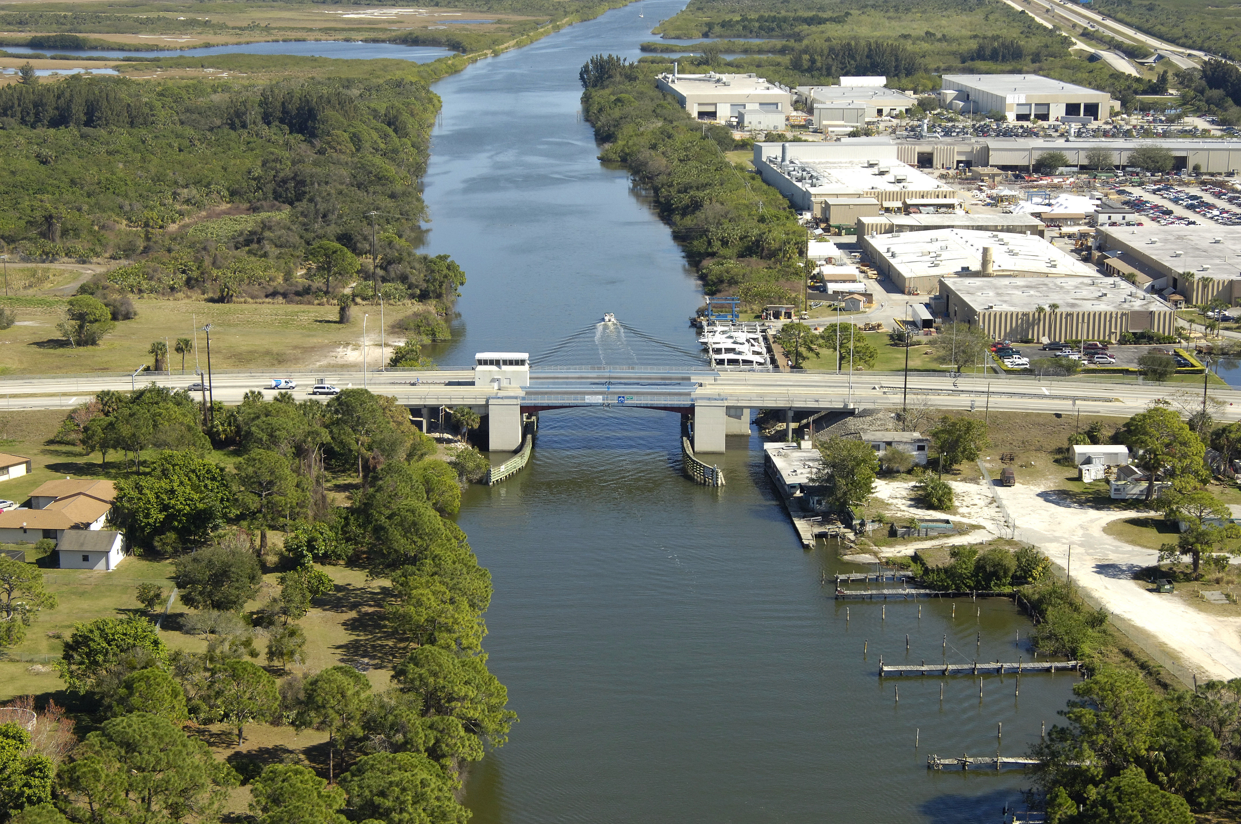
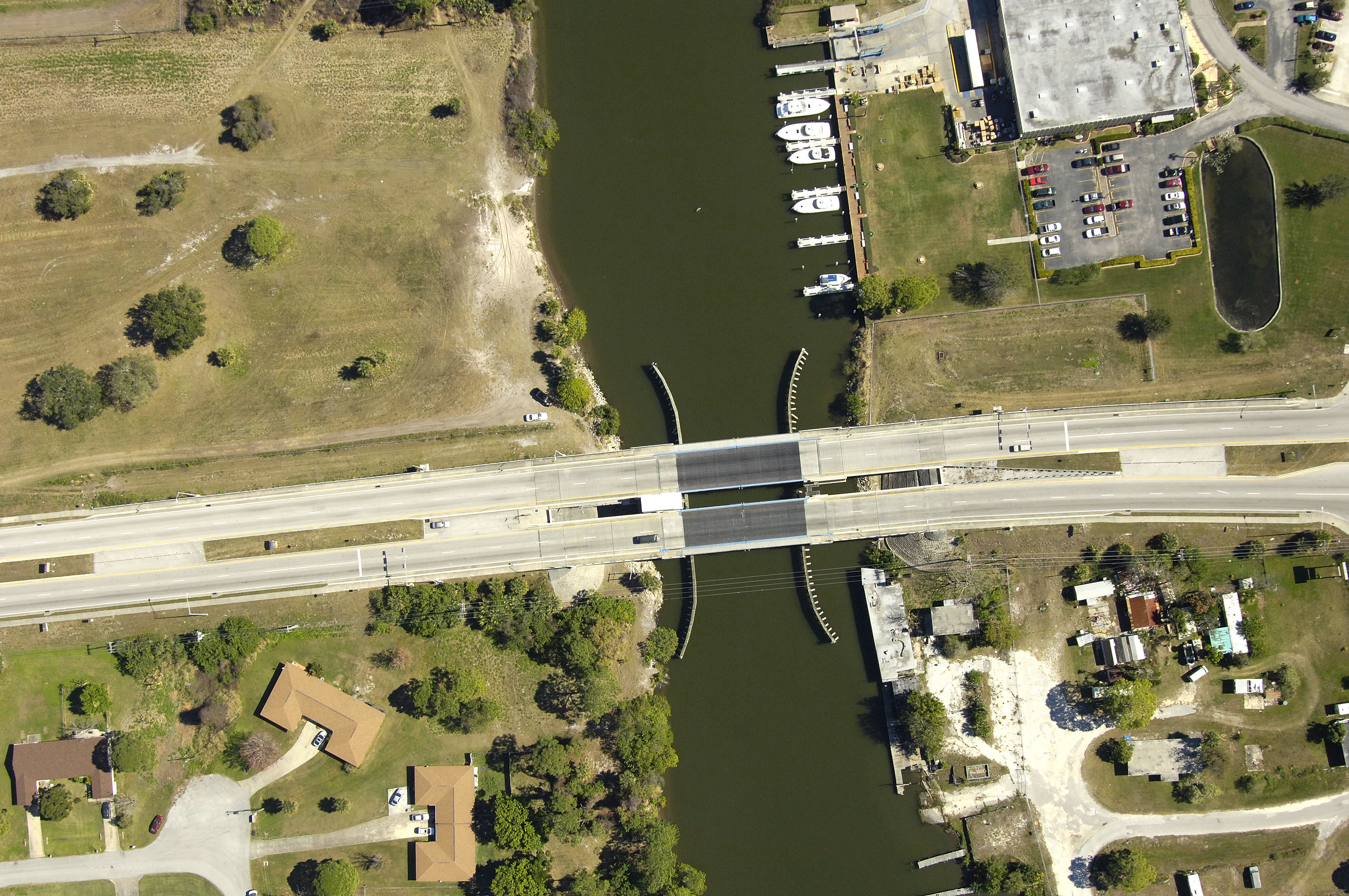
Located near the western terminus of the Canaveral Barge Canal, the Courtenay Parkway Bascule Bridge hops southbound traffic onto Merritt Island. On the ICW route, the Canaveral Barge Canal is just east of Mile Marker 894.
Navigating the Bridge:
Use NOAA Charts 11485 and 11478.
The bridge has a closed vertical clearance of 21 feet with 90 feet of horizontal clearance at the center span. The Canaveral Barge Canal has a project depth at id-channel of 11 .5 feet. A lookout for commercial traffic is always warranted here; some say its not even an option.
Bridge Schedule:
Depending on schedule, the bridge can be opened by horn signal (one long, one short) or by hailing the bridge tender on VHF Channel 09. (All bridges in the state of Florida must be hailed on VHF Channel 09.)
Local Notices to Mariners:
Local Notices to Mariners are available online from the U.S. Coast Guard.