


Kittery Town Harbor
Kittery, Maine United States
Marinas near Kittery Town Harbor
| Name | Reviews | Max LOA | VHF | Dock Depth | Gas / Diesel | Lift / Crane | Wifi | Amps |
|---|---|---|---|---|---|---|---|---|
| Piscataqua Marina | 125.0' | 9 | Low 22.0' | - | - | 30/50 | ||
| Prescott Park Municipal Dock | 55.0' | 9 | - | - | - | - | ||
| Badgers Island Marina | - | - | - | - | - | - | - | |
| NH Port Authority Commercial Fish Pier | - | - | - | - | - | - | - | - |
| The Marina at Harbour Place | 150.0' | 13 | Low 18.0'High 0.0' | - | - | - | ||
| Back Channel Marina | - | - | - | - | - | - | - | - |
| Old Ferry Landing | - | - | - | - | - | - | - | - |
| Portsmouth Harbor Cruises | - | - | - | - | - | - | - | - |
| Port Harbor Marine Kittery | - | - | - | - | - | - | - | - |
| Kittery Point Yacht Club | 0.0 m | - | Low 0.0 mHigh 0.0' | - | - | - | - | |
| Navy Yacht Club | - | 0.0 m | - | Low 0.0'High 0.0' | GYesDYes | - | - | - |
| Safe Harbor Kittery Point | 65.0' | 71 | - | - | LYesCYes | 30, 50 | ||
| Kittery Harbormaster | - | - | - | - | - | - | - | - |
| Great Cove Boat Club | 40.0' | 9 | Low 6.0'High 134.0' | - | - | - | ||
| Portsmouth Yacht Club | 60.0' | 78 | Low 10.0' | G$5.44/galD$5.55/gal | - | - |
Introduction:
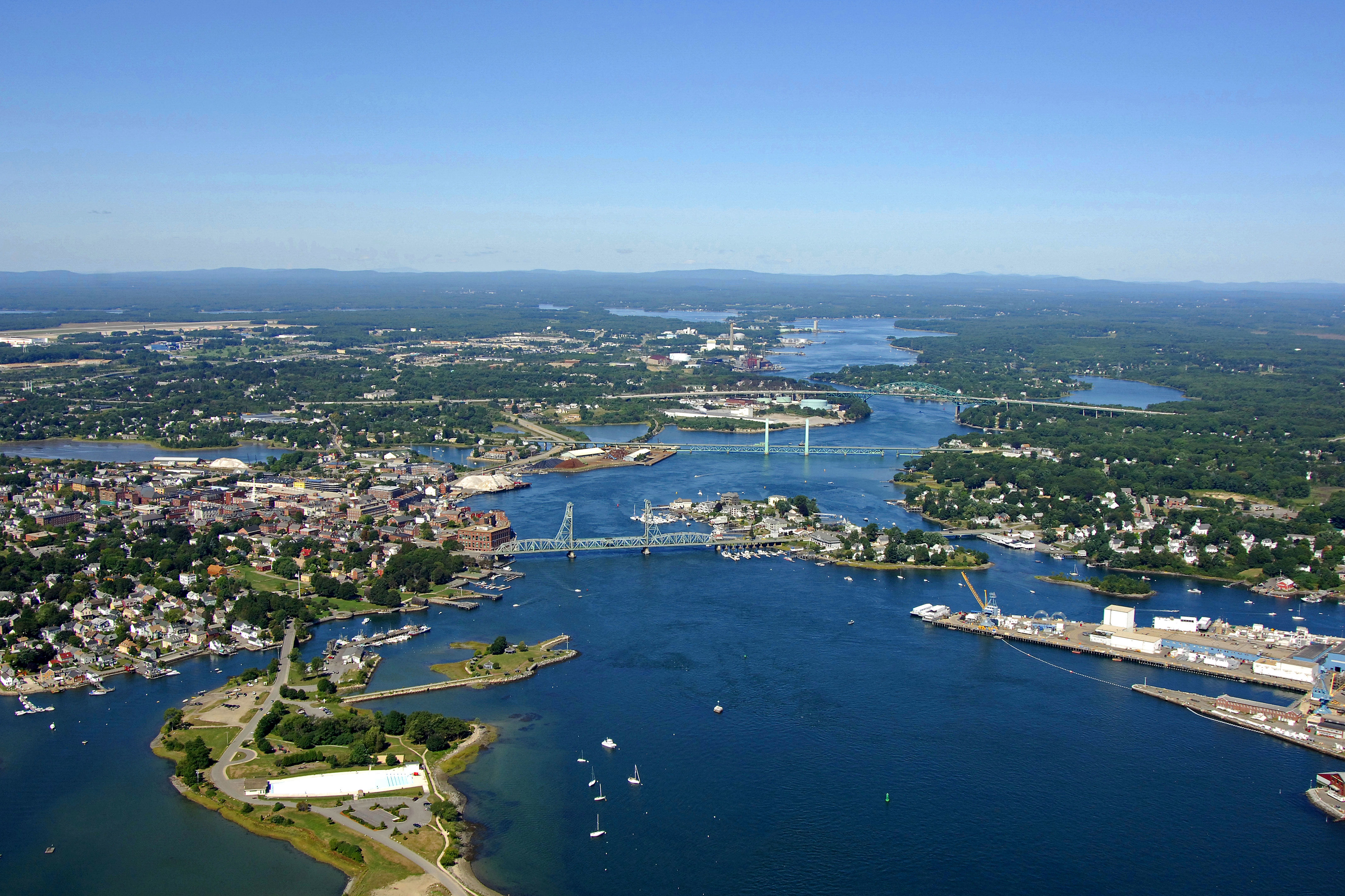
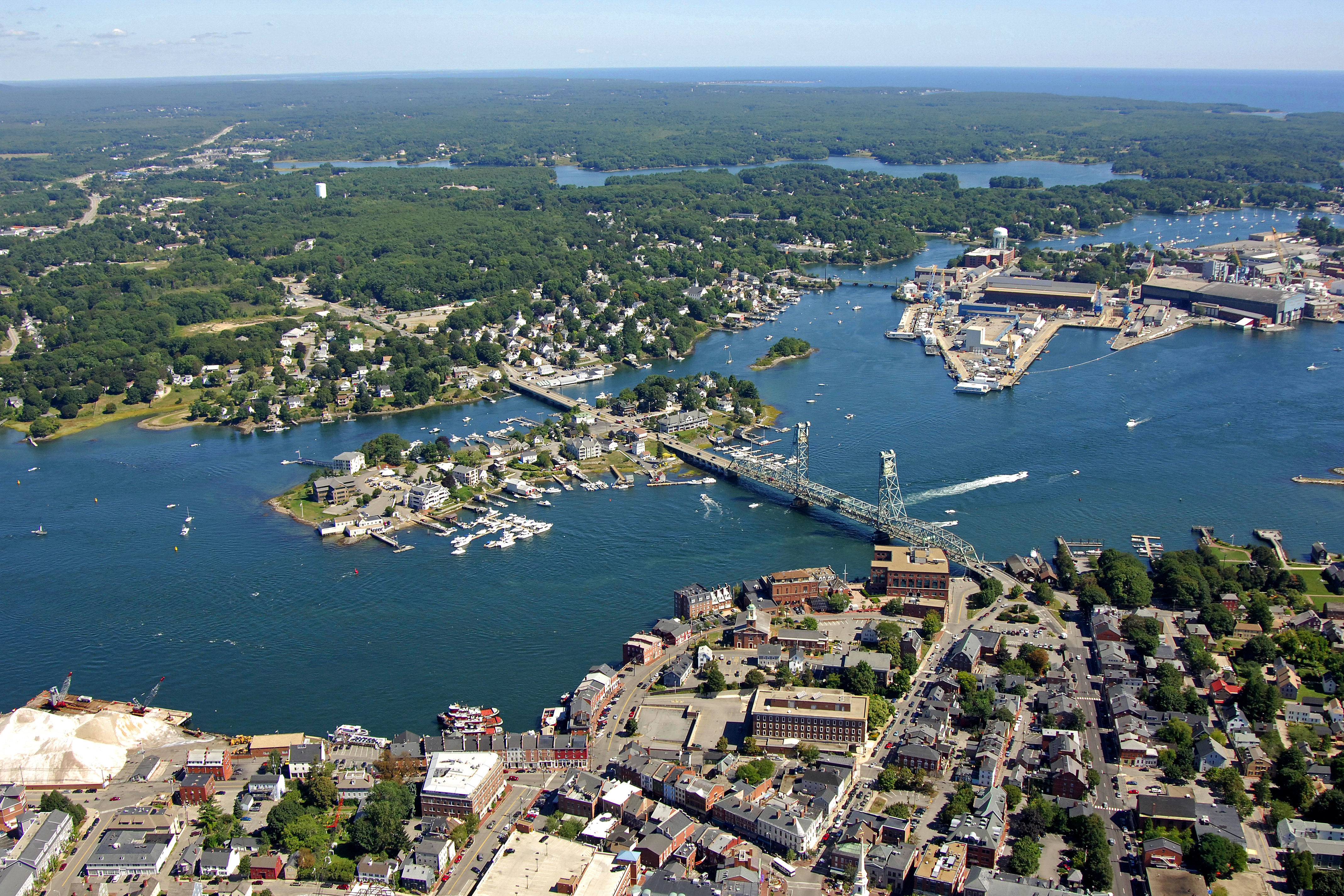
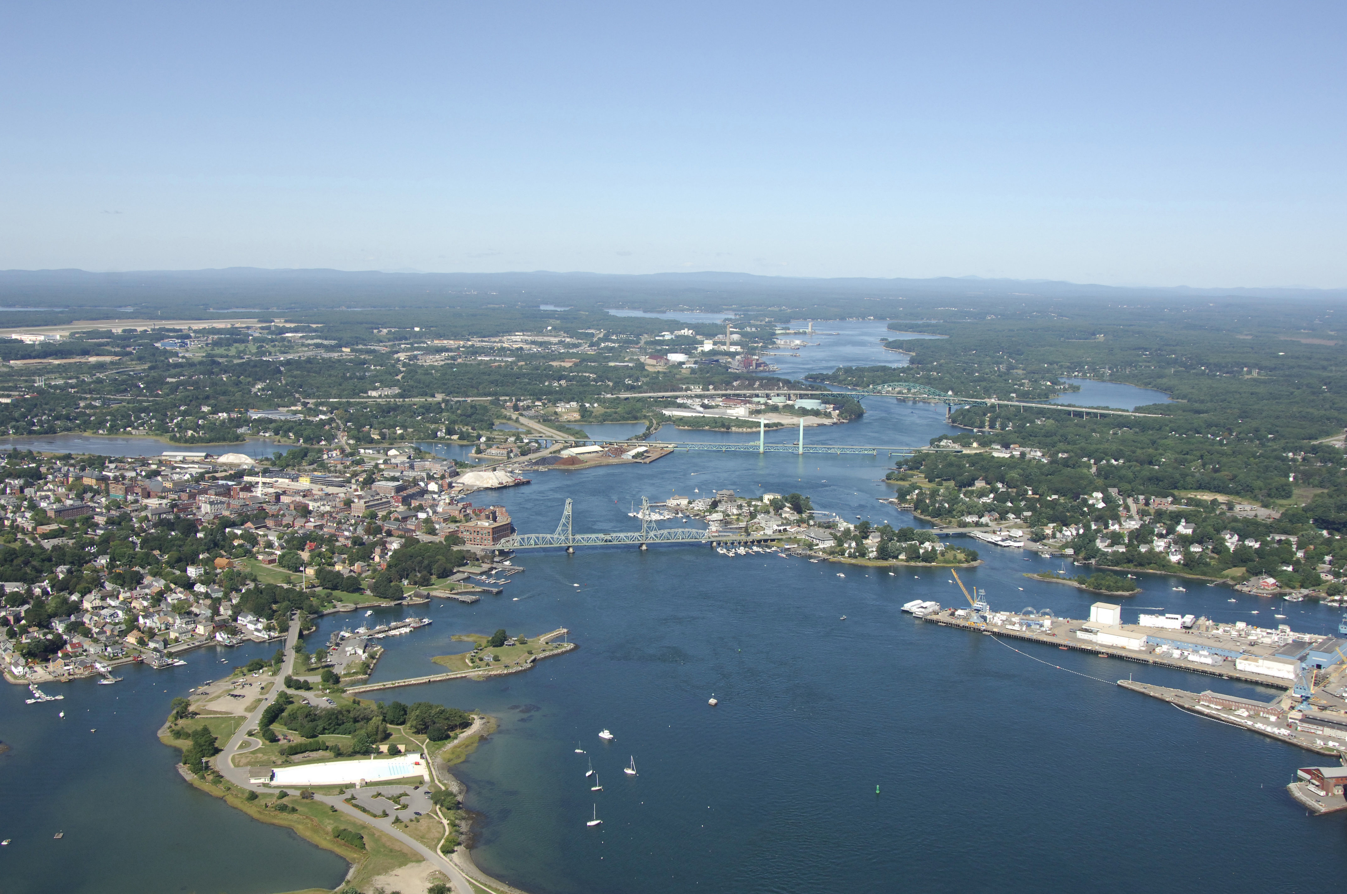
Kittery is Maines first coastal town when traveling north, and is located just across from Portsmouth, NH, on the Piscatagua River. The image above is a view from the southwest looking northeast over the Piscatagua River. The city of Portsmouth is located in the bottom (south) portion of the image, while Kittery (Maine) is located across the bridge to the north. The small island between the bridges is Badger Island, and off to the right--with the pointy end--is Seavey Island.
There are two primary marinas on the Piscatagua River in Kittery, and both are located within two miles of the Piscatagua River entrance at the Atlantic Ocean. Both of these marinas are located on either side of Kittery Point, and both of them accept transient guests at their slips. Gas and diesel fuel are hard to find here, however, and you must travel up to the York River for fuel.
Navigating the Water:
Use NOAA Chart 13283.
Kittery is approached via a passage from the south from the Atlantic Ocean through the Piscatagua River.
From the Atlantic, first set a course to pick up flashing red buoy 2KR, which is located at an approximate position of N 43 02.959 W70 41.466. once you have successfully reached flashing red buoy 2KR, set and follow a new course of about 344 degrees magnetic for approximately one mile until you reach flashing red buoy 2, which is located southwest of Wood Island.
After you successfully find flashing red buoy 2, head north on an approximate course of 341 degrees magnetic for about a half-mile until you reach green can buoy 3. Past green can buoy 3, head to the north--out and around New Castle Point--and once you are well north of the aforementioned point, steer toward the northwest to find flashing green buoy 5, which is located at an approximate position of N43 04.471 W70 42.675.
The last portion of the passage into Kittery and Portsmouth involves changing course to the west on a course of about 284 degrees magnetic for approximately 1.3 miles. Along this route, you should be able to sight a range that is helpful for navigating and staying in the channel at night.
Once you have cleared the last course change, the water opens up past Seavey Island and heads toward Basger Island and the bridges that link Portsmouth and Kittery (Portsmouth if on the south side of the river and Kittery is to the north).
Local Notices to Mariners:
Local Notices to Mariners are available online from the U.S. Coast Guard.