


Hampton Harbor
Hampton, Virginia United States
Marinas near Hampton Harbor
| Name | Reviews | Max LOA | VHF | Dock Depth | Gas / Diesel | Lift / Crane | Wifi | Amps |
|---|---|---|---|---|---|---|---|---|
| Safe Harbor Bluewater | 200.0' | 16 | Low 10.0' | G$5.20/galD$5.40/gal | LYes | 50 | ||
| Hampton Yacht Club | - | - | - | GNearby | - | - | - | |
| The Batten Pocket | - | - | - | - | - | - | - | - |
| Custom House Marina | - | 0.0' | - | Low 0.0 mHigh 0.0' | - | - | - | - |
| The Docks at Downtown Hampton | - | 16 | Low 12.0' | - | - | - | ||
| Merrimac Shores Marina | - | - | - | - | - | - | - | - |
| Hampton Marina and Dry Storage | - | - | 16 | - | G$5.40/galD$5.15/gal | LYes | 30 | |
| The Marina at 37 North (FKA: Old Point Comfort Marina) | 50.0' | 16 | Low 13.0' | G$3.60/galD$3.25/gal | LYes | - | 30, 50 | |
| Salt Ponds Marina Resort | 110.0' | 16 | Low 8.0' | G$4.20/galD$3.65/gal | - | 30/50 | ||
| Southall Landings Marina | - | 0.0' | 16 | Low 0.0 mHigh 0.0' | - | - | - | |
| Langley Marina | - | - | - | - | - | - | - | |
| Rebel Marine Service | - | 0.0' | 16 | Low 0.0 mHigh 0.0' | - | - | 30 / 50 | |
| Willoughby Marina | - | 105.0' | 16 | - | - | - | - | 30, 50 |
| Norfolk Naval Sailing Center | 90.0' | 71 | Low 10.0' | - | - | - | ||
| Marina Cove Boat Basin | - | - | - | - | LYes | - | - |
Navigating the Water:
Use NOAA Chart 12222.
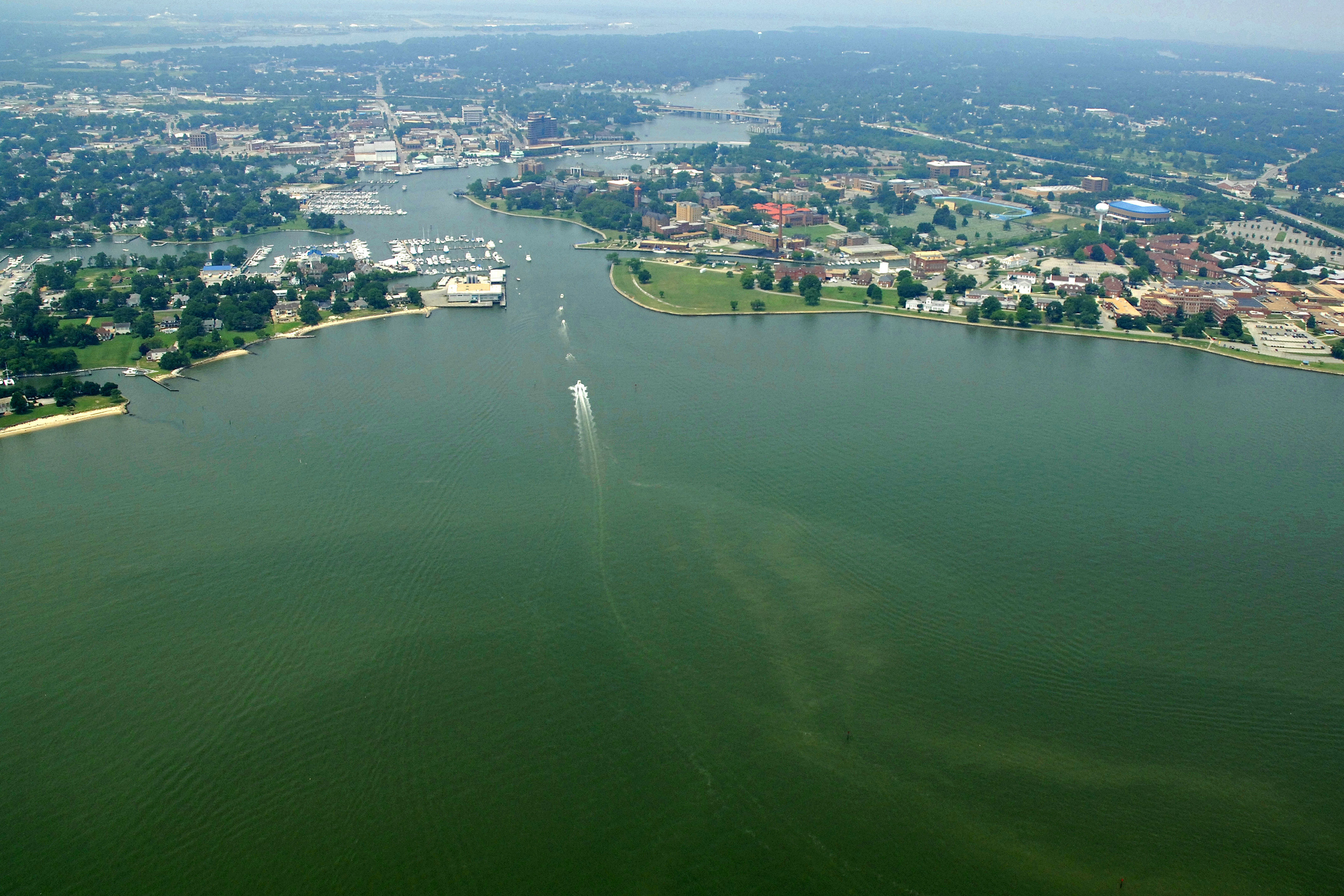
The Hampton River is reached via Hampton Roads, which also serves as the mouth of the James River at its confluence with the Chesapeake Bay. On entering the Hampton Road area from the Chesapeake Bay, be advised that this is a high traffic area for commercial freighters, tugs with tows and some of the largest Naval vessels on Earth - a close watch is warranted.
Once inside, pick up flashing green 2 just beyond Old Point Comfort. This starts the approach channel to Hampton and the Hampton River. The Hampton River entrance channel has a tabulated depth of 12 feet in mid-channel all the way to the river mouth. Once you are inside the river, a series of markers will guide you toward the 29-foot fixed vertical clearance bridge that sets the overhead clearance for the river.
Local Notices to Mariners:
Local Notices to Mariners are available online from the U.S. Coast Guard.
Introduction:
Hampton Roads has been called one of the finest natural harbors in the world. Home to Navy ships, commercial fishing trawlers, cargo vessels, submarines and pleasure craft, Hampton Roads is a busy estuary that feeds into the Atlantic Ocean via the Chesapeake Bay.
The Hampton River and the City of Hampton are located on the southern portion of Virginias Eastern Shore about 12 miles north of Norfolk at the entrance of the James River and its confluence with the Chesapeake Bay. Miles of shoreline and waters that range from quiet ponds and tranquil tidal estuaries to the Hampton River and the Chesapeake Bay provide plenty of opportunities for boating and fishing in Hampton. With Hampton Roadsthe world's greatest harborat their front door, there are virtually limitless ways to enjoy yourself on the water in Hampton. Hampton offers a safe harbor and nearly a dozen amenity-rich marinas for recreational boaters.
More than a place to dock boats, the area is a lively urban waterfront village. Popular annual events include the Blackbeard Pirate Festival, Hampton Cup Regatta and Hampton Bay Days. From May through September, Hampton's Saturday morning Market Place and Saturday evening Street Fest welcome boaters with spirited entertainment, family-oriented activities and a taste of Hampton.
[i]Portions Courtesy City of Hampton Virginia.[/i]
Transportation:
Local public transportation is provided by Hampton Roads Transit, which runs on regular schedules around the area and also into Norfolk and the Norfolk International Airport.
The Norfolk International Airport features regularly scheduled major air service with connecting service to larger locations. Shuttle and taxi service to and from the facility is avilable by making arrangements with the airport.
For transit schedules and shuttle service to the airport, see the Helpful Links section below for more details.