


Maya Cove
British Virgin Islands
Marinas near Maya Cove
| Name | Reviews | Max LOA | VHF | Dock Depth | Gas / Diesel | Lift / Crane | Wifi | Amps |
|---|---|---|---|---|---|---|---|---|
| Tropic Island Marina | - | 0.0 m | - | Low 0.0 mHigh 0.0 m | - | - | - | - |
| Hodge's Creek Marina | - | 0.0' | - | Low 0.0 mHigh 0.0' | - | - | - | |
| Penn's Landing Marina | - | 0.0' | 16 | Low 0.0 mHigh 0.0' | GYesDYes | - | - | - |
| Sea Breeze Marina | - | 0.0 m | - | Low 0.0 mHigh 0.0' | - | - | - | - |
| JY Harbour View Marina | - | - | - | - | - | - | - | - |
| Mega Surface Marina | - | 0.0 m | - | Low 0.0 mHigh 0.0' | - | - | - | - |
| Guana Island Moorings | - | - | - | - | - | - | - | - |
| Scrub Island Resort, Spa & Marina | - | 74 | - | G$7.50/galD$8.50/gal | - | - | ||
| Clipper Marina | - | - | - | - | - | - | - | - |
| Tortola Yacht Services | - | - | - | - | - | LYes | - | - |
| Prospect Reef Marina | - | 0.0 m | - | Low 0.0 mHigh 0.0' | - | - | - | - |
| Moorings Marina | - | 0.0' | - | Low 0.0 mHigh 0.0' | - | - | - | - |
| Tortola Yacht Club | - | 0.0 m | - | Low 0.0 mHigh 0.0' | - | - | - | - |
| Fort Burt Marina | - | - | - | - | GYesDYes | - | - | |
| Footloose Marina | - | 0.0' | - | Low 0.0 mHigh 0.0' | - | - | - | - |
Introduction:
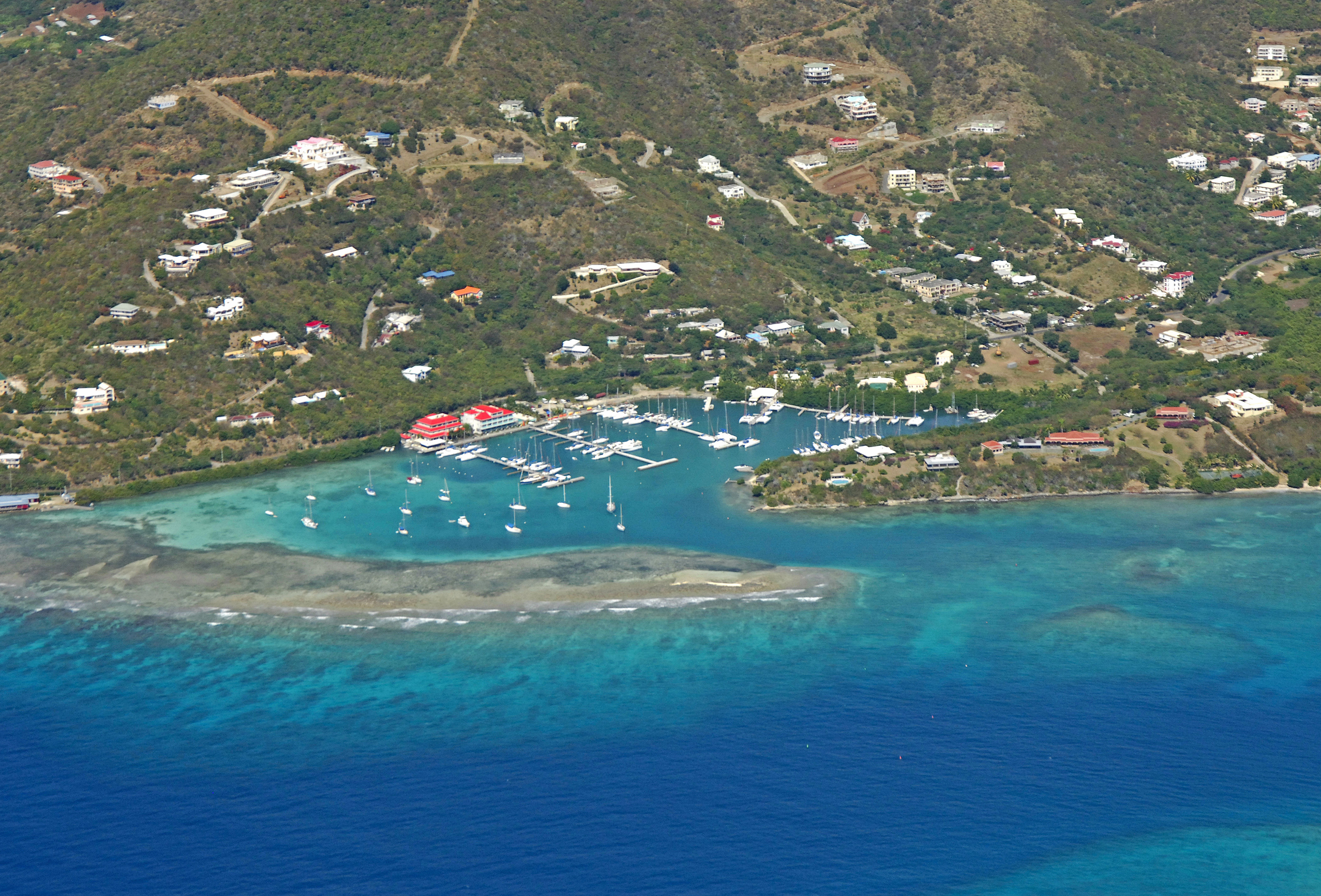
Maya Cove is a small, well-protected cove on the east end of Tortola, just south of Fat Hogs and East End bays. This is a pleasant, but busy area, as the high hills above and reefs in front of the cove protect it from wind and waves, making it popular with boaters. Youll find the area quite bug-free as well.
Navigating the Water:
Maya Cove is reached via an approach from the south or west through Paraquita Bay. Once you have successfully navigated your way into Paraquita Bay, set your sights on the opening to Maya Cove to the west.
As visible in the image above, a long reef extends northeast across the entrance channel, and a narrow channel works its way in just to the north of that tip south of another reef patch on the other side. This channel is well marked and easy to navigate with 8- to 10-foot depths. Inside the cove, you will find a mooring field to the south, and two marinas on the north end (Hodges Creek Marina and Sunsail).
Local Notices to Mariners:
See our Local Notices to Mariners blog for updates on the latest conditions and advisories for this area.