


St. Marys Harbor
St. Marys, Georgia United States
Marinas near St. Marys Harbor
| Name | Reviews | Max LOA | VHF | Dock Depth | Gas / Diesel | Lift / Crane | Wifi | Amps |
|---|---|---|---|---|---|---|---|---|
| Lang's Marina | - | 0.0' | 16 | Low 12.0'High 0.0' | GYesDYes | - | - | - |
| St. Marys Intracoastal Gateway Marina | 130.0' | 16 | Low 25.0' | - | - | - | ||
| St Marys Boat Services | - | - | - | - | - | LYes | - | - |
| Oyster Bay Yacht Club | 65.0' | 13 | Low 6.0' | - | - | - | - | |
| Florida Petroleum Corp | - | 0.0' | 16 | Low 30.0'High 0.0' | - | - | - | - |
| Fernandina Harbor Marina | 250.0' | 16 | Low 8.0' | G$6.379/galD$5.793/gal | - | 30 / 50 | ||
| Tiger Point Marina | 0.0' | 16 | Low 8.0'High 13.0' | - | - | - | ||
| Egans Creek Marina | - | 0.0' | - | Low 0.0'High 0.0' | - | - | - | - |
| Olde Towne Marina | - | 0.0' | - | Low 0.0 mHigh 0.0' | - | - | - | - |
| Amelia Island Marina | 90.0' | 72 | Low 6.0' | G$5.399/galD$5.89/gal | LYes | 30, 50, | ||
| Kingsley Plantation Dock | - | - | - | - | - | - | - | - |
| Brown's Creek Fish Camp Inc. | - | 0.0' | - | Low 0.0'High 0.0' | - | - | - | - |
| Clapboard Creek Fish Camp | - | 0.0 m | - | Low 0.0'High 0.0' | - | - | - | - |
| Clapboard Creek Marina Inc | - | 0.0' | - | Low 0.0'High 0.0' | - | LYes | - | - |
| Riverfront RV Park | - | - | - | - | - | - | - |
Introduction:
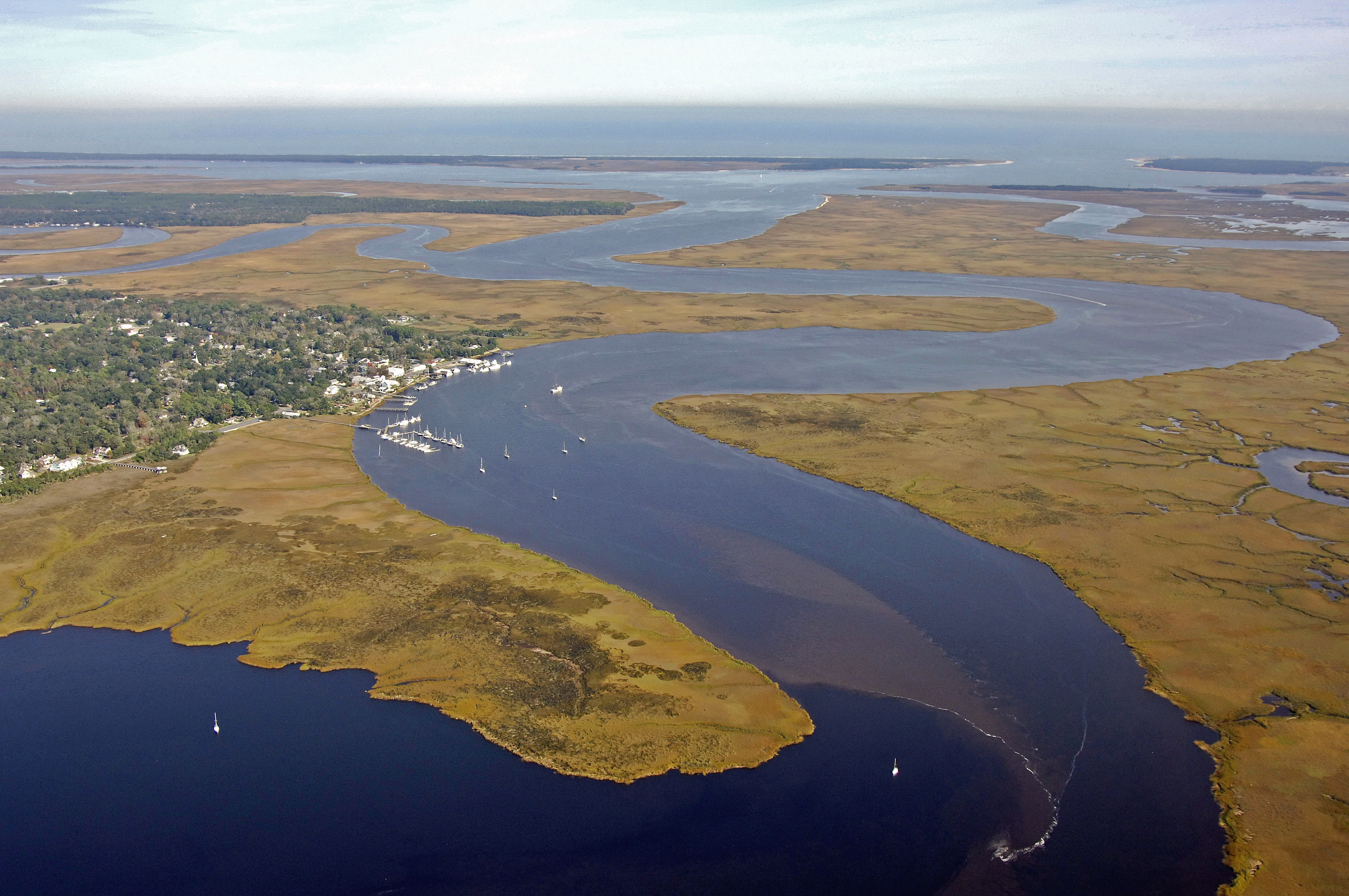
St. Marys is the last seaside town you will encounter off the Intracoastal Waterway before you arrive in the state of Florida. Home of the Kings Bay Trident Nuclear Submarine Base, most of the local economy is driven by Naval activities and a small tourist economy. St. Marys is just over the Florida border from Fernandina Beach and 30 miles south of Jekyll Island.
There is a marina in St. Marys, but there are not facilities for transient guests or a fuel dock. There is a large anchorage off the town waterfront in eight to ten feet of water with good holding. Currents can be strong here, so make sure to get a good set on your anchor.
History:
St. Marys was first established in the mid 1500s by the French and Spanish. The English settled in St. Marys in 1787.
Navigating the Water:
Use NOAA Chart 11489.
St. Marys is approached from the east via Cumberland Sound and the St. Marys River west of Cumberland Island. From the Intracoastal Waterway route in Cumberland Sound, you will want to exit the channel at flashing green buoy 29, and then set a course to the west up the St. Marys River to intercept flashing green 3 about two and a half miles farther on at the junction of the North and St. Marys rivers.
From flashing green 3, round the corner to the south and pick up green daybeacon 5, red daybeacon 6, red daybeacon 8, flashing red 10, red daybeacon 12, and then flashing green 13 into the St. Marys waterfront.
Local Notices to Mariners:
Local Notices to Mariners are available online from the U.S. Coast Guard.
Things To Do/Local Events:
The Cumberland Island Seashore is accessible from St. Marys via a tour boat that leaves from the waterfront at the Cumberland Island Visitors Center. Ashore on the national seashore you can tour the old Carnegie mansion Dungeness, walk the beach, or camp out for a night under the stars at the islands tent site Sea Camp. This is the island where JFK Junior was wed in 1996.
If you are in the mood for some excellent low-country seafood, try Langs on the far west end of the Saint Marys waterfront on St. Marys Street. The fried shrimp is out of this world and the portions are huge.
Transportation:
Jacksonville International Airport is conveniently located only 30 minutes south of St. Marys. See the Helpful Links section for transportation links.
Helpful Links:
Saint Marys Calendar of Events
Jacksonville International Airport
Harbor Reviews
It is such a Beautiful little Hallmark Town Nestled on the Saint Mary's River. Morning Sunrises are so Beautiful and the Waters are so Calm. The Mayor even loves to walk along Main street every now and then! I would live here if I could!