


Titusville Harbor
Titusville, Florida United States
Marinas near Titusville Harbor
| Name | Reviews | Max LOA | VHF | Dock Depth | Gas / Diesel | Lift / Crane | Wifi | Amps |
|---|---|---|---|---|---|---|---|---|
| Westland Boatyard & Marina | 90.0' | 16 | Low 8.0'High 63.0' | GNearbyDNearby | LYes | 30, 50 | ||
| Titusville Municipal Marina | 130.0' | 16 | - | G$5.54/galD$5.75/gal | - | 30, 50, 100 | ||
| Kennedy Point Marina | 80.0' | - | Low 5.0' | - | - | 30, 50 | ||
| Cape Crossing Marina | - | 60.0' | - | Low 7.0'High 0.0' | - | - | 30, 50 | |
| Jolly Gator Fish Camp | - | - | - | - | - | - | - | - |
| Harbortown Marina | 0.0' | 16 | Low 7.0'High 0.0' | G$3.86/galD$3.44/gal | LYes | 30 & 50 | ||
| Port Canaveral Marine | - | 0.0' | - | Low 0.0 mHigh 0.0' | - | - | - | - |
| Ocean Club at Port Canaveral | 140.0' | 16 | Low 12.0'High 0.0' | GYesDYes | - | 30/50/100 | ||
| Cape Marina | 120.0' | 16 | Low 12.0' | G$5.37/galD$5.36/gal | LYes | 30/50 | ||
| Port Canaveral Yacht Club | 65.0' | 73 | Low 12.0' | - | - | 30 and 50 | ||
| Bluepoints Marina | - | - | - | - | GYesDYes | - | - | - |
| Rusty's Seafood & Oyster Bar | - | 0.0 m | - | Low 0.0 mHigh 0.0 m | - | - | - | - |
| Sunrise Marina & Tiki Bar | - | - | - | - | GYesDYes | - | - | - |
| Cocoa Village Marina | 0.0' | 16 | Low 7.0'High 0.0 m | - | - | - | ||
| Island Point Marina | - | - | - | - | - | - | - | - |
Introduction:
Titusville, sometimes known as Space City Florida, is located only 20 miles from the Kennedy Space Center where launches of all sorts, including the Space Shuttle, take place during the year. Titusvilles population swells by thousands when a Shuttle launch is scheduled and hundreds, if not thousands, of boats anchor out to get a glimpse of the launchs fireworks.
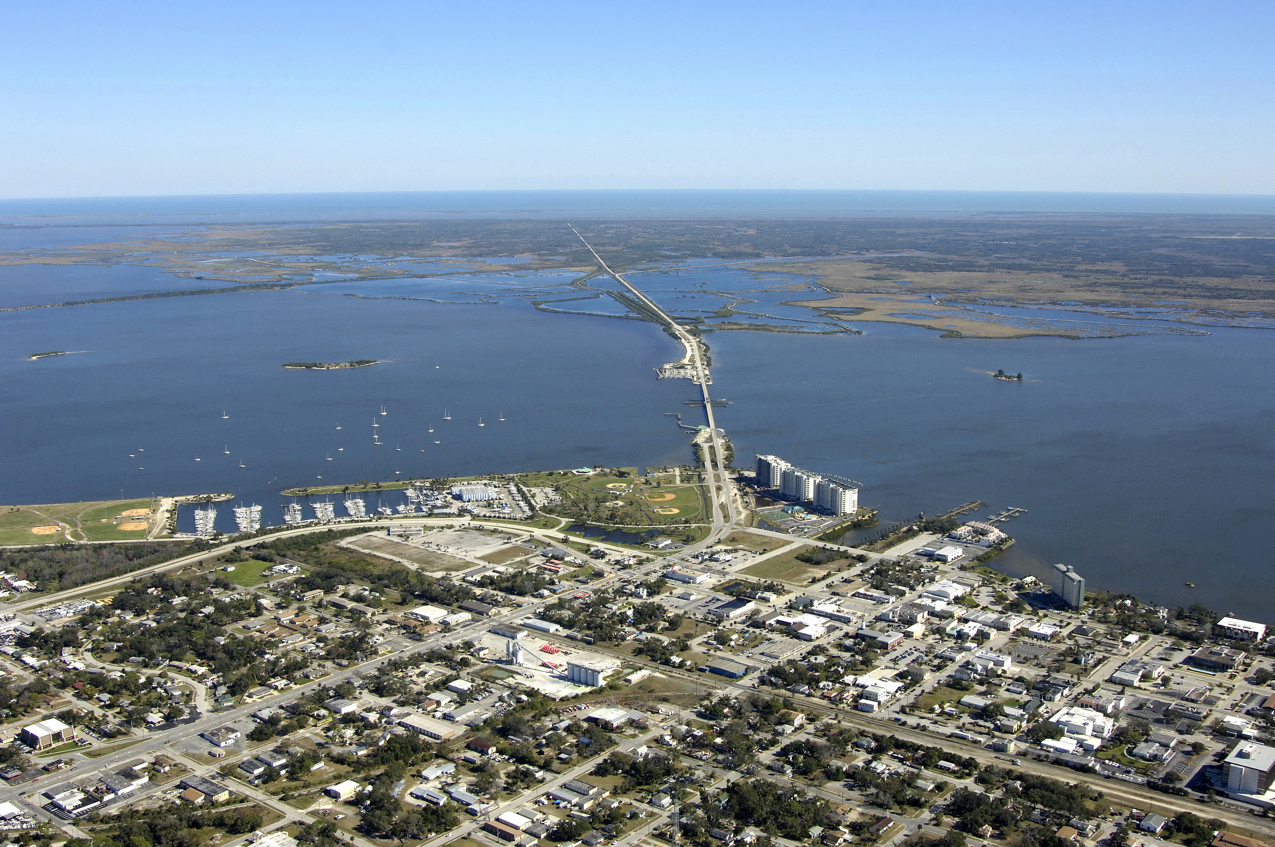
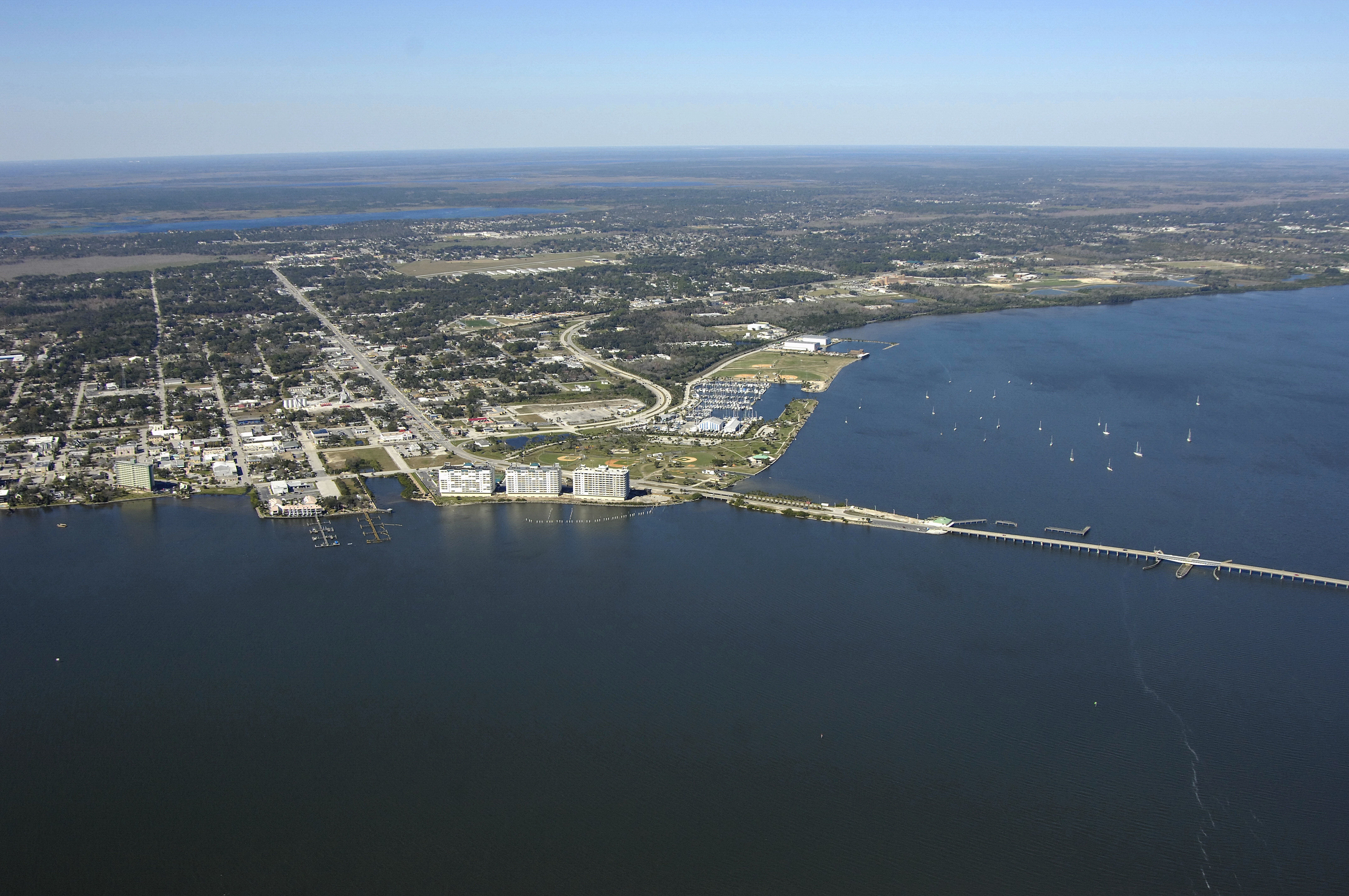
There are three good marinas in the Titusville area, and all of them accept transient guests at their slips. Inside the municipal yacht basin to the north of the Max Brewer Bridge is the Titusville Municipal Marina and Westland Marine, the latter of which has a 50-ton lift for haul-out and related repair services. Cruising boaters who wish to anchor out usually drop the hook just off the municipal yacht basin in four- to six-foot depths.
Navigating the Water:
Located near ICW Mile 880, Titusville poses little in the way of navigational obstacles for the cruising mariner. Visible in the image above is the Titusville Max Brewer Swing Bridge (nine-foot closed vertical clearance), which has a restricted opening schedule. Year round, Mon. through Fri., except weekends and Federal Holidays, there are no openings from 6:00 to 7:15 a.m., and again from 3:15 to 4:30 p.m. The bridge opens on demand at all other times.
Approaching from the north, Flashing red 26 and green daybeacon 27 set you up for the approach into the Titusville area. About a half-mile south of these marks off the Waterway, the entrance to the Titusville Municipal and Westland marina basins come into view. The approach channel to the protected basin has a reported depth of eight feet. Green daybeacon 1 and red daybeacon 2 are located near waypoint 28 37.498N 80 48.318W, and mark the beginning of the entry channel. Green daybeacon 3, red daybeacon 4, green daybeacon 5, and red daybeacon 8 lead directly into the marina basin from there.
Proceeding south on the Waterway, make your way through the Max Brewer Swing Bridge (mind the aforementioned opening restrictions above), and then pick up flashing green 29 and red daybeacon 30, which will steer you farther south on the Waterway route toward Port St. John and Cocoa. West of flashing green 29 and red daybeacon 30, just at the base of the bridge, is the Harbour Towne Marina.
Local Notices to Mariners:
See our Local Notices to Mariners blog for updates on the latest conditions and advisories for this area.
Things To Do/Local Events:
See our Helpful Links section below for a detailed calendar of events.