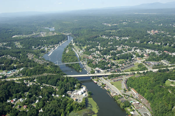
Kingston Harbor
Kingston, New York United States
Marinas near Kingston Harbor
| Name | Reviews | Max LOA | VHF | Dock Depth | Gas / Diesel | Lift / Crane | Wifi | Amps |
|---|---|---|---|---|---|---|---|---|
| Tidewater Marina | - | 0.0' | - | Low 0.0'High 0.0' | - | - | - | - |
| Marina Roberti | - | - | - | - | GNearby | - | - | - |
| Lou's Boat Basin | - | 0.0 m | - | Low 0.0'High 0.0' | - | - | - | - |
| Hudson Valley Watersports Marina | - | 0.0 m | - | Low 0.0 mHigh 0.0' | - | - | - | - |
| Kingston Power Boat Assn | - | - | - | - | - | - | - | - |
| Anchorage Marina & Restaurant | 42.0' | - | Low 0.0'High 0.0' | GNearbyDNearby | - | 30/50 | ||
| Jeff's Yacht Haven | - | - | - | - | - | - | - | - |
| Rondout Yacht Basin | - | 16 | High 57.0' | G$5.27/galD$4.77/gal | LYes | 30, 50 | ||
| Hideaway Marina | - | 0.0' | - | Low 0.0'High 0.0' | - | - | - | - |
| Kingston City Marina | 150.0' | - | - | - | - | 30, 50, 100 | ||
| Hudson River Maritime Museum | 220.0' | 16 | Low 16.0'High 200.0' | - | - | 30, 50 | ||
| Hidden Harbor Yacht Club | - | 0.0' | - | Low 0.0'High 0.0' | GYesDYes | - | - | - |
| Kingston Lighthouse Landing | - | 0.0 m | - | Low 0.0'High 0.0 m | DYes | - | - | - |
| Mills Norrie Marina | - | 0.0' | 16 | Low 0.0'High 0.0' | - | - | - | - |
| Norrie Point Marina | - | 0.0' | - | Low 0.0'High 0.0' | - | - | - | - |
Introduction:
The city of Kingston and Roundout Creek are located off the Hudson River about 10 miles south of Saugerties and 30 miles north of Newburgh. One of the most interesting features you will notice when entering Roundout Creek is the Roundout Lighthouse, which was built in 1915. It is one of a number of distinctive and unique Hudson River Lighthouses of similar design. The lighthouse is now owned and maintained by the city of Kingston and there are tours available on weekends.
Rondout Creek has excellent depths, easy navigation and plenty of marine facilities. There are eight marinas in Kingston, and three of them accept transient guests at their slips. There are five haul-out facilities on the creek and many of them specialize in engine and outboard motor repairs. The town dock is located on the north shore of the creek, and is within easy reach of the visitors center and shopping areas.
Navigating the Water:
Use NOAA Chart 12347.
From the Hudson River, set a course to pick up quick flashing green buoy 73, and then move northwest toward flashing green 1, flashing green 3 and the Rondout Lighthouse at the mouth of the creek. Once you have cleared the lighthouse, the channel bends to the west, and is marked by a series of daybeacons along the inlet jetty. Depths in the creek entrance are reported at 13 feet, and hold to at least eight feet all the way to the Conrail Railroad Bridge (144-foot fixed vertical clearance) about two miles upstream from the creek entrance. Two other fixed bridges cross the creek about one mile from the mouth that have 56 and 86 feet of vertical clearance, respectively, as you enter move upstream.
There are marinas scattered along the entire length of Roundout Creek, but the highest density of them is located between the second fixed bridge and the Conrail Railroad Bridge farther upstream.
Local Notices to Mariners:
Local Notices to Mariners are available online from the U.S. Coast Guard.


