


Bass Harbor
Tremont, Maine United States
Marinas near Bass Harbor
| Name | Reviews | Max LOA | VHF | Dock Depth | Gas / Diesel | Lift / Crane | Wifi | Amps |
|---|---|---|---|---|---|---|---|---|
| Up Harbor Marine | - | - | - | - | - | - | - | - |
| Tremont Town Dock | - | 16 | Low 10.0' | - | - | - | - | |
| Bass Harbor Boat Corporation | - | - | - | - | - | - | - | - |
| Thurston's Lobster Pound | - | - | - | - | - | - | - | - |
| Morris Yachts | - | 0.0 m | - | Low 0.0 mHigh 0.0' | - | - | - | - |
| Bass Harbor Marine | - | 0.0 m | - | Low 0.0 mHigh 0.0' | - | - | - | - |
| Dysart's Great Harbor Marina | 250.0' | 9 | Low 14.0' | G$5.99/galD$5.79/gal | - | - | ||
| Southwest Harbor Town Dock | - | 0.0' | - | Low 0.0 mHigh 0.0' | - | - | - | - |
| Downeast Diesel Marine | - | 0.0 m | - | Low 0.0'High 0.0' | - | - | - | - |
| Manset Yacht Service | - | 0.0 m | - | Low 0.0 mHigh 0.0' | - | - | - | - |
| Hamilton Marine | - | - | - | - | - | - | - | - |
| Beal's Lobster Pier | - | 0.0' | 16 | Low 0.0'High 0.0' | - | - | - | - |
| Southwest Boat Marine Services | - | 0.0' | - | Low 0.0 mHigh 0.0' | - | - | - | - |
| Hinckley Yacht Services - Southwest Harbor | - | 10 | - | D$5.95/gal | LYes | - | ||
| Claremont Hotel | - | 0.0' | - | Low 0.0'High 0.0' | - | - | - | - |
Introduction:
Bass Harbor is located on the southwest portion of Mount Desert Island about 2.5 miles cross-island from Southwest Harbor and 16 miles southwest of Schoodic Harbor. Inside Bass Harbor are a variety of marine service and marina facilities. Of the five marinas located here, two of them accept transient guests, two others pump both gas and diesel fuel, and one has a lift for haul-out and related repairs. Moorings are also available for the night if you prefer to tie up in the harbor.
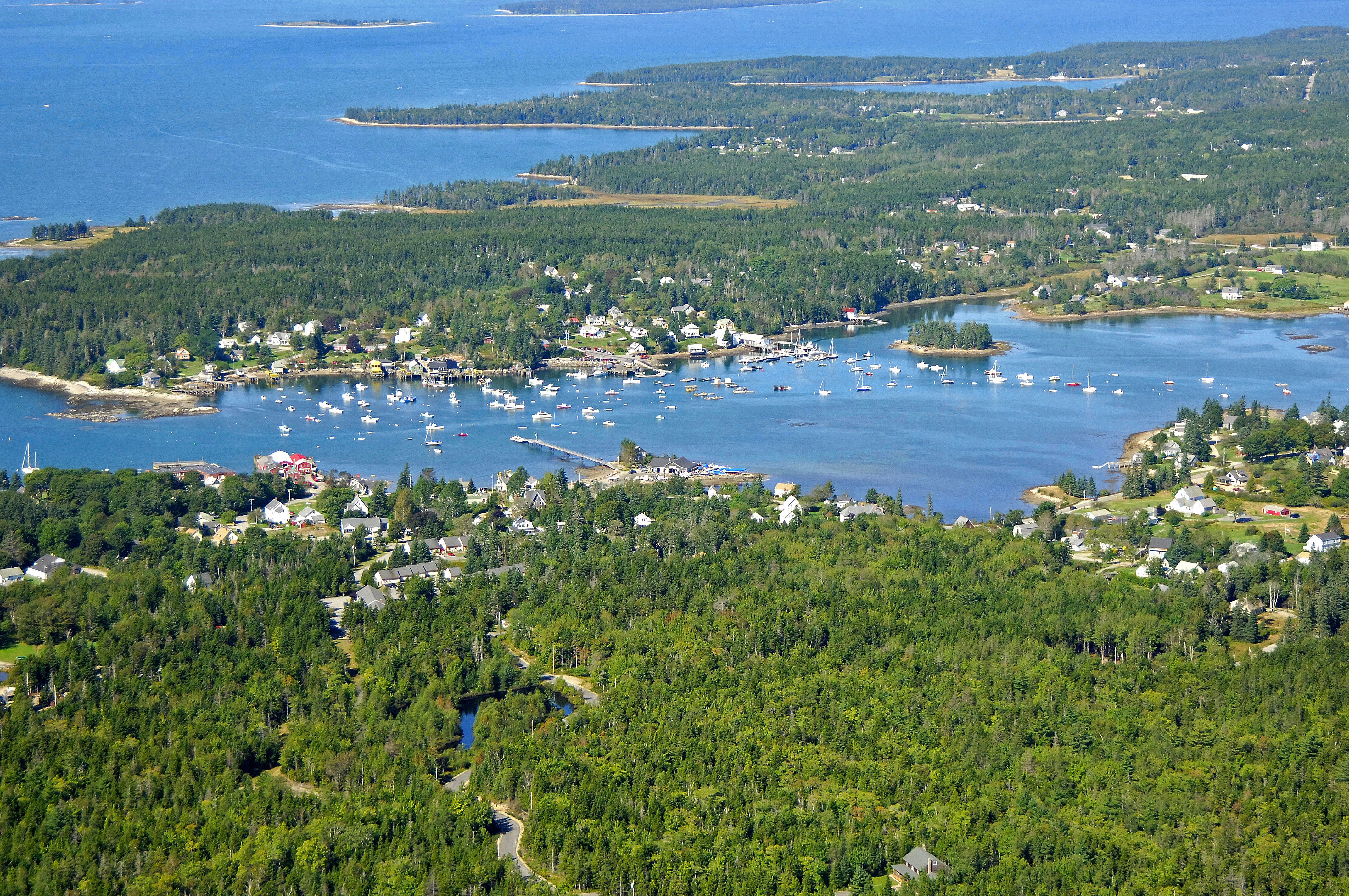
The image above is a view from the north-northeast looking south-southwest over where Bass Harbor meets Blue Hill Bay. Off in the top portion of the image are Placentia, Black, Little Gott and Great Gott Islands. A variety of marina and marine service locations can be seen along the waterfront, but most notably, Morris Yachts, builder of fine sailboats, is visible on the left-hand side of the image.
Navigating the Water:
Use NOAA Charts 13316 and 13318.
Bass Harbor is reached via an approach from the southwest through Blue Hill Bay. If you are approaching at night, Bass Harbor Head Lighthouse has an occulting red light (every four seconds) that stands 56 feet above the water. On your initial approach, first set a course to arrive in the area of waypoint N44 13.311 W68 20.946.
Once you have successfully navigated to the area of the waypoint, set an approximate course of 003 degrees magnetic for about .8 mile to arrive just south of the narrowing piece of water that leads into Bass Harbor proper. Make sure you honor green can buoy 1 and red nun buoy 2 at Weaver Ledge on your way north.
Green can buoy 5 marks the entrance back into the harbor and town wharf where most of the marine service and marina facilities are located. Depths in the primary portion are reported on the chart at 10 feet, but begin to shallow gradually north of Johns Island.
Local Notices to Mariners:
Local Notices to Mariners are available online from the U.S. Coast Guard.
Transportation:
A local ferry provides regular service to nearby Swans Island for those visitors who would like to explore the nearby island.
Like most of the outlying harbors and coves on Mount Desert Island, Bass Harbor is remote, and the only way to get around is by bike or on foot. Much like the rest of Mount Desert Island, you will have to be fairly self-sufficient to get around efficiently.