Cape May Canal East Inlet


You might also consider...


About
Introduction:
The Cape May Canal is a sea-level (no locks) man-made passage that runs from the Delaware Bay north of Cape May Point three miles east to Cape May Harbor. The canal makes the trip into Cape May Harbor possible without negotiating sometimes choppy Cape May Point and Cape May Inlet.
Minimum depths in the canal are a relatively deep seven plus feet, and as long as your boat does not tower more than 55 feet, you will have no problems with any of the three bridges here (the railroad swing bridge - four-foot closed vertical clearance - is left in the open position unless rail traffic is approaching.
Inside Cape May Harbor are a plethora of marine facilities with transient slips, fuel, repairs and all other sorts of services. Some of these facilities are among the best ont he coast hereabouts.
HIstory:
The United States Army Corps of Engineers undertook construction of the Cape May Canal to provide a protected route for ships transiting the coast from Delaware Bay during World War II. German U-Boats were known to operate off Cape May Point, and routing ships inside avoided possible attack from the Germans. The canal would also complete the lower section of the New Jesrey Intracoastal Waterway in 1942.
Navigating the Water:
Use NOAA Chart 12316.
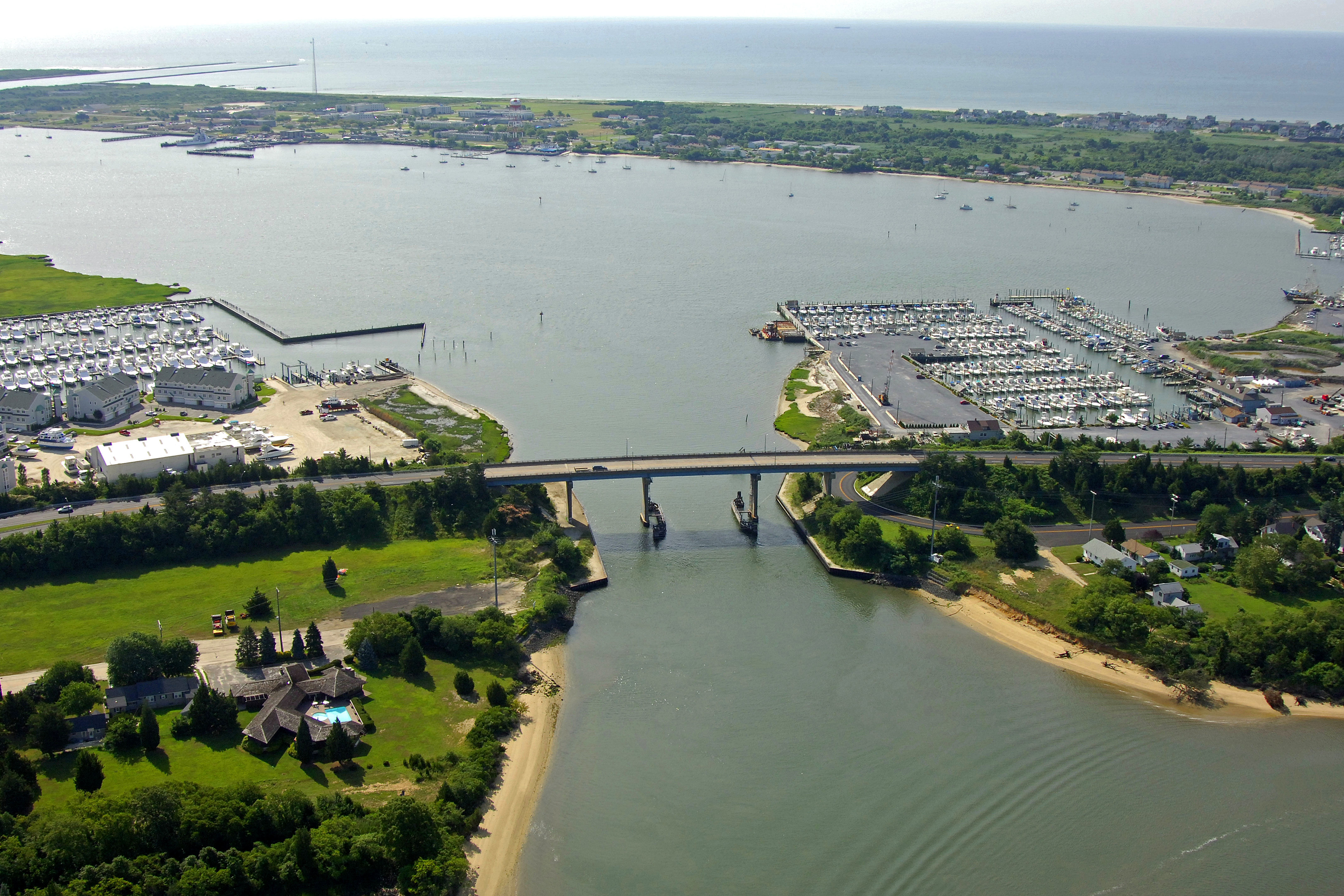
Although the image above shows the Cape May Canal where it terminates at Cape May Harbor, the primary entrance is three miles to the west near Higbee Beach. We will discuss both entrances here.
From Delaware Bay, set a course to intercept flashing red buoy 8, which is about a half-mile to the west of the jetties at the canal entrance. Flashing green (horn) 11 and flashing red 10 mark the north and south jetties to the inlet, respectively. Once inside, keep a sharp eye out to port for ferry boats entering and departing the Cape may-Lewes Ferry terminal. Once you have cleared their basin, proceed east until you exit at the 55-foot fixed vertical clearance bridge shown above into Cape May Harbor.
From Cape May Harbor, exit the harbor channel at flashing red 12, and then set a course to the northwest to pick up flashing red 14 just before you get to the fixed bridge at the top end of the canal. If you need marina facilities upon entering or exiting the canal, you can work your way up Cape Island Creek just northwest of the 55-foot fixed vertical clearance bridge, or in Cape May Harbor at the terminus of the canal to starboard (visible in the image above).
Things To Do/Local Events:
Local Notices to Mariners are available online from the U.S. Coast Guard.