Harris River Inlet


You might also consider...


About
Introduction:
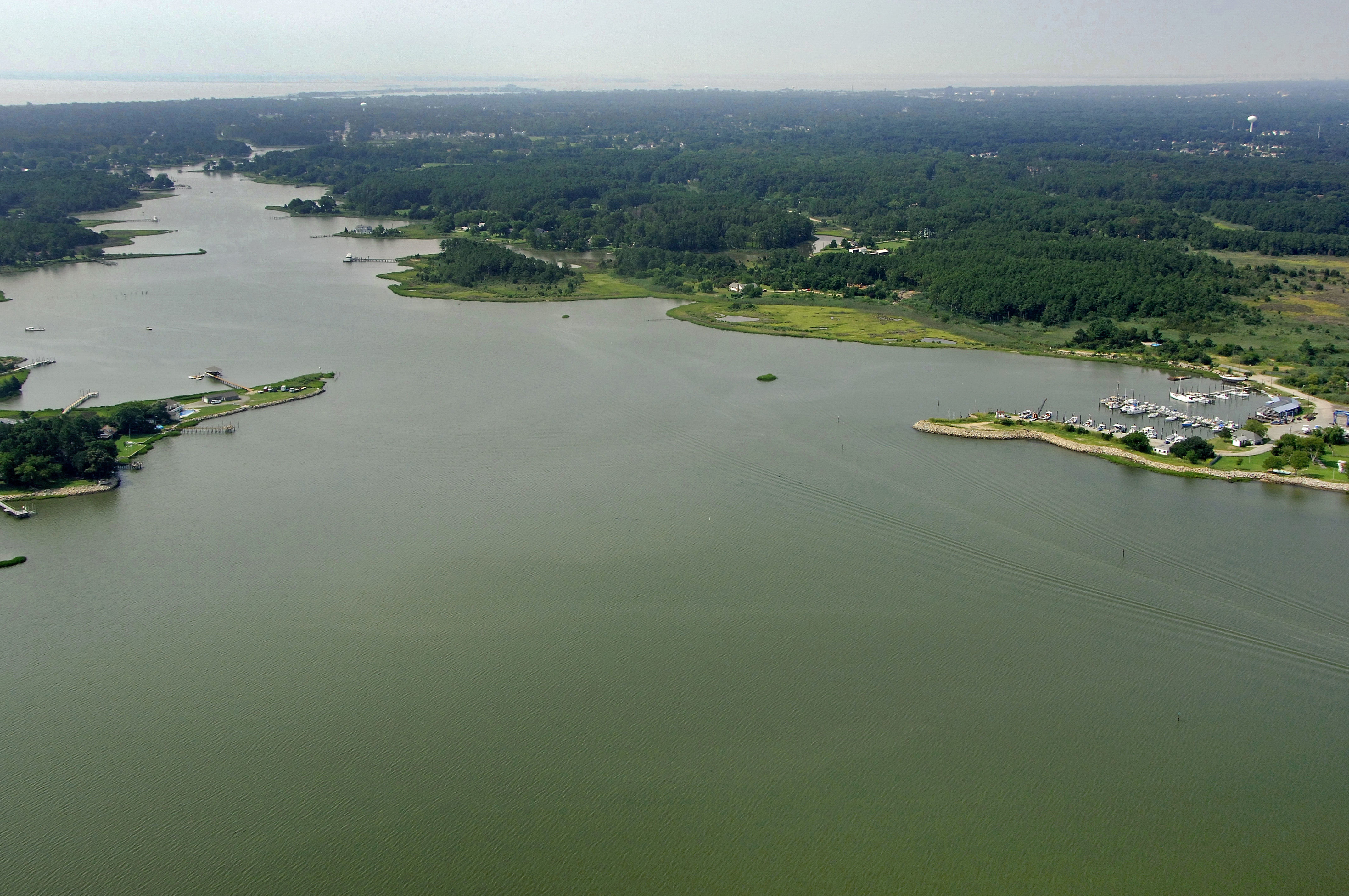
The Harris River is located off of Back River on the Western Shore of Virginia about five miles north of the City of Hampton. One of several branches off of Back River near the mouth of the Chesapeake Bay, Harris River is perhaps the widest, deepest and best protected of them all. There is a marina at the mouth of the creek and anchorage is available farther upstream in a mud bottom with four- to seven-foot depths. The only direction the creek is open to is the north; all other directions are well covered by trees.
Navigating the Water:
Use NOAA Chart 12238.
Flashing green 1BR marks the beginning of the entrance into Back Creek form the Chesapeake Bay southeast of Northend Point. From flashing green 1, pick up red daybeacon 2, flashing red 4, flashing green 5, red daybeacon 6, flashing green 7, and then the two main entrance markers flashing green 9 and flashing red 8 at the Back River entrance.
From Northend Point, follow the series of daybeacons leading off to the west until you reach flashing green 17 at the mouth to the Harris River. On your way from Northend Point, be sure to mind flashing green 13, which marks a shoal extending to the west. Once you have made your southerly turn toward the Harris River, simply follow the daybeacons into the mouth at Windmill Point.
Local Notices to Mariners:
Local Notices to Mariners are available online from the U.S. Coast Guard.