Pablo Creek North Inlet
You might also consider...

29 Reviews
The marina is a world-class facility, nestled along the Ortega River in the h... Read More
63 Reviews
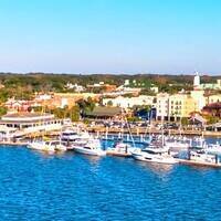
Nestled in the heart of historic Fernandina Beach, Fernandina Harbor Marina i... Read More

7 Reviews
Oyster Bay Yacht Club is tucked away on the northern tip of Oyster Bay Harbou... Read More
About
Introduction:
Breaking off the Saint Johns River at Chicopit Bay, Pablo Creek takes the Intracoastal Waterway (ICW) boater south from ICW Mile 741, past Jacksonville Beach, and on to the Tolomato River at ICW Mile 760.
Navigating the Water:
Use NOAA Chart 11489.
Flashing green 1, off the Mile Point Lower Range on the Saint Johns River starts you in toward Chicopit Bay, and then onto Pablo Creek to the south. After clearing flashing green 1, a series of green daybeacons (visible on the image above) mark a narrow channel, which has very shallow depths on either side make sure to honor them religiously.
Local Notices to Mariners:
Local Notices to Mariners are available online from the U.S. Coast Guard.
Reviews
No reviews yet! Be the first to write a review of Pablo Creek North Inlet.