Kennebec River Inlet
| Popham Beach, Maine United States | |
| 43° 45' 20.16'', -69° 46' 54.12'' | |
| Atkins Bay |


You might also consider...


About
Introduction:
The Kennebec River is located on the middle Maine Coast and empties into the Atlantic Ocean just west of Sheepscot Bay. The Kennebec River gets its start at Moosehead Lake, and then flows 150 miles south toward the Atlantic Ocean. Along the way, it passes by the cities of Madison, Augusta and Bath.
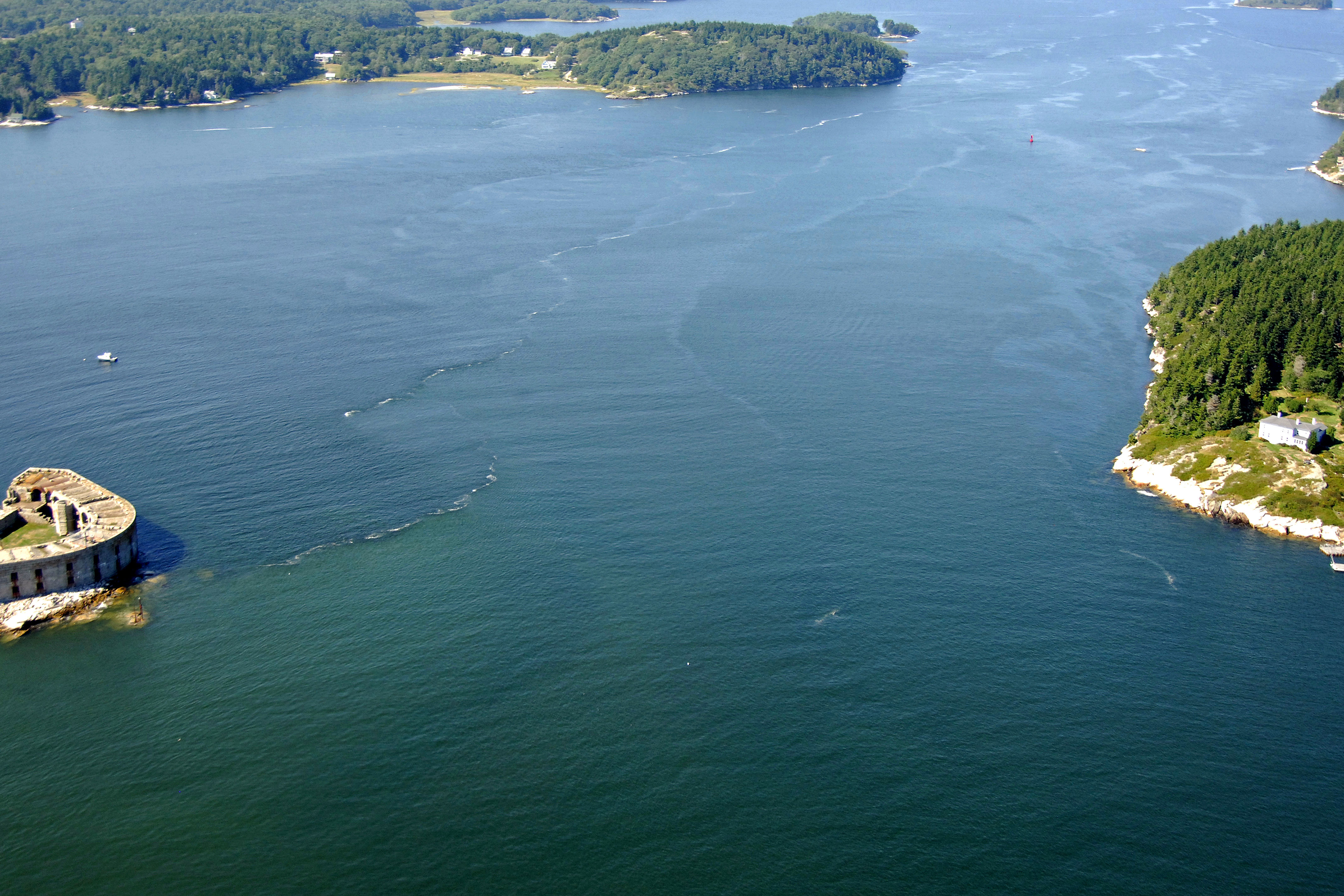
The image above is a view from the southeast looking northwest over the Kennebec River where it empties into the Atlantic Ocean. Off to the left (west) side of the image, Fort Popham, a Civil-War-era fort that was never technically completed, but still a popular attraction for visitors. The right (north) side of the image is dominated by Gilbert Head, which is at the southern end of Long Island. Farther up ini the top portion of the image, long and wide Cox Head can be seen.
The Kennebec River is swift and sometimes tricky and treacherous. If you take a close look at the image above near Fort Popham, not the tide rips formed on the south side of the inlet. Currents can run quite strong, and traveling with a fair tide is recommended, especially for auxiliary or underpowered vessels.
The first major marine facilities directly on the Kennebec River are located in the city of Bath, which is located about ten miles upstream.
Navigating the Water:
Use NOAA Chart 13293.
The Kennebec River is reached via an approach from the east from the Atlantic Ocean. To reach the Kennebec River, first set a course for flashing green bell buoy 1, which is located at an approximate waypoint of N43 43.819 W69 44.899. Once you have safely navigated to flashing green bell buoy 1, set a new course to the northwest to intercept red and green buoy KR, about a half-mile away.
From red and green buoy KR, set a new course of about 333 degrees magnetic for .7 mile, where you will find red nun buoy 4, which marks a ledge extending south from Stage Island. The next course change is to the northwest where things can get a bit exciting with strong tide rips and currents.
From Red nun buoy 4, set a course of about 322 degrees magnetic for about .7 mile until you reach green can buoy 5. Past green can buoy 5, head a bit farther north to intercept red nun buoy 6, and then head north-northwest into the Kennebec River past Fort Popham.
Local Notices to Mariners:
Local Notices to Mariners are available online from the U.S. Coast Guard.