The Gut West Inlet


You might also consider...


About
Introduction:
The Gut is a narrow passage of water that not only allows passage between Johns Bay and the Damariscotta River, but it also divides and creates Rutherford Island away from the mainland. The Gut is located off the town of South Bristol and situated three miles northwest of Pemaquid Point and four miles northeast of Boothbay Harbor.
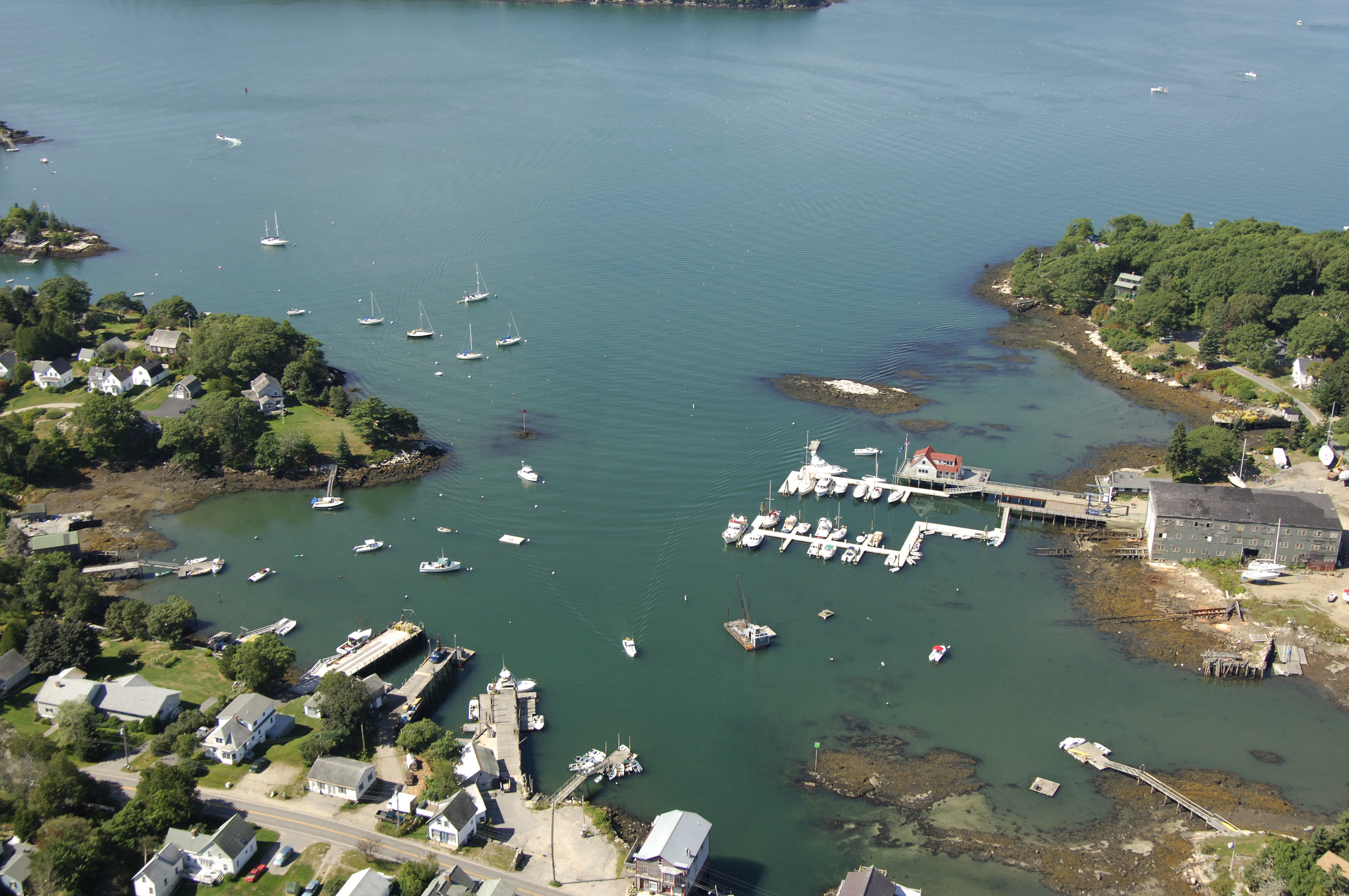
The image above is a view from the west looking east over the entrance to the Gut from the Damariscotta River. The body of land to the right (south) is Rutherford Island. Off to the left (north) is the town of Bristol. Farther up in the image toward the top is a three-foot vertical clearance swing bridge, which opens on signal at most times. The last note of interest are the thousands of lobster trap floats that can be seen dotting the approach into The Gut.
Despite its relatively small geographical size and narrow channel, The Gut is home to four well-equipped marine service and marina facilities. Two of the facilities are located on the west side of the aforementioned swing bridge and two are located to its east.
If you are looking transient slips, Gamage Shipyard Storage and Repair and Osiers Wharf both have slips available for visiting boaters. Both of these facilities also pump gas and diesel fuel. The moorings in the Gut are maintained by the Bittersweet Landing Boatyard and Gamage Shipyard Storage and Repair. Bittersweet Landing Boatyard and Gamage Shipyard Storage and Repair both have lifts for haul-outs and related repair services.
Navigating the Water:
Use NOAA Chart 13293.
The western side of The Gut is approached through the Damariscotta River just east of Farnham Point. Minimum depths in the Gut are between five and eight feet, with the shallowest depths occurring at the swing bridge in South Bristol. The only other major challenge to navigation is a strong current that runs here on both tides and hundreds, if not thousands of lobster pot floats on the approach.
From the Damariscotta River, first pick up red nun buoy 6, which is located at an approximate waypoint of N43 51.420 W69 34.039. Once you have successfully picked up red nun buoy 6,set a course to the northeast to intercept red daybeacon 2, and then farther on to green daybeacon 3. The swing bridge normally opens on signal, but if you need to pass through, make sure to radio ahead and verify, especially if there is a strong current running.
Local Notices to Mariners:
Local Notices to Mariners are available online from the U.S. Coast Guard.