Galveston Bay Inlet
| Galveston, Texas United States | |
| 29° 21' 0.0'', -94° 43' 10.55'' | |
| Galveston Bay |


You might also consider...


About
Introduction:
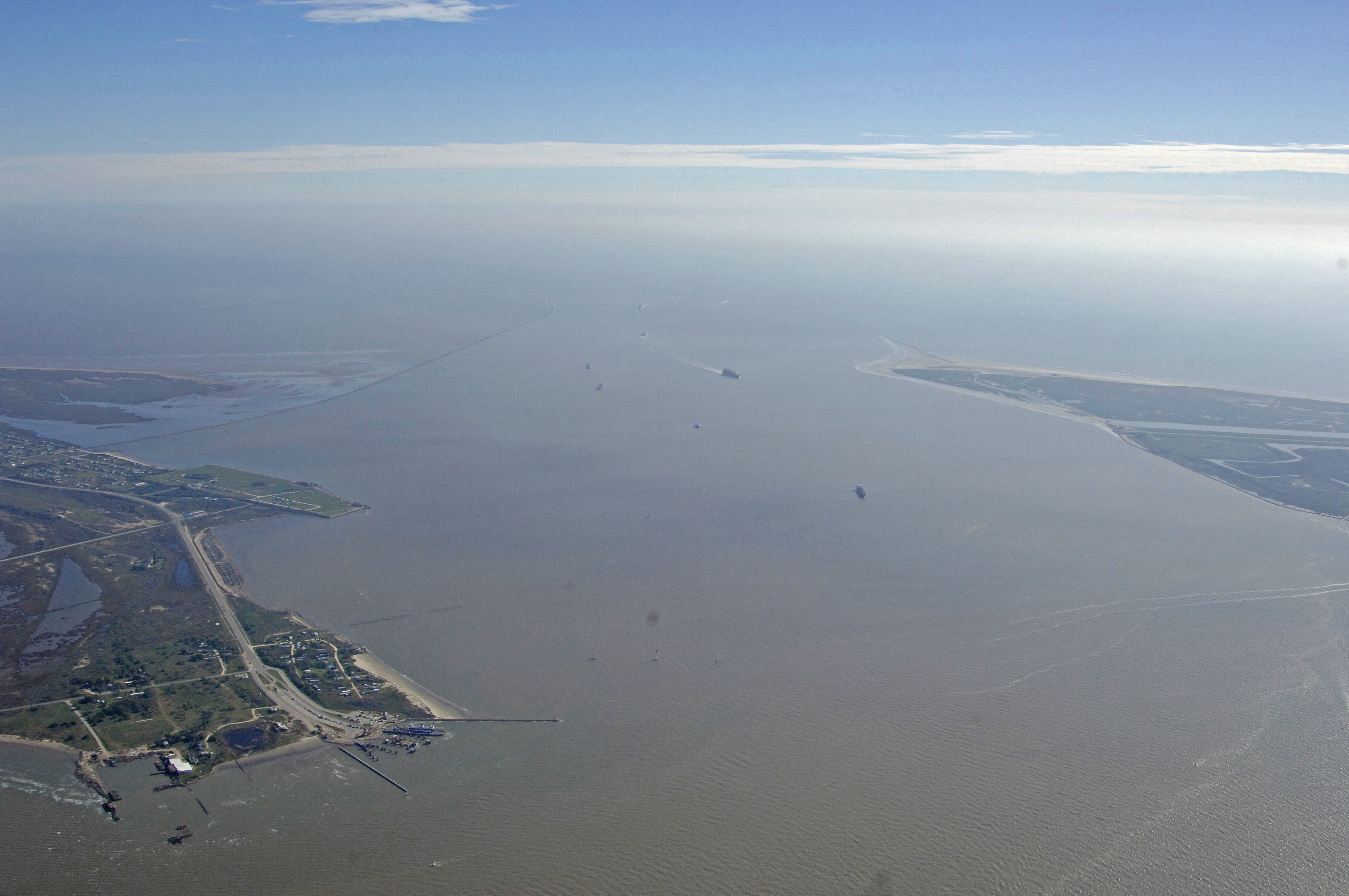
The image above is a view from the south over Galveston and Pelican islands and up into the entrance channel to Galveston Bay between Port Bolivar to the east (right) and the long port barrier from Texas City to the left (west). Though the depths in and around Galveston Island are fairly deep and kept dredged for oil tankers and commercial vessels all the way up to the Houston Ship Channel, the majority of Galveston Bay is shallow, with average depths of five to 10 feet. Outside of the ship channels is nowhere near a navigational nightmare, but you do have to keep an eye out on where you are and what areas you may be heading into.
Galveston Bay encompasses many shoreside areas, and many are set up to handle visiting boaters with good facilities. In Galveston itself, the majority of the marinas are located just south of Pelican Island and north of Galveston Island right among the port facilities. These marinas are visible to the left (west) in the image above, if you use the zoom feature that is located in the upper left-hand corner of the image. The second largest marina area is around Offatts Bayou just near Teichman Point and farther east near the airfield on Galveston Island.
Navigating the Water:
Navigating in and around the Galveston Island area is quite easy if you keep a few pointers in mind. First, this is a commercial cargo and oil refining area, and some of the largest oil tankers, car carriers and even cruise ships use the deep-water channels the lead into Galveston Bay and the surrounding waters. Secondly, much of the off-channel water in Galveston Bay is shallow (five to ten feet with shallower spots), so you must keep an eye on the depth sounder and plot your navigational course for the deepest water if you draw more than five feet. Lastly, the maze of lights and onshore aids to navigation can make finding lighted buoys a nightmare at night. A slow and steady course, and a GPS, if available, are highly recommended tactics.
Statute Mile 350 of the Gulf Intracoastal Waterway is located dead in the center of the Galveston approach channel. This inland water way leads west and east of Harvey Lock in Louisiana, and farther west to the Rio Grande River.
Local Notices to Mariners:
See our Local Notices to Mariners blog for updates on the latest conditions and advisories for this area.