Kent Island Narrows Inlet North
| Queenstown, Maryland United States | |
| 38° 58' 39.0'', -76° 14' 34.07'' | |
| Kent Narrows |


About
Introduction:
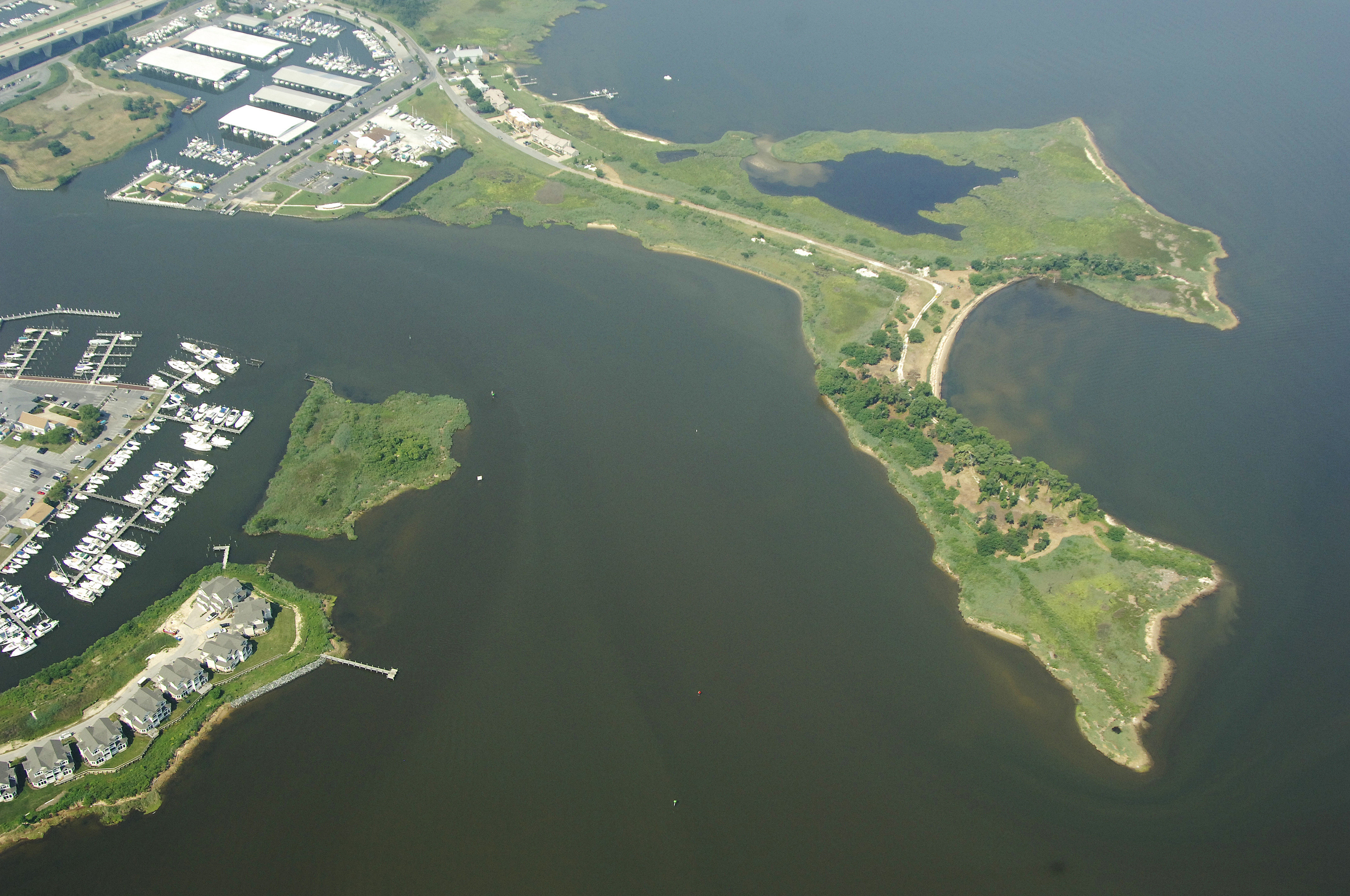
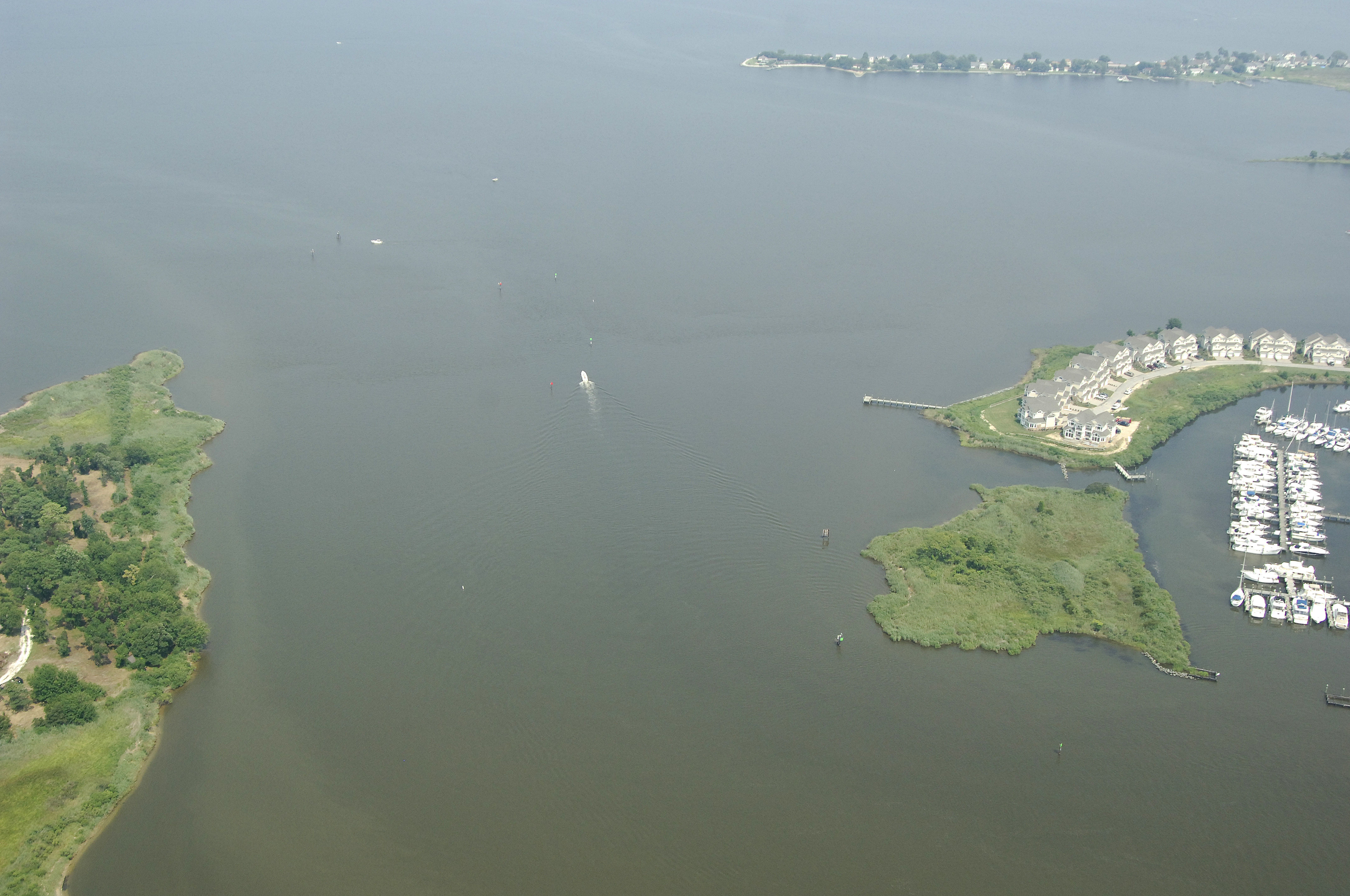
Kent Island Narrows is a major north-south thorofare that allows boating traffic from the Chester River to travel south, and into, Eastern Bay. Kent Island Narrows is line with just about every imaginable marine service including marinas, repair yards, dock bars and restaurants. Summertime traffic here is hectic, as boats ply the water for fish, and traveling mariners look for the best slip to tie up at for the evening.
Navigating the Water:
Use NOAA Chart 12272.
From the Chester River, Kent Island Narrows North Inlet is reached via along dredged channel that approaches from the northwest, and then makes a sharp dogleg to the south. Kent Island Narrows is notorious for two things: shoaling and strong currents. Although thousands of boaters make this passage every year without event, usually only careless mariners are the ones that end up on a shoal.
From the north, quick flashing red 2K and quick flashing green 1K mark the beginning of the passage toward Kent Island Narrows. Next in line are flashing red 4 and flashing green 3, followed by quick flashing red 6 and quick flashing green 5. At this point, the channel makes a turn to the south, and flashing red 8 and green daybeacon 9 must be observed in order to avoid going aground on the two-foot-deep shoal extending south from the western tip of the island.
Two more sets of daybeacons and a flashing green light help guide you in the rest of the way to Kent Island Narrows. A 65-foot fixed vertical clearance bridge crosses the Narrows at the half way point, and a 18-foot closed vertical clearance bascule bridge follows just south of the first high clearance bridge.
The bascule Bridge operates on a restricted opening schedule. From Nov.1- to April 30 the bridge opens on signal from 6 a.m. to 6 p.m. From May 1 to Oct. 31, the bridge opens on the hour and half-hour from 6 a,m to 9 p.m. Other times need not open.
Local Notices to Mariners:
Local Notices to Mariners are available online from the U.S. Coast Guard.