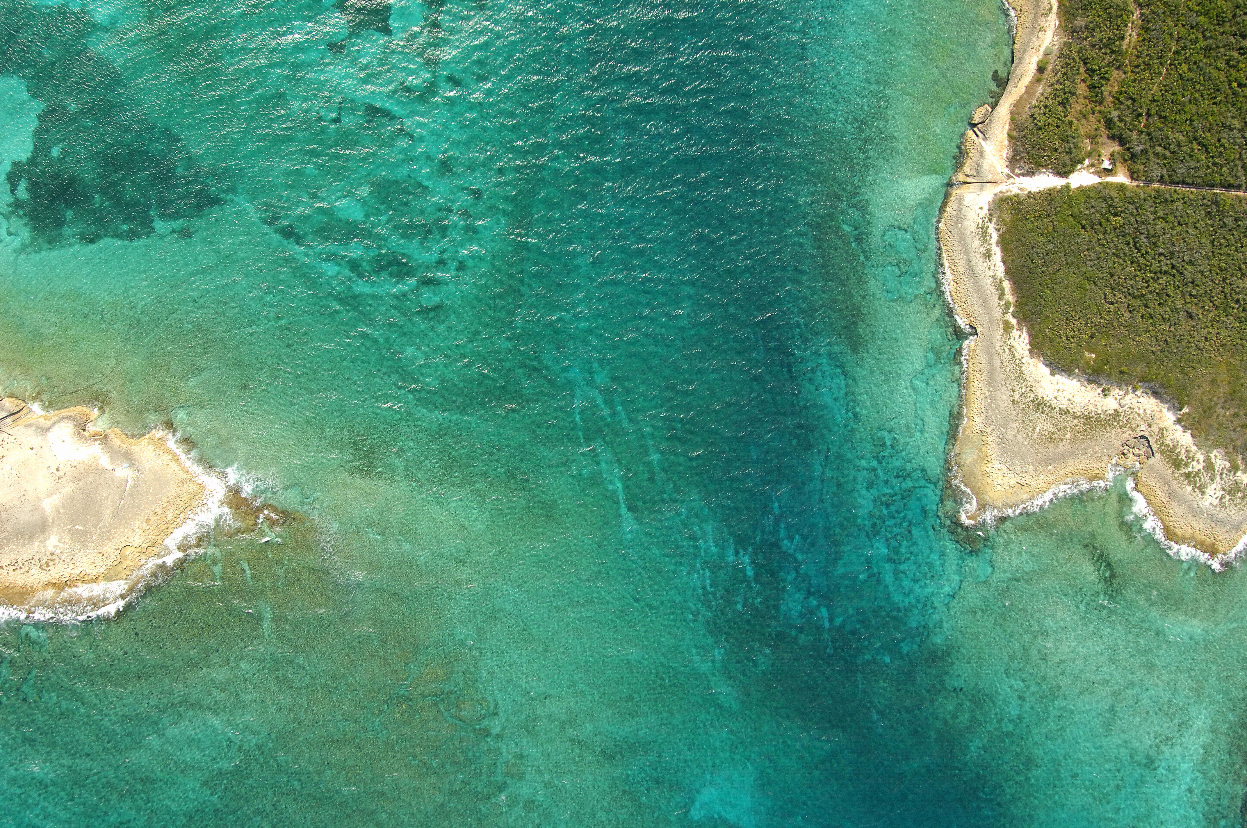
Harbour Mouth Inlet
| Eleuthera Bahamas | |
| 25° 28' 42.6'', -76° 37' 13.44'' | |
| Harbor Island |


You might also consider...


About
Introduction:
Harbour Mouth is located on the south side of Harbor Island and cuts between Eleuthera and Harbour islands from the east via the Atlantic Ocean. Located on the northern end of the island of Eleuthera, Harbour Island itself is one of the most popular destinations in the Bahamas. Known fondly as Briland by many visitors, Harbour Island is filled with shops, markets, boutiques and all manner of provisioning and supply facilities a cruising boater could ask for. The island is quite popular, and during busy in-season weekends, golf carts jam the streets in a Bahamian traffic jam that is quite a spectacle to see.
There are two primary marinas on the island and both are located off the west side side of the central portion of the island. Valentines Resort and marina is to the north and is the larger of the two, while Harbour Island Club and Marina is to the south. Anchorage is available off both marinas in seven to 10 feet of water.
Navigating the Water:
The southern entrance into Harbour Island is known as Harbor Mouth and is the primary means of reaching the harbor and bay behind Harbour Island. Harbour Mouth is approached from the east. Arriving in the area, first set a course to intercept waypoint 25 28.996N 76 37.114W, which is almost a mile northeast of the Harbour Mouth entrance between Harbor and Eluethera islands. Once you have picked up the aforementioned waypoint, set a course of 229 degrees true for a distance of almost a mile. Depths in the channel between Eleuthera and Harbour Island range from 13 to 19 feet. Be sure to mind the jagged reefs on either side of the inlet channel.
Once inside, you have two channels to choose from and your draft will help you decide which to take. The southern passage has six- to seven-foot depths, while the northern passage is a bit shallower with four- to six-foot depths.
To start the northern passage just west of the Harbour Mouth Inlet, first pick up waypoint 25 28.519N 76 37.7191W. From here, set a course of 256 degrees true for a distance of one mile. This will lead you through the deepest parts of the passage, but keep an eye on your depth sounder and mind a charted wreck to the south on the western end of the channel.
For the southern passage, start out at the same aforementioned waypoint as above (25 28.519N 76 37.7191W), but set a course of 206 degrees true for about .6 mile. There are shallow sand bars on either side of the channel, but if you mind your depth sounder and post a lookout on the bow for the deepest water, you should do fine. Once clear of the narrow sliver of water between the two sandbars, set a course of 238 degrees true for about .8 mile, and then change course to 270 degrees true to run behind the western extension of a large sand bar.
The two course intercept at waypoint 25 28.438N 76 38.883W, and from here, you can head toward the north, making sure to avoid the long shoal that works west from the bottom end of Harbour Island. Once you have cleared the shoal, you can proceed to the northeast on a course of 24 degrees true toward the two marinas and the double anchorages on the west side of the island. The two marinas and the anchorages are visible n the image above just off the left (west) side of Harbour Island.
Local Notices to Mariners:
See our Local Notices to Mariners blog for updates on the latest conditions and advisories for this area.