Grunland Creek Inlet
About
Local Notices to Mariners:
Local Notices to Mariners are available online from the U.S. Coast Guard.
Introduction:
Grunland Creek is a small piece of water about six-tenths of a mile in from the Back River entrance at the Chesapeake Bay, and is located on the rivers southern shore. Grunland Creek and the Back River are seven miles northeast of Hampton and 18 miles west of Cape Henry, which is on the northern end of the mouth of the Chesapeake Bay.
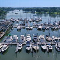
The image above is a view from the south looking north over the mouth of Grunland Creek where it meets Back River. To the right (east) is the Back River Inlet where it empties into the Chesapeake Bay, and farther on in the upper portion of the image is Big Salt Marsh. Note the exposed shoal on the approach to the creek.
Navigating the Water:
Use NOAA Chart 12238.
Once you have cleared the entrance into the Back River at Northend Point, pick up green daybeacon 9B, and then head southwest to intercept red daybeacon 2, which leads off on a side channel south toward Grunland Creek. (Grunland Creek cannot be reached from the main Back River Channel, due to shoals. You must use this side channel to reach it.)
Past red daybeacon 2, continue to head south-southwest and follow in red daybeacon 4, red daybeacon 6, green daybeacon 7, red daybeacon 8, and then green daybeacon 9, where you will turn south to intercept green daybeacon 1 at the entrance to the channel to Grunland Creek. Next comes red daybeacon 2, and green daybeacon 3. The rest of the aids to navigation into Grunland Creek are not charted, but reportedly well-placed. Depths range from three to five feet, but if you are in doubt, call ahead to the Belle Isle Marina for the latest conditions on the approach.
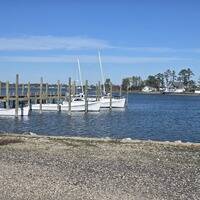
Just inside Grunland Creek to starboard on entry is the Belle Isle Marina, which has transient slips available for guests, and a lift for haul-outs and related repair services. Anchorage is scarce inside the creek, due to several docks that encroach into the channel.


