


Great Oak Harbor
Great Oak, Maryland United States
Marinas near Great Oak Harbor
| Name | Reviews | Max LOA | VHF | Dock Depth | Gas / Diesel | Lift / Crane | Wifi | Amps |
|---|---|---|---|---|---|---|---|---|
| Safe Harbor Great Oak Landing | 90.0' | 9 | Low 6.0' | G$4.59/galD$5.29/gal | LYes | 100 | ||
| Great Oak Yacht Club | - | 9 | - | - | - | - | - | |
| Worton Creek Marina | 60.0' | 16 | - | GYesDYes | LYesCYes | 30, 50 | ||
| Wharf at Handy's Point LLC | 55.0' | - | - | GNearby | LYes | 30, 50 amp | ||
| Green Point Landing | - | 0.0' | 16 | Low 10.0'High 0.0' | - | - | - | - |
| Spring Cove Marina | - | - | Low 6.0' | - | - | - | ||
| Scott Point Marina | - | 0.0 m | - | Low 0.0 mHigh 0.0' | - | - | - | - |
| Chestertown Marina | 326.0' | 16 | Low 6.0'High 0.0' | GYesDYes | - | - | 30/50/100 | |
| Osprey Point Marina | 60.0' | 16 | Low 6.0'High 0.0' | - | - | 1x30 / 2x30 / 1x50 | ||
| Swan Creek Marina | 55.0' | 16 | Low 6.0' | - | LYes | 30, 50 | ||
| Haven Harbour Marina | 80.0' | 16 | Low 6.0' | G$6.213/galD$5.981/gal | LYesCYes | 30-50 | ||
| Chester River Yacht Club | - | - | - | - | - | - | - | - |
| Moonlight Bay Marina & Inn Rock Hall | - | 35.0' | - | Low 7.0'High 0.0' | GNearbyDNearby | - | - | |
| Chester River Marine Service | - | - | - | - | - | - | - | - |
| Gratitude Marina | 50.0' | 16 | Low 6.0' | GYesDYes | LYesCYes | 30, 50 |
Introduction:
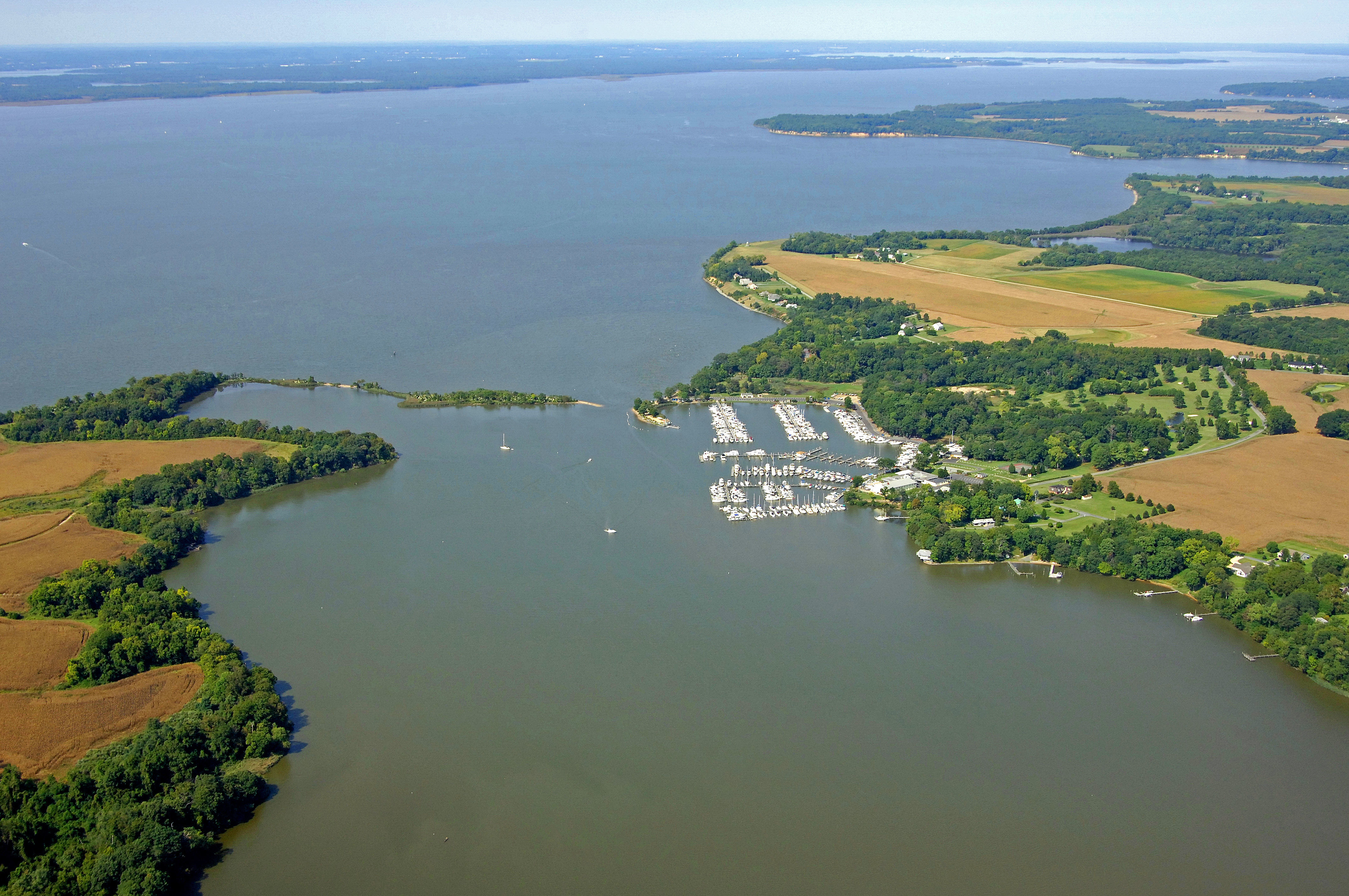
Fairlee Creek is a small, and extremely well-protected and beautiful piece of water that is located on Marylands upper Eastern Shore, 15 miles northwest of the mouth of the Patapsco River and 21 miles south-southeast of the C&D Canals western entrance near Chesapeake City.
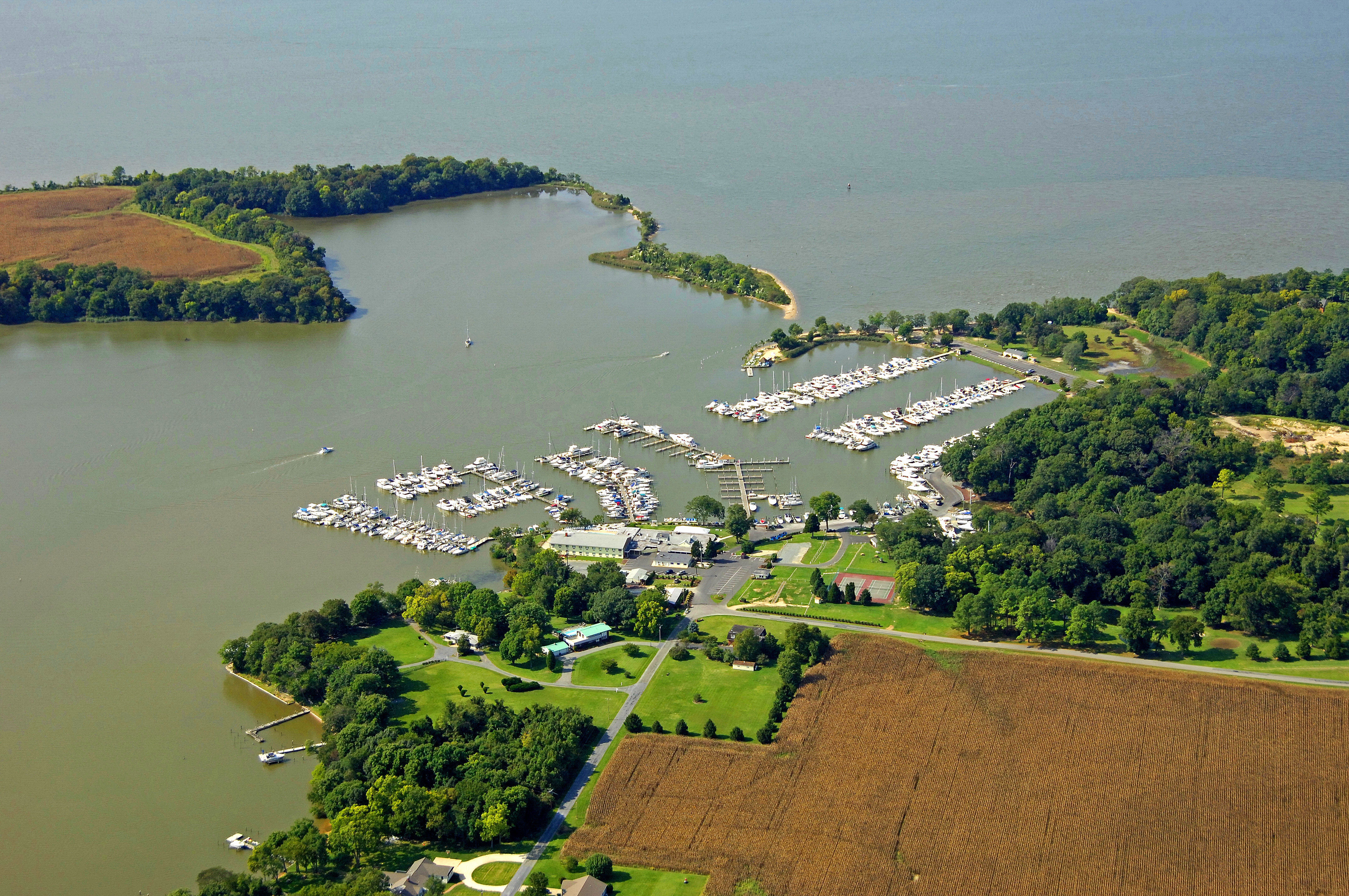
Inside the creek is the expansive Mears Great Oak Landing Marina, a 70 acre boaters paradise boasting a 9 hole par 3 golf course and private sand beach. There are plenty of places to drop the hook and explore; the entire creek carries about 4-7 depths and 5-9 at the entrance.
The image above is a view from the southeast looking northwest over the Great Oak Landing area and Fairlee Creek, with the Chesapeake Bay in the background. Great Oak is a scenic peaceful area, so in addition to its 9 hole golf course, the marina provides 2 great eateries, and shopping opportunities for gifts and novelties in the ships store as well as kids programs and an entertainment schedule. You may be able to grab a ride with one of the marina employees into Rock Hall or Chestertown. Great Oak Lodge is also located at the marina, with 28 well appointed rooms perched on a hill with breathtaking views of Fairlee Creek and the Chesapeake Bay.
A short walk up the beach is Great Oak Manor, a gorgeous private house built in 1938 that was converted to an elegantly furnished bed & breakfast. Marina visitors are welcome.
Navigating the Water:
Fairlee Creek is located off the main upper Bay shipping channel just east of Pooles Island. From the main Bay channel, exit to the east at flashing red buoy 32 (approximately N39 16.736 W76 13.777), and then set a course of 129 degrees magnetic for about 1.2 miles to pick up flashing red 2F at the mouth of the creek. Depth of 5-9 is reported at the mouth of Fairlee Creek (4-7 foot depths inside), and carefully placed private aids to navigation often give a good sense of where the deepest water is. A slow and cautious approach with a sharp eye on the depth sounder is the best advice.
Local Notices to Mariners:
Local Notices to Mariners are now exclusively available online from the U.S. Coast Guard.