


Rock Hall Harbor
Rock Hall, Maryland United States
Marinas near Rock Hall Harbor
| Name | Reviews | Max LOA | VHF | Dock Depth | Gas / Diesel | Lift / Crane | Wifi | Amps |
|---|---|---|---|---|---|---|---|---|
| Rock Hall Marine Railway | - | 0.0' | - | Low 5.0'High 0.0' | - | - | - | - |
| North Point Marina | 100.0' | 16 | Low 7.0' | G$5.289/galD$5.899/gal | - | 30, 50 | ||
| Black Duck Inn and Dock Side Cafe | - | - | - | - | - | - | - | - |
| Rock Hall Landing | 120.0' | 16 | Low 10.0' | - | - | 30, 50 | ||
| Bayside Marina | - | 0.0 m | - | Low 0.0 mHigh 0.0 m | - | - | - | - |
| Haven Harbour South | 55.0' | 16 | Low 7.0' | - | LYesCYes | 30-50 | ||
| Haven Harbour Marina | 80.0' | 16 | Low 6.0' | G$6.629/galD$6.394/gal | LYesCYes | 30-50 | ||
| Osprey Point Marina | 60.0' | 16 | Low 6.0'High 0.0' | - | - | 1x30 / 2x30 / 1x50 | ||
| Spring Cove Marina | - | - | Low 6.0' | - | - | - | ||
| Gratitude Marina | 50.0' | 16 | Low 6.0' | GYesDYes | LYesCYes | 30, 50 | ||
| Moonlight Bay Marina & Inn Rock Hall | - | 35.0' | - | Low 7.0'High 0.0' | GNearbyDNearby | - | - | |
| Swan Creek Marina | 55.0' | 16 | Low 6.0' | - | LYes | 30, 50 | ||
| Grays Inn Creek Marina | 120.0' | - | Low 8.0' | DNearby | - | 50/30 | ||
| Long Cove Marina | 0.0' | - | Low 0.0 mHigh 0.0' | G$4.59/galD$3.99/gal | LYes | - | ||
| Lankford Bay Marina | 65.0' | 16 | Low 7.0' | G$5.10/galD$3.90/gal | LYesCYes | 30/50 |
Introduction:
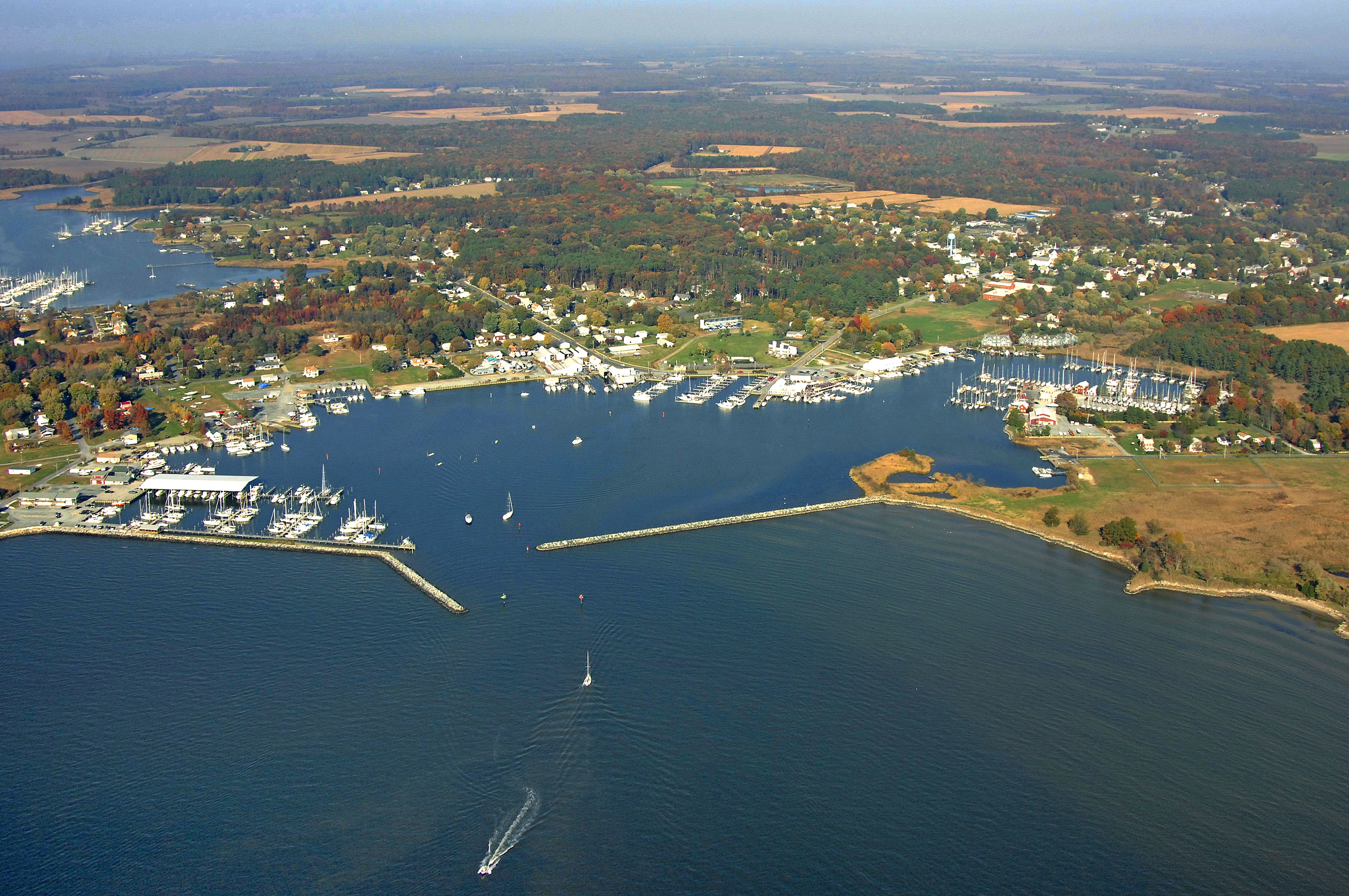
Rock Hall, located on Maryland's upper Eastern Shore, is a quaint fishing town that sits about 19 miles due east of Baltimore and 12 miles north of the Chesapeake Bay Bridge. This quiet community (named for the jagged Swan Point Shoal - called The Rocks hereabouts) is a convenient stopover or destination location for boaters and traces its history back to 1707 - first as an important tobacco port, then later as a major fishing and crabbing center.
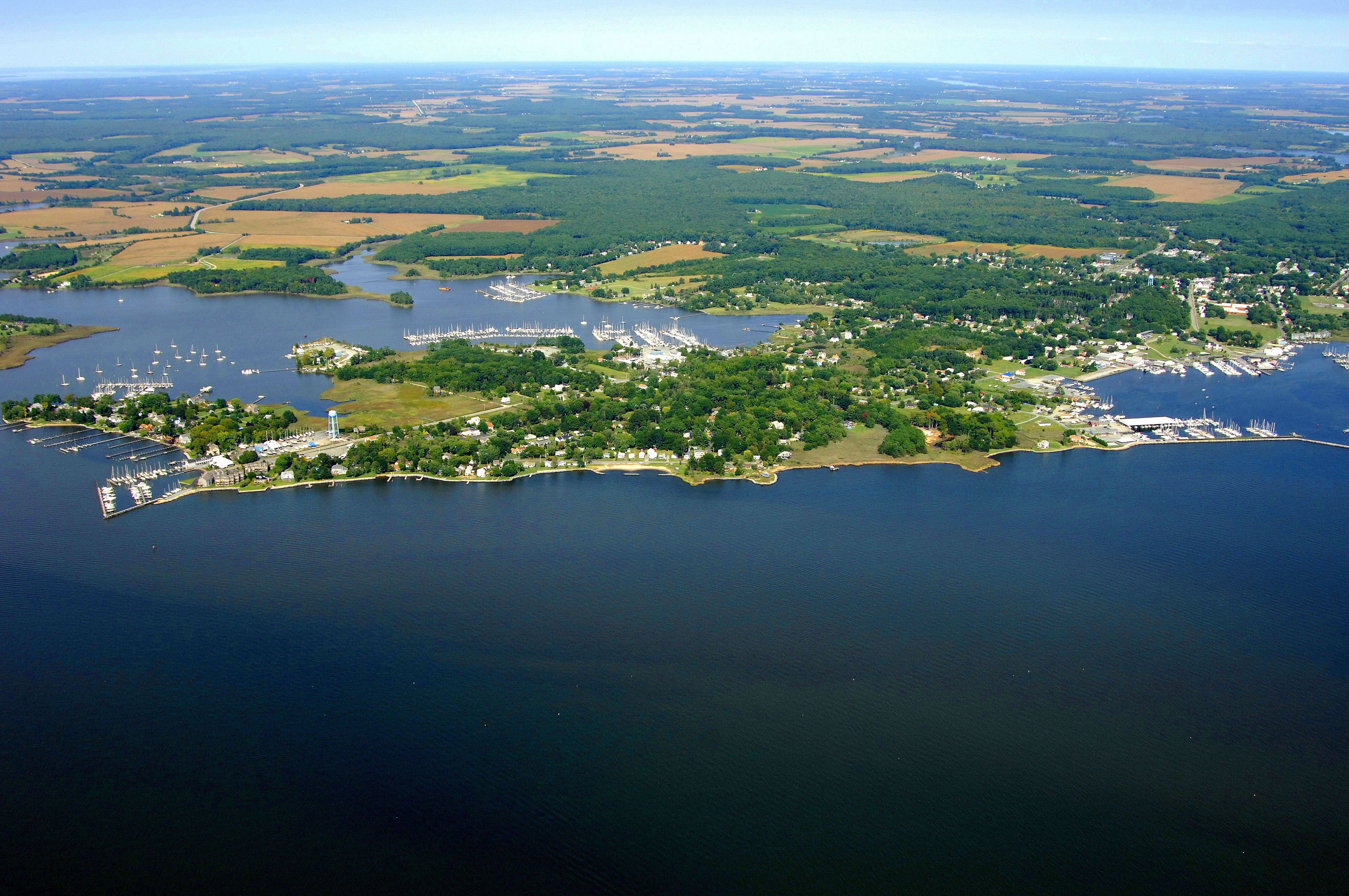
Swan Creek and Rock Hall Harbor are the two main yachting venues here, and the town itself is alive with artists, music, entertainment, and known for its many celebrations, festivals, spectacular fireworks and great restaurants. Be sure and check the <a rel='nofollow' href=http://www.rockhallmd.com/calendar.php>calendar</a> as there is always something fun to do. Visitors from all over the world come to enjoy Rock Hall's natural wildlife settings and a trip back to a simpler time. There are several large-scale marinas in the harbors and almost any type of repair or refit can be undertaken here.
Navigating the Water:
Use NOAA Charts 12278 and 12272.
If you are approaching Rock Hall Harbor Inlet from the Chesapeake Bay, keep in mind that you will have to go around the Swan Point Bar, which extends about three miles south from Tavern Creek at the mouth of Swan Creek. There are a couple of spots that those with drafts of less than five feet can get through, but only with advance local knowledge.
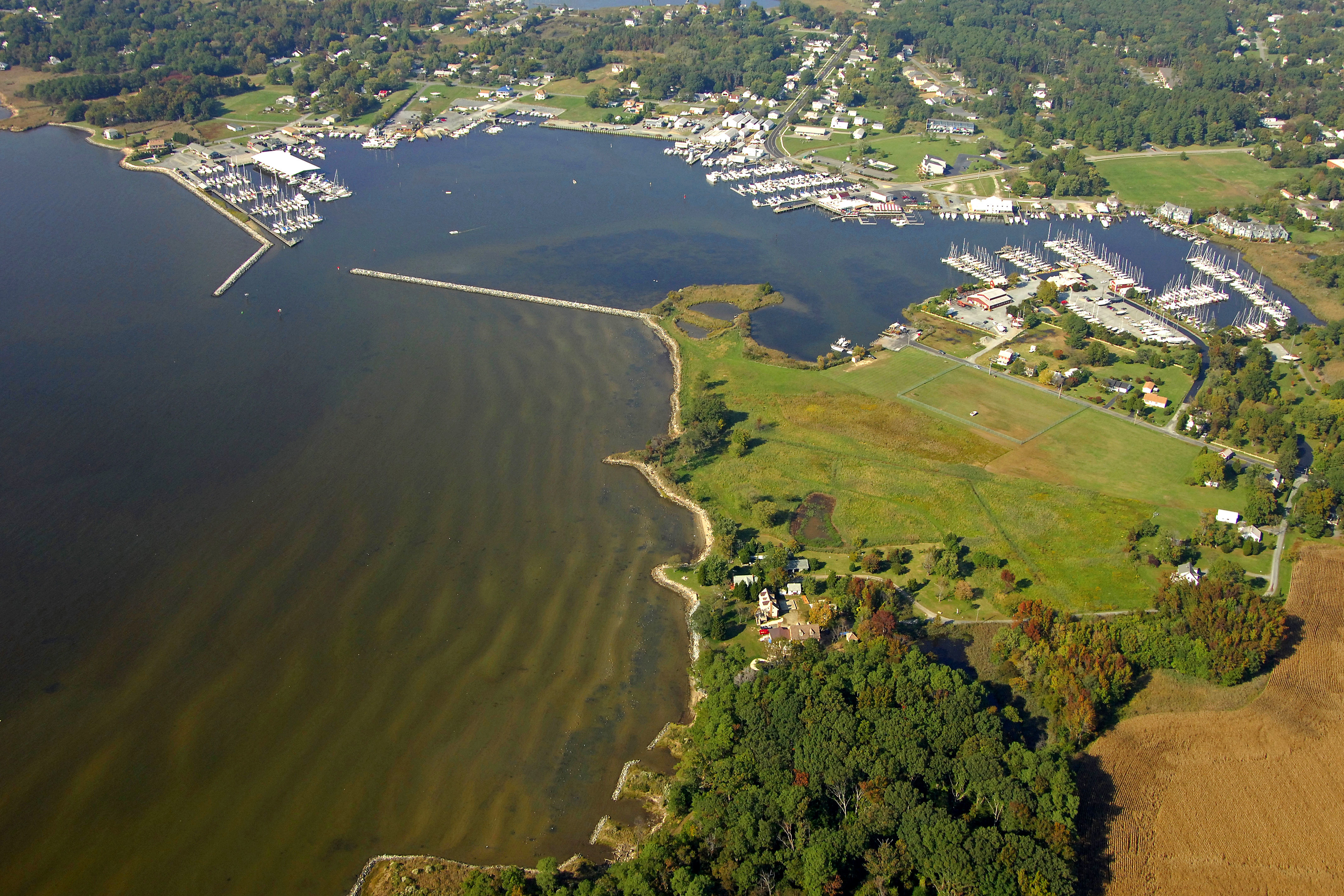
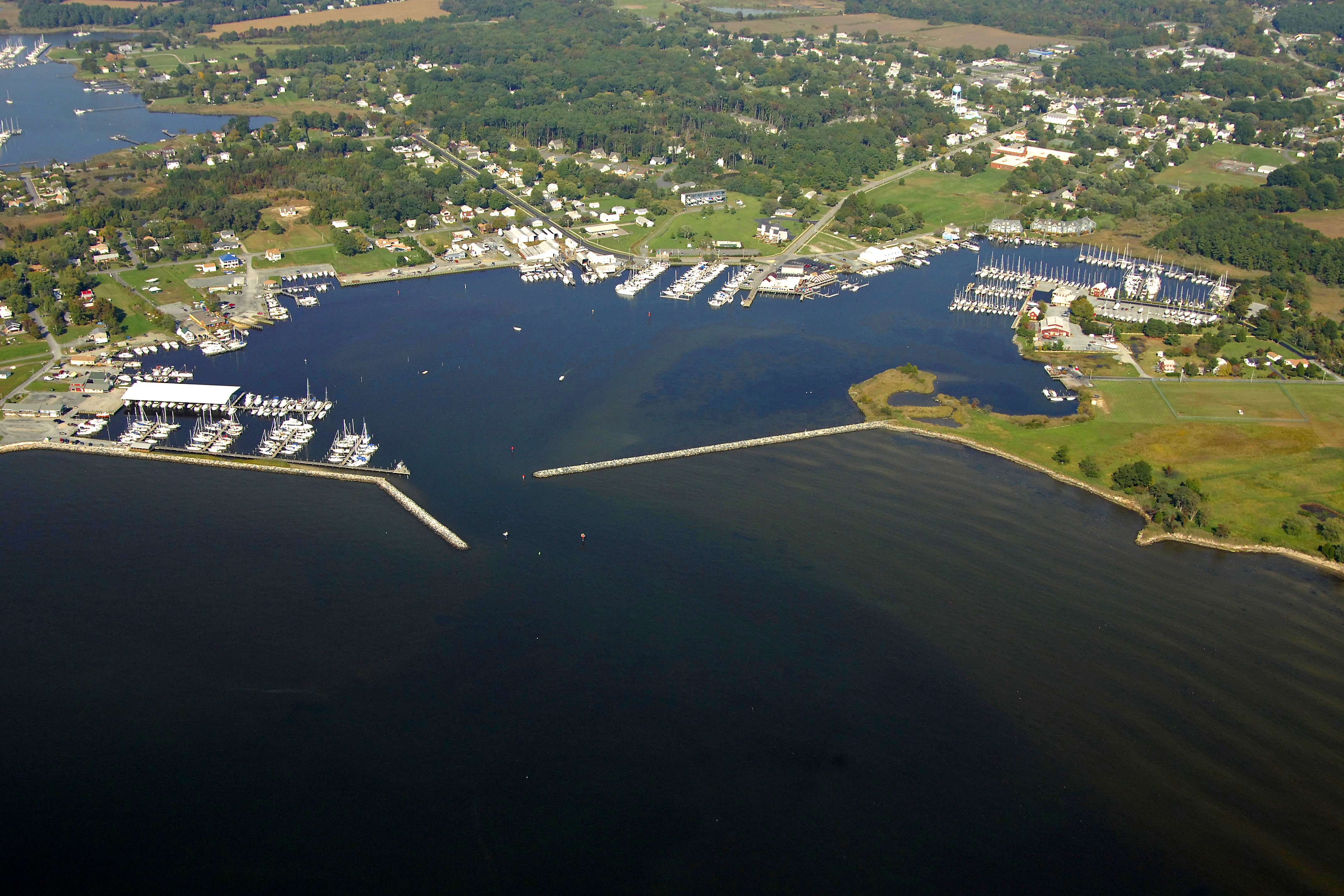
We recommend heading down to green can 3, which marks the southern end of the Swan Point Bar, and then head for flashing red buoy 4. From here, set a course for green can 1, and then for flashing green 5 and flashing red 4, which mark the breakwatered entrance to the harbor (visible in the image above).
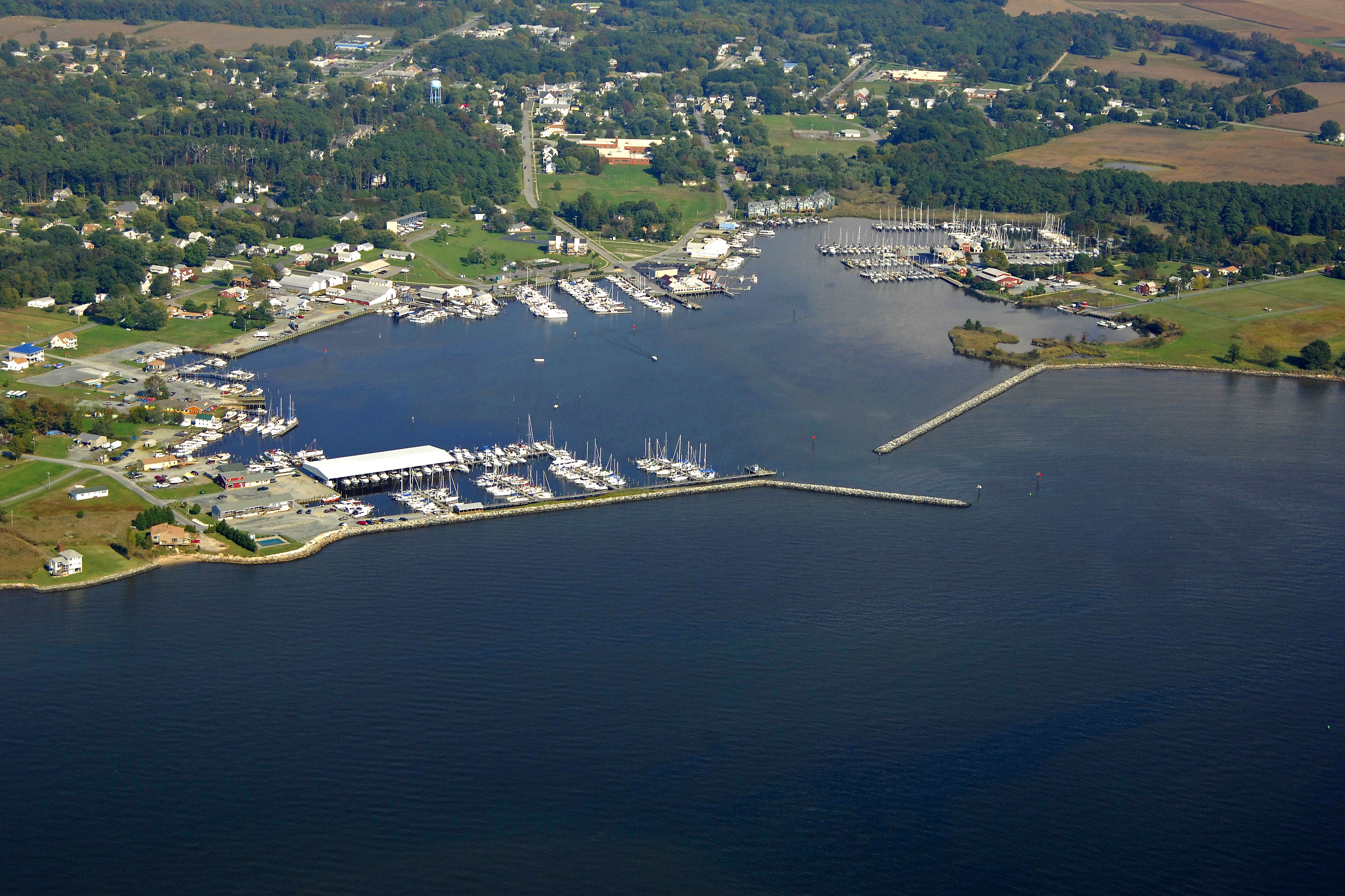
Once inside, the harbor is laid out in a roundabout fashion, with the centerpiece being a large two-foot-deep deep shoal that all the aids to navigation circulate around. Several marinas, repair facilities and a couple of popular waterfront restaurants line the shores here.
To reach Swan Creek, we also recommend heading down to green can 3, which marks the southern end of the Swan Point Bar, and then head for flashing red buoy 4. From here, green can 6 leads you to flashing red 6 and in toward Swan Creek (keep an eye out for the lit breakwater around the Gratitude Marina). Red nuns 6A and 6 keep you clear of the shoal extending from Gratitude at its northern end.
Once inside, follow the fixed aids and daybeacons, but keep in mind that green can 9A has a shallow spot extending past its location; give it a wide berth. Upstream there are four major marinas, and two have repair service available.
Local Notices to Mariners:
Local Notices to Mariners are available online from the U.S. Coast Guard.