Cape May Inlet


You might also consider...


About
Navigating the Water:
The Cape May Inlet is a deep, all-weather inlet that allows thousands of boats to safely travel to and from the Atlantic Ocean and Cape May Harbor every year. Located five miles east of Cape May Point off the Atlantic Ocean, which is near Cape May Channel, the inlet allows access to Cape May Harbor and Jarvis Sound. Jarvis Sound leads north along the New Jersey Intracoastal Waterway toward Wildwood and Cape May Harbor leads south to meet up with the Cape May Canal, which eventually empties into Delaware Bay. Cape Harbor is also the location of southern terminus of the New Jersey Intracoastal Waterway.
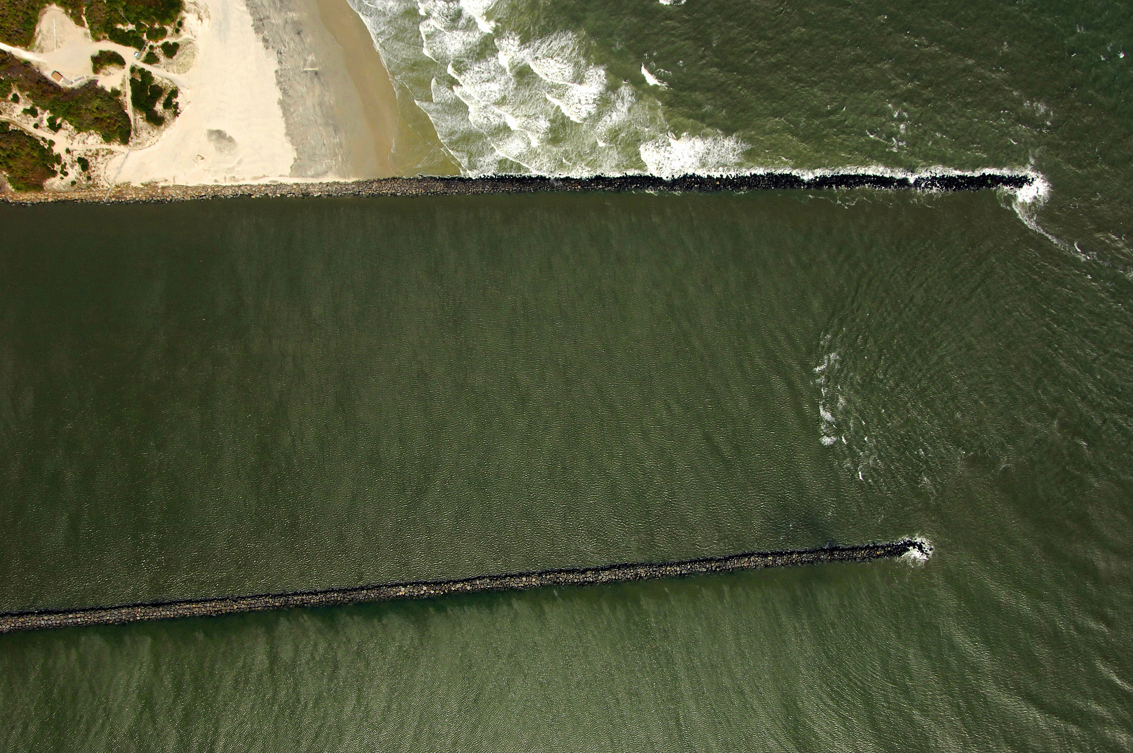
The image above is a view from the east looking west over the Cape May Inlet where Cape May Harbor and Jarvis Sound empty into the Atlantic Ocean. Cape May Harbor can be seen entering the inlet from the left (south), while Jarvis Sound is visible behind the inlet to the right (north). The beach on the right-hand portion of the image is Two Mile Beach, and just behind it is a 641-foot-high LORAN tower, which is an excellent landmark when approaching from offshore.
There are 22 marinas in the Cape May Harbor area. The largest group is centered around the Cape Island Creek and northern terminus of the Cape May Canal. The second group, located near the inlet and visible in the image above consists of about six marinas. These are among the finest in Cape May, and you can find transient slips, gas and diesel fuel, lifts for haul-outs and related repairs, and a host of sub vendors at most facilities specializing in electronics, engine, hull, and propeller repairs.
Navigating the Water:
Use NOAA Chart 12316. Arriving from offshore, keep a sharp eye out for the charted LORAN tower on the east side of the inlet; it makes a good long-distance landmark on your arrival from offshore. Closer in, flashing red bell buoy 2CM marks the initial approach toward the Cape May Inlet. After picking up flashing red buoy 2CM, set an approximate course of 332 degrees magnetic for .6 mile until you reach flashing red 4 and flashing green 5 on the north and south jetties of the inlet, respectively. Inside the inlet you will find 19- to 25-foot depths, but keep in mind that like any inlet, a strong current that opposes the wind can stir up a bit of a chop.
Farther inside you have the choice of heading north or south. Flashing red buoy 2 is the point where you will bend off gradually to the northwest up Jarvis Sound, while flashing green buoy 3 will lead you into Cape May Harbor. The majority of Cape May Harbors marinas are situated in the southern and northwestern portions of the harbor.
Local Notices to Mariners:
Local Notices to Mariners are available online from the U.S. Coast Guard.