Point Judith Pond Inlet
| Jerusalem, Rhode Island United States | |
| 41° 22' 26.05'', -71° 30' 51.83'' | |
| Snug Harbor |


You might also consider...


About
Introduction:
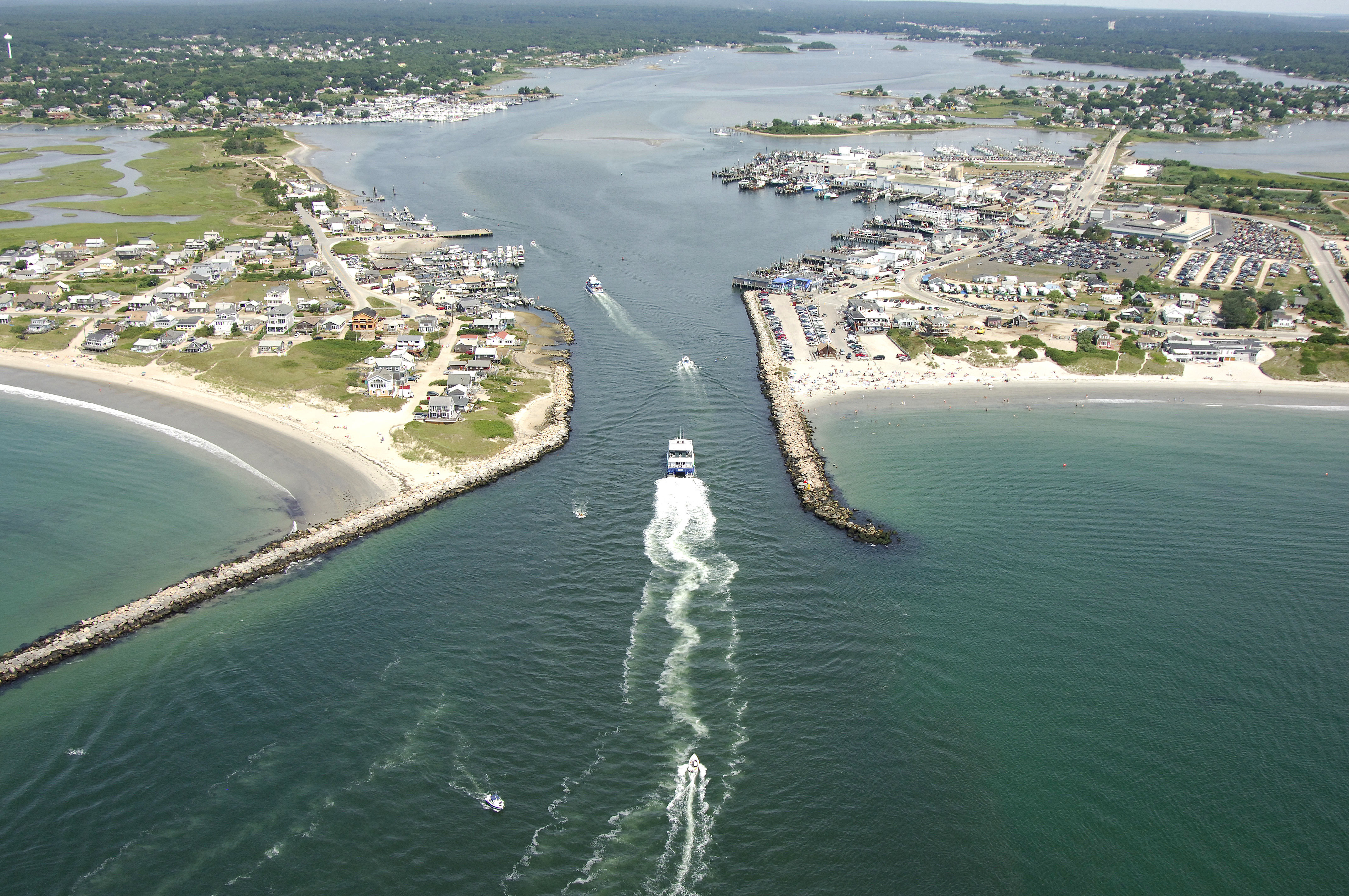
Point Judith Pond is located 13 miles southwest of Newport and almost 15 miles north of Block Island on Rhode Islands southern coastline. Beside tying up and relaxing for the evening, boaters enjoy the Point Judith area for its fine beaches, unique home-style seafood restaurants and idyllic northeast feel. Called Salt Pond by local residents, commercial fishing and boating dominate the economy here. Inside at Point Judith Pond are a wide array of marine facilities, fish coops, commercial fishing piers and ferry terminals that stretch all the way up to Wakefield, RI, at the head of the pond about four miles north of the inlet.
The towns of Galilee, Jerusalem, Snug Harbor and Wakefield all line Point Judith Pond, and each town has a wide variety of marine service establishments that will serve the cruising mariner. Jerusalem and Galilee are obviously the closest to the inlet, and as such their facilities are the most popular and heavily used. If you fail to find a place to tie up at the inlet, you can move just a bit farther north to Snug Harbor, or to Wakefield about 3.5 miles farther.
Local Notices to Mariners:
Local Notices to Mariners are available online from the U.S. Coast Guard.
Navigating the Water:
Use NOAA Chart 13219.
Point Judith Pond is protected by a series of breakwaters and jetties that form the Point Judith Harbor of Refuge right outside the main inlet to the pond. There are two breaks in the outer jetty, and either entrance is safe for passage (although the east entrance is deeper). Inside at the Point Judith Harbor of Refuge, there is a designated anchorage behind the V- shaped notch in the jetty, but holding is poor, especially in windy weather.
From the Atlantic Ocean, first set a course for flashing red 2 and flashing green 3 (horn) on the dividing breakwaters at the west entrance. From here, you will take a sharp turn to port to follow the channel up the west breakwater to the inlet opening itself. Red nun buoys 2, 4 and 6 mark the channel up to the inlet entrance, which is marked with flashing red 8.
Depths in the point Judith Harbor of Refuge and in the Point Judith Inlet are about 10 feet, but mariners are advised to use the area with caution. Swift currents, submerged objects and a summertime lawn of lobster pots add to the challenge of navigating here. Once inside, both Galilee and Jerusalem have marinas with transient space.