Bullock Cove Inlet
| Bay Spring, Rhode Island United States | |
| 41° 44' 44.88'', -71° 21' 12.96'' | |
| Warwick Harbor |
You might also consider...


About
Introduction:
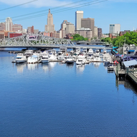
Bullock Cove is located on the Providence River about six miles south of Providence and five miles northeast of Warwick near Bullock Neck. Although broad and wide, the cove offers good protection from most directions, except from the south, which is open to the Providence River.
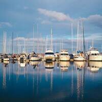
Inside Bullock Cove there are three marinas, and one of them offers facilities for transient guests. You may also be able to arrange (for a fee) use of one of the marinas facilities if you are anchored or moored out.
Navigating the Water:
Use NOAA Chart 13221.
From the Providence River, flashing green buoy 1 marks the beginning of the approach channel to Bullock Cove, and is then followed by red nun 2, green can 1A, red nun 2A, green can 3, red nun 4, green can 5 and red nun 6. Once you have cleared the preliminary marks, a series of privately maintained daybeacons will guide you the rest of the way in. Depths in the approach channel are six feet, and there is a breakwall at the inlet on the west side (unmarked).
Inside the cove, two marinas are visible immediately upon entrance, one to the east and one to the west. Farther upstream is the third marina, which is surrounded by moorings and anchored boats. Moorings on the entire cove are administered by a few different entities, and if there are no instructions on the mooring, expect a visit for payment at some point during your stay. Depths in the cove shallow rapidly to three feet above the last marina.
Local Notices to Mariners:
Local Notices to Mariners are available online from the U.S. Coast Guard.
Reviews
Well-protected but shallow. 3 commercial marinas: One corrupt (managed by harbormaster), one incompetent (drops classic yachts, dismasts boats with free-swinging crane) and one very pricey. No rental moorings, no anchorage on more than 2’ depth. Hazards include free-ranging derelict municipal floats.


