St. Augustine Inlet
| St. Augustine, Florida United States | |
| 29° 54' 32.04'', -81° 17' 12.11'' | |
| St. Augustine |

You might also consider...


About
Introduction:
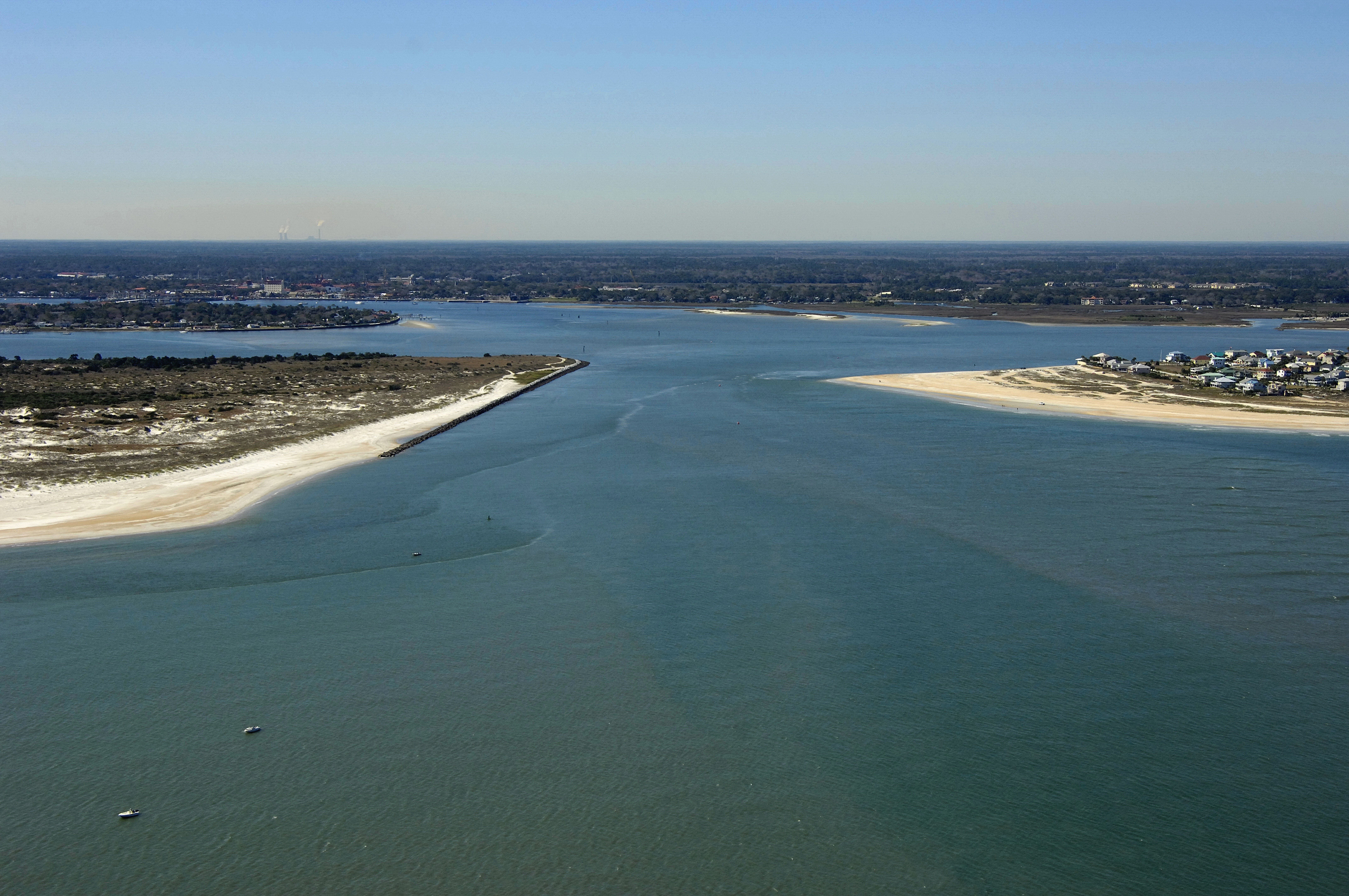
The image above is a view from the east looking west over the St. Augustine Inlet. Cape Francis and Conch Island are visible to the left (south), while Vilano Beach can be seen on the right (north) side of the inlet passage. The deeper portion of the inlet is visible as a darker strip of water on the south side of the inlet, but only use this as a general guide.
If you decide to attempt the St. Augustine Inlet, you should only do so with advance local knowledge from a reputable source. Alternatively, you can follow a locally-hailed boat in, but keep in mind your leader may be as unaware of conditions as you.
Navigating the Water:
Use NOAA Chart 11485.
The St. Augustine Inlet is by far the most dynamic part of the area where it, the Tolomato and Matanzas rivers converge. Though local boats use this are heavily and frequently, visiting boaters should be aware that the inlet is potentially hazardous during storm conditions when wind meets current. The shallowest portion of the inlet, by far, is the area around the outside markers, which are uncharted, as they are moved frequently by the Coast Guard to reflect the deepest area of the inlet. If you are in doubt as to current conditions in the inlet, you should call ahead to one of the St. Augustine-area marinas or to the SeaTow or BoatU.S towing operations in the area.
North of the inlet, the Tolomato River passes under the Usina Bridge (65-foot fixed vertical clearance) just north of flashing green 57A, and then proceeds south toward the St. Augustine Inlet past red nun buoy 58C, red nun buoy 58D, an unnumbered flashing red light, red nun 58E, green nun 59, and then red nun 60. Once you have picked up red nun 60, you can set a course southwest toward flashing green 1 and red nun 2, which both mark the beginning of the Matanzas River north of St. Augustine.
Once you have cleared flashing green 1 and red nun 2, the channel bends toward the west past Davis Shores, eventually turning south near the Bridge of Lions (25-foot closed vertical clearance, replacement span under construction). The Matanzas River then flows south all the way to ICW Mile 810 near Silver Lake.
There are many marinas in the St. Augustine area, and most of them cater to transient guests, as this area is very heavily used by cruising boaters. North of the Usina Bridge and the St, Augustine Inlet is the Camachee Cove facility, which has a repair yard, large transient marina, and restaurant bar with dockside slips. The majority of the rest of the marinas are located up the San Seastian River in St. Augustine, with repair yards and transient marinas on the south and north ends of the river.
Local Notices to Mariners:
Local Notices to Mariners are available online from the U.S. Coast Guard.
Reviews
Easy inlet, at high tide saw no less than 15 feet, just don’t try to shortcut the corners.
Can be very tricky to enter or exit this inlet due to strong currents and shoal in along the north side of the channel. Recent dredging in the Intracoastal has been completed.