


Manatee River Harbor
Bradenton, Florida United States
Marinas near Manatee River Harbor
| Name | Reviews | Max LOA | VHF | Dock Depth | Gas / Diesel | Lift / Crane | Wifi | Amps |
|---|---|---|---|---|---|---|---|---|
| Bradenton Yacht Club | - | 185.0' | 16 | - | GYesDYes | - | 30, 50 | |
| Cut's Edge Harbor Marina | - | 60.0' | - | Low 0.0 mHigh 0.0' | - | LYes | - | 30 |
| Marsh Harbor Marina | - | - | - | - | LYes | - | - | |
| Marlow Marine | - | 97.0' | - | - | - | LYes | - | - |
| Snead Island Boat Works | 65.0' | - | Low 8.0'High 0.0' | - | LYes | - | 30, 50 | |
| Tropic Isles Marina | - | - | - | - | - | - | - | |
| Safe Harbor Regatta Pointe | 100.0' | 71 | Low 8.0'High 0.0' | G$5.10/galD$4.10/gal | - | - | 30-50 | |
| Blenker Boatworks & Marina | - | 65.0' | 16 | Low 5.0'High 0.0' | GYes | LYes | - | 30, 50 |
| Twin Dolphin Marina | 110.0' | 72 | Low 8.0' | G$6.799/galD$6.899/gal | - | 30, 50 | ||
| Riviera Dunes Marina - Sales/Leasing | 120.0' | 16 | Low 18.0'High 0.0' | GYesDYes | - | 30, 50, 100 | ||
| Riviera Dunes - Association | - | 68 | Low 16.0' | G$6.899/galD$6.309/gal | - | - | ||
| Manatee River Marina | 40.0' | - | - | G$7.53/gal | - | - | - | |
| Safe Harbor Pier 77 | 50.0' | 67 | Low 7.0' | G$7.95/galD$7.49/gal | - | 30-50 AMP | ||
| Parrot Cove Marina | 65.0' | - | Low 5.0'High 8.0' | - | - | - | ||
| Palm View Marina | - | - | - | - | - | - | - |
Introduction:
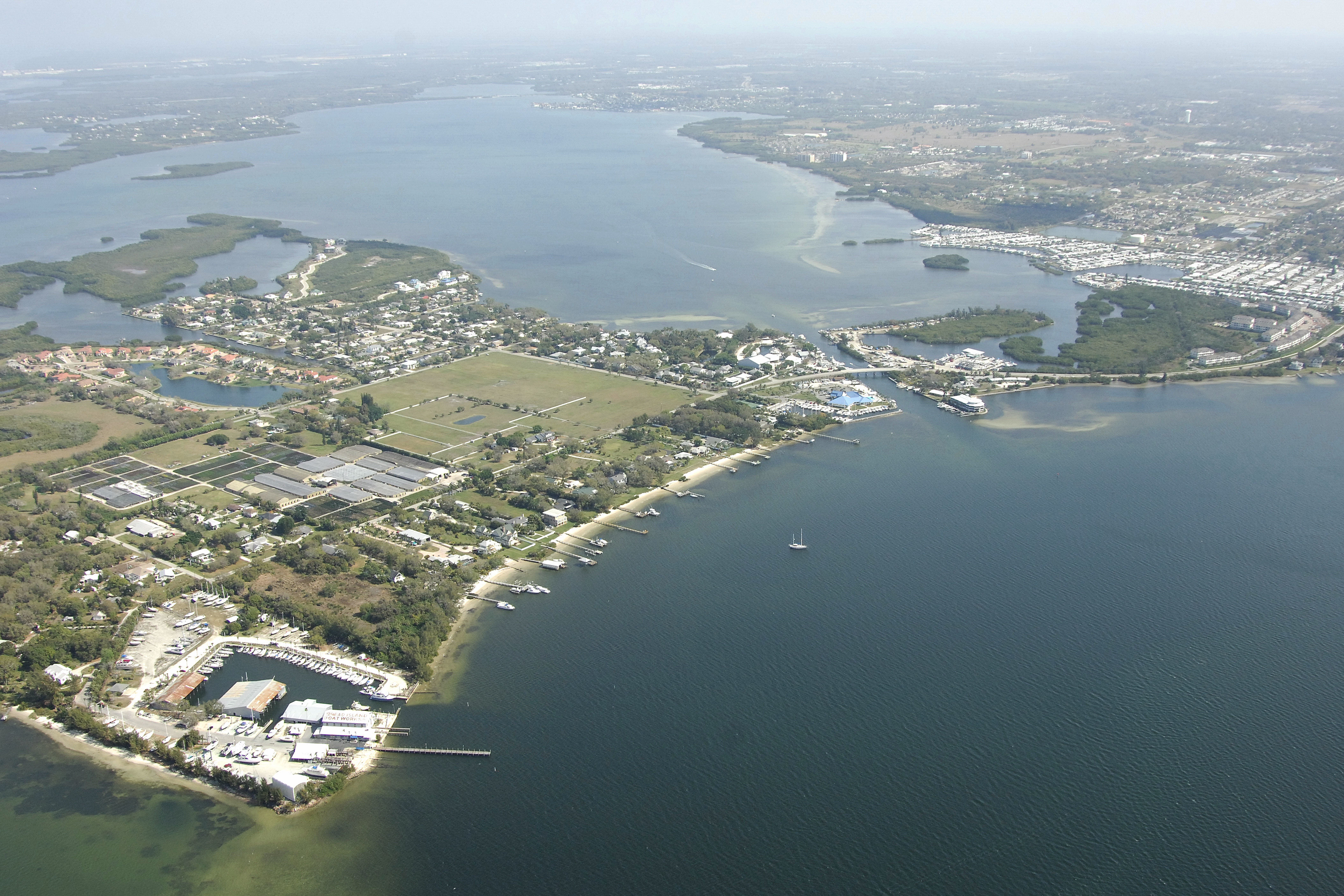
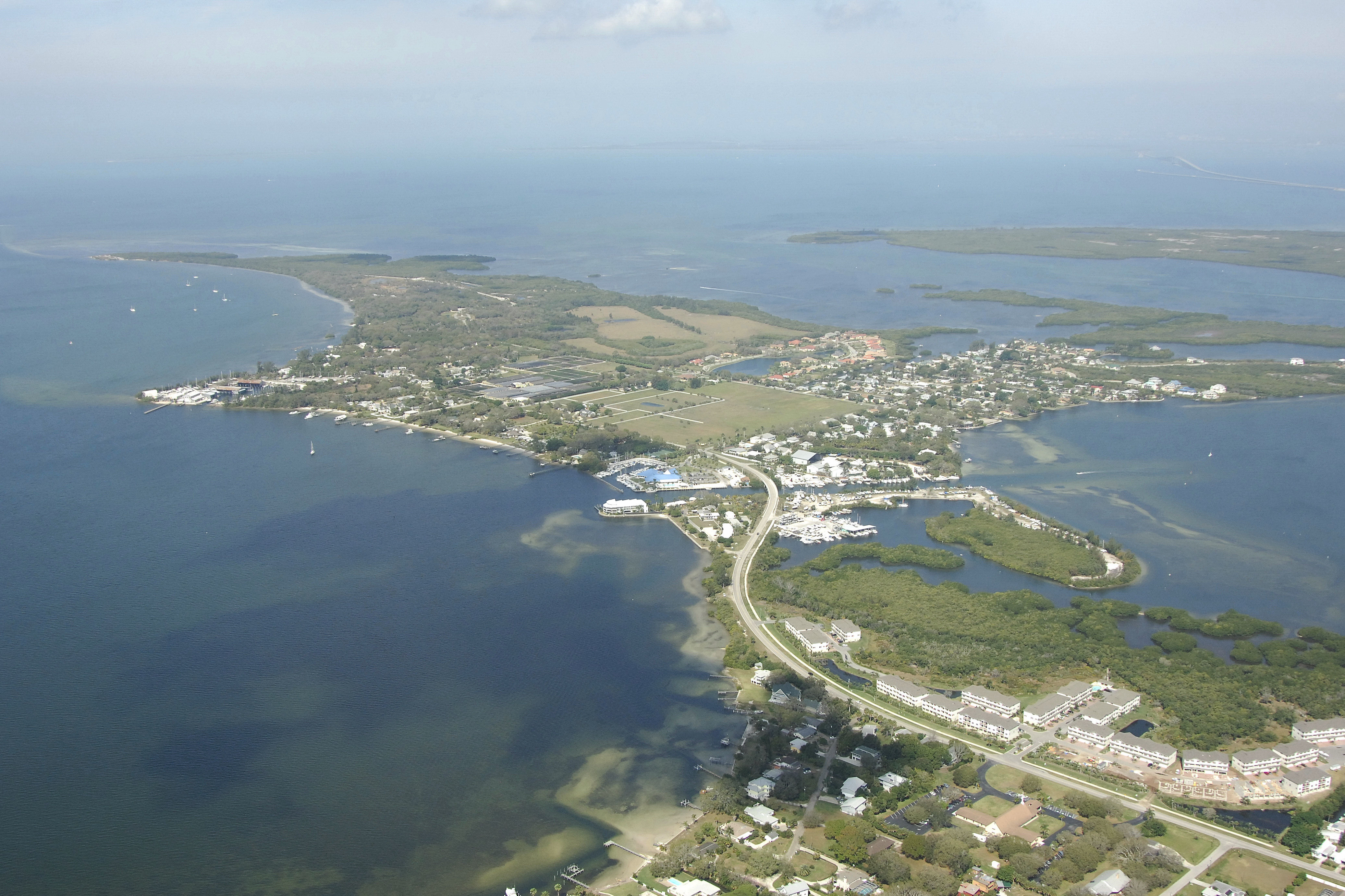
Bradenton is a moderate-sized city on the west coast of Florida about 16 miles north of the center of Sarasota and 26 miles south of the St. Petersburg-Tampa area. The aerial photo above is a view from the northeast looking southwest across the Snead Island Cutoff and the Manatee River, with Snead Island itself lying on the right (northwest) portion of the image above. The top portion of the photo shows Palma Sola Bay, and near the horizon, a small sliver of the Gulf Intracoastal Waterway can be seen.
Navigating the Water:
Snead Cut is pictured above, and has three-foot depths. The cut separates Snead Island (right) from mainland Bradenton, but also allows travel from Teira Ceia Bay to the Manatee River and vice-versa. Although there are plenty of shoals dotting the Manatee River, there are some excellent anchoring areas and places to explore. Be sure to mind the narrative below to ensure you can pass under he fixed bridges on the Manatee River if yours is a tall mast.
The primary area for marinas and boating interests is located to the left (east) around the set of three bridges that cross the Manatee River. Traveling east, the first two marinas are on opposite shores of the river before the first bridge, a fixed 41-foot vertical clearance bridge. The last marina in the locality of the bridges is farther past the aforementioned fixed bridge through a bascule bridge (five-foot closed vertical clearance, opens on demand) and another fixed bridge with a 40-foot vertical clearance. This last marina lies just north (to port) behind Craig Point after you go under the last bridge. Snead Island Boatworks is located to the right (west) in the image above and has the only lift for haul-outs and related repair services in this local area.
Local Notices to Mariners:
See our Local Notices to Mariners blog for updates on the latest conditions and advisories for this area.
Things To Do/Local Events:
The beaches of Sarasota and Anna Maria Island are to the west, while St. Petersburg and Tampa are only a moderate distance away across the Sunshine Skyway Bridge. Whether its beaches in the local area, or shopping, museums, and sightseeing in the larger cities close by, boredom seldom settles in for mariners in the area. For a detailed calendar of events for the area, see our Helpful Links section below for more details.
Transportation:
The Sarasaota-Bradenton International Airport is located only nine miles to the southeast of Bradenton and features regular daily jet service from several major national carriers. A shuttle can be arranged to/from the airport, or you can arrange for a taxi cab to shuffle you off to the airport from the Bradenton area.
Helpful Links:
Manatee-Bradenton Chamber of Commerce