


Knapps Narrows Harbor
Tilghman, Maryland United States
Marinas near Knapps Narrows Harbor
| Name | Reviews | Max LOA | VHF | Dock Depth | Gas / Diesel | Lift / Crane | Wifi | Amps |
|---|---|---|---|---|---|---|---|---|
| Fairbanks Bait & Tackle | - | - | - | - | - | - | - | - |
| Fairbank Tackle | - | - | - | - | GYes | - | - | - |
| Severn Marine Service | - | 57.0' | - | Low 6.0'High 0.0' | - | LYesCYes | - | 30 |
| Knapp's Narrows Marina and Inn | - | 100.0' | 16 | Low 7.0'High 0.0' | GYesDYes | LYes | 30, 50 | |
| Tilghman Island Inn | - | 36.0' | 16 | Low 3.0'High 0.0' | - | - | 50 | |
| Tilghman Island Marina | 125.0' | 16 | Low 10.0'High 0.0' | - | - | 30, 50 | ||
| Talbot County Pier | - | 0.0 m | - | Low 0.0 mHigh 0.0' | - | - | - | - |
| Wylder Hotel Tilghman Island | - | - | - | - | - | - | - | - |
| Tilghman-On-Chesapeake | - | 50.0' | - | Low 7.0'High 0.0' | - | - | twin 30 single 50 | |
| Lowes Wharf Marina Inn | - | 60.0' | - | Low 4.0'High 0.0' | GYesDYes | - | 30 | |
| St Michaels Marina LLC | 230.0' | 16 | Low 9.0' | G$5.099/galD$5.399/gal | - | 30 AMP, 50 AMP, 100 AMP | ||
| Higgins Yacht Yard | 100.0' | 16 | Low 6.0' | - | LYesCYes | 30 amp & 50 amp | ||
| St Michaels Harbour Inn Marina & Spa | 150.0' | 16 | Low 10.0' | GNearbyDNearby | - | 30 Amp 50 Amp 100 Amp | ||
| Chesapeake Bay Maritime Museum | 229.0' | 16 | Low 10.0' | GYesDYes | - | 30, 50, 100 | ||
| Miles River Yacht Club | 60.0' | 68 | - | - | - | - |
Introduction:
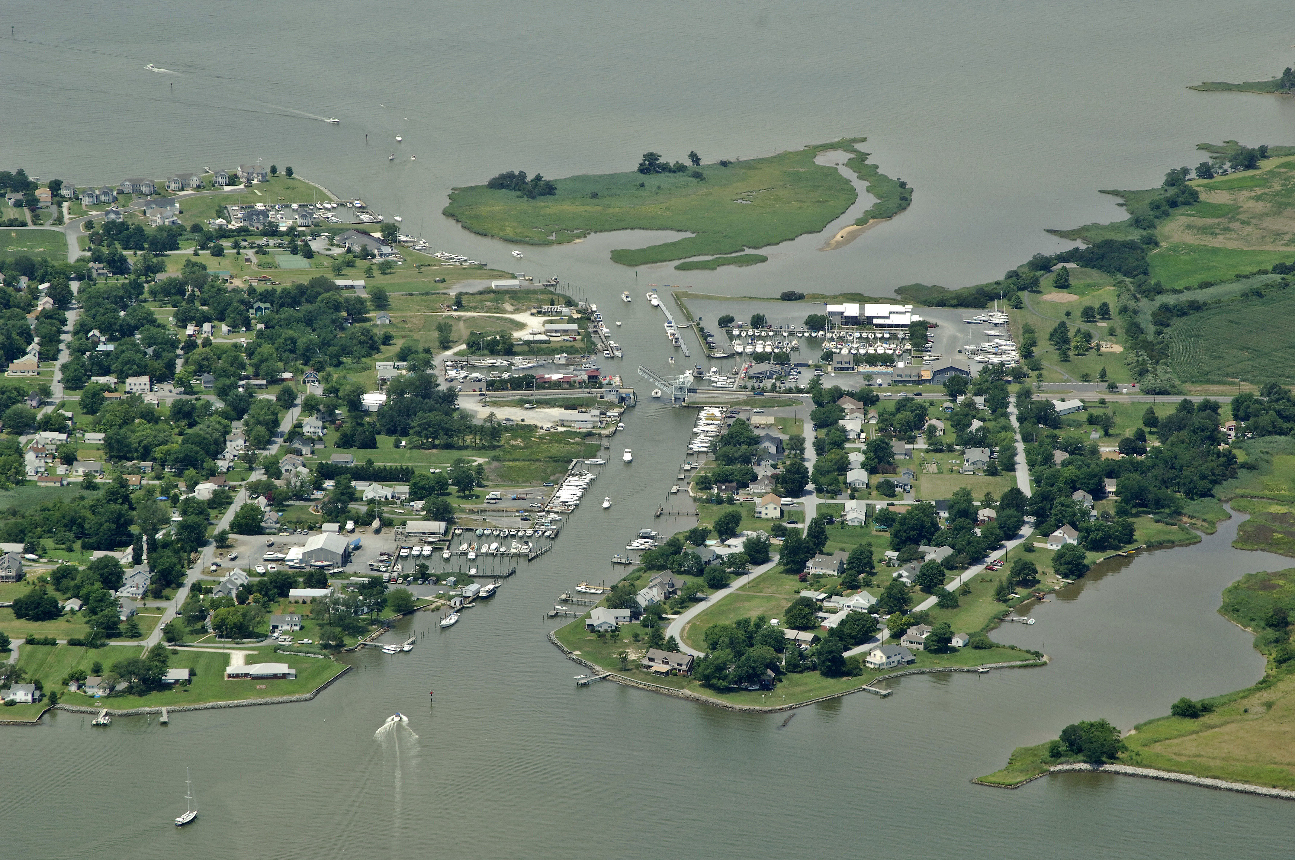
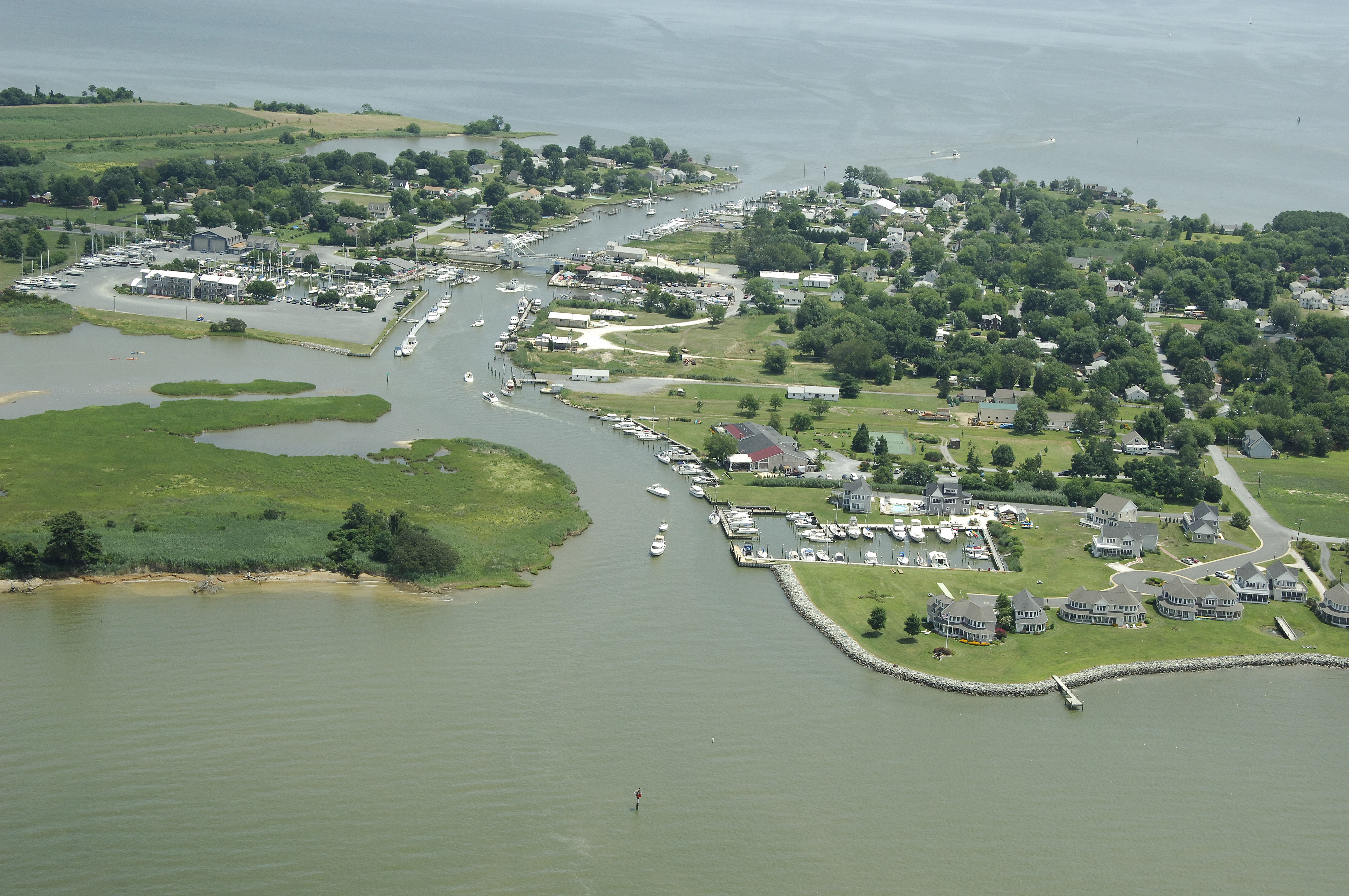
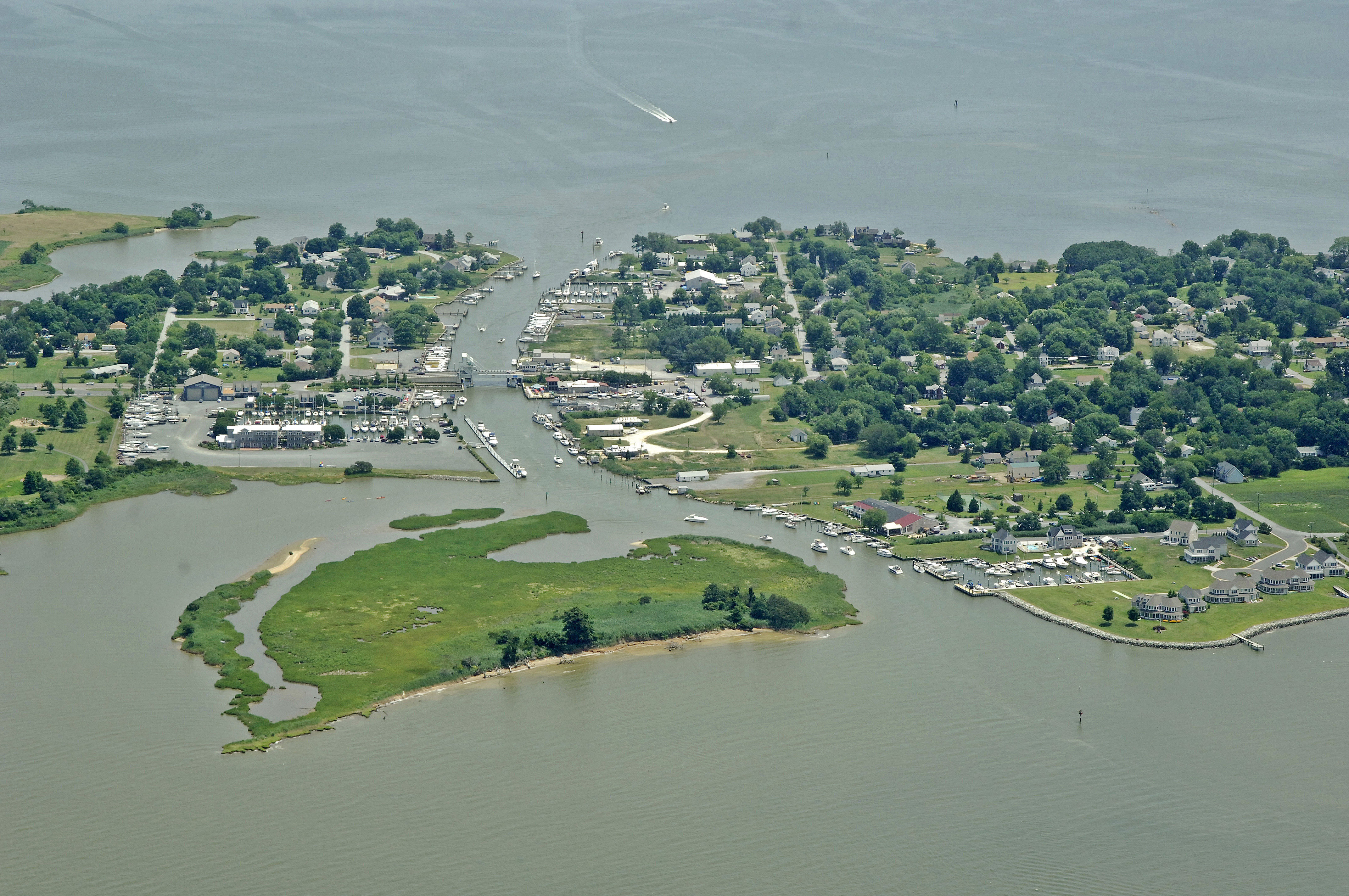
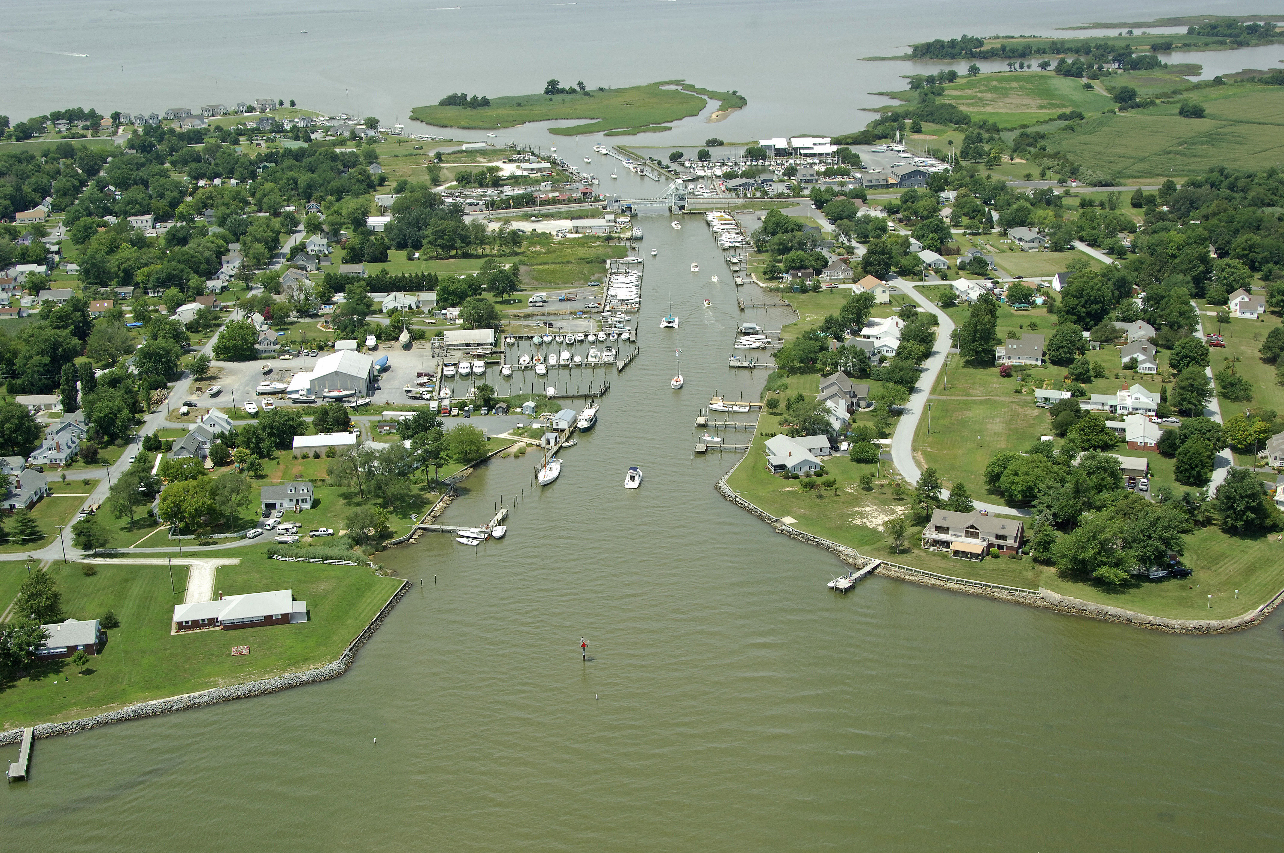
Knapps Narrows is a water break in the Tilghman Island Peninsula that not only allows access to the Choptank River from the Chesapeake Bay without rounding Blackwalnut Point, but also serves as home to some of the last remaining fishing vessel that sails - the Chesapeake Bay Skipjack. Knapps Narrows is 18 miles from Annapolis and loacted in the mid-Bay region.
Navigating the Water:
Use NOAA Chart 12266.
Although the rehabilitation of Poplar Island (to the west) has had a significant beneficial effect on the shoaling problem at Knapps Narrows, shoaling does still exist, and boats with drafts over 6.5 feet should not attempt the passage at any tide.
From the east, flashing green 1 marks the entrance approach to Knapps Narrows, followed by flashing red 4, and then green daybeacon 5. From here, you must pass through the Knapps Narrows Bascule Bridge (12-foot closed vertical clearance with 42 feet of horizontal clearance in the center span). The bridge opens on demand 24 hours a day. There is a small but well equipped marina just to the east of the bridge where transient dockage or repairs can be arranged.
Flashing green 3 marks the eastern approach to Knapps Narrows. After clearing this mark, set a course for green daybeacon 5, and then flashing red 6 (visible in the image above). During any change of the tide, be sure to keep an eye on your position within the Narrows to ensure you are not being taken off course, and possibly aground.
Local Notices to Mariners:
Local Notices to Mariners are available online from the U.S. Coast Guard.