


Noank Harbor
Noank, Connecticut United States
Marinas near Noank Harbor
| Name | Reviews | Max LOA | VHF | Dock Depth | Gas / Diesel | Lift / Crane | Wifi | Amps |
|---|---|---|---|---|---|---|---|---|
| Noank Village Boatyard | 130.0' | 72 | - | - | LYesCYes | - | ||
| Noank Marine Service | - | 0.0 m | - | Low 0.0 mHigh 0.0' | - | - | - | - |
| Ram Island Yacht Club | - | - | - | - | - | - | - | - |
| Haring's Marine | - | 0.0' | 9 | Low 0.0 mHigh 0.0' | GYesDYes | - | - | - |
| Maxwell Boat Yard | - | 0.0' | - | Low 0.0 mHigh 0.0' | - | - | - | - |
| Mystic River Marina | - | 9 | - | G$5.049/galD$5.269/gal | LYes | 30, 50, 100 | ||
| Spicer's Noank Marina | 60.0' | 68 | - | - | LYesCYes | - | ||
| Noank Shipyard | 300.0' | 9 | Low 12.0' | G$5.10/galD$5.15/gal | LYesCYes | 30, 50 | ||
| Mystic Shipyard West | 0.0' | 9 | Low 0.0 mHigh 0.0' | - | LYes | - | ||
| Willow Point Marina | - | 0.0 m | - | Low 0.0 mHigh 0.0' | - | - | - | - |
| Mason's Island Yacht Club | - | 0.0 m | - | Low 0.0 mHigh 0.0' | - | - | - | - |
| Palmer's Cove Marina | - | 23.0' | - | Low 2.0'High 5.0' | - | - | - | - |
| Mason's Island Marina | 0.0 m | - | Low 0.0 mHigh 0.0' | - | - | - | - | |
| Safe Harbor Mystic | 65.0' | 9 | Low 11.0' | G$5.509/galD$5.789/gal | LYesCYes | 30, 50, | ||
| Fort Rachel Marina | 60.0' | 9 | Low 8.0'High 0.0' | - | LYesCYes | 30/50 |
Introduction:
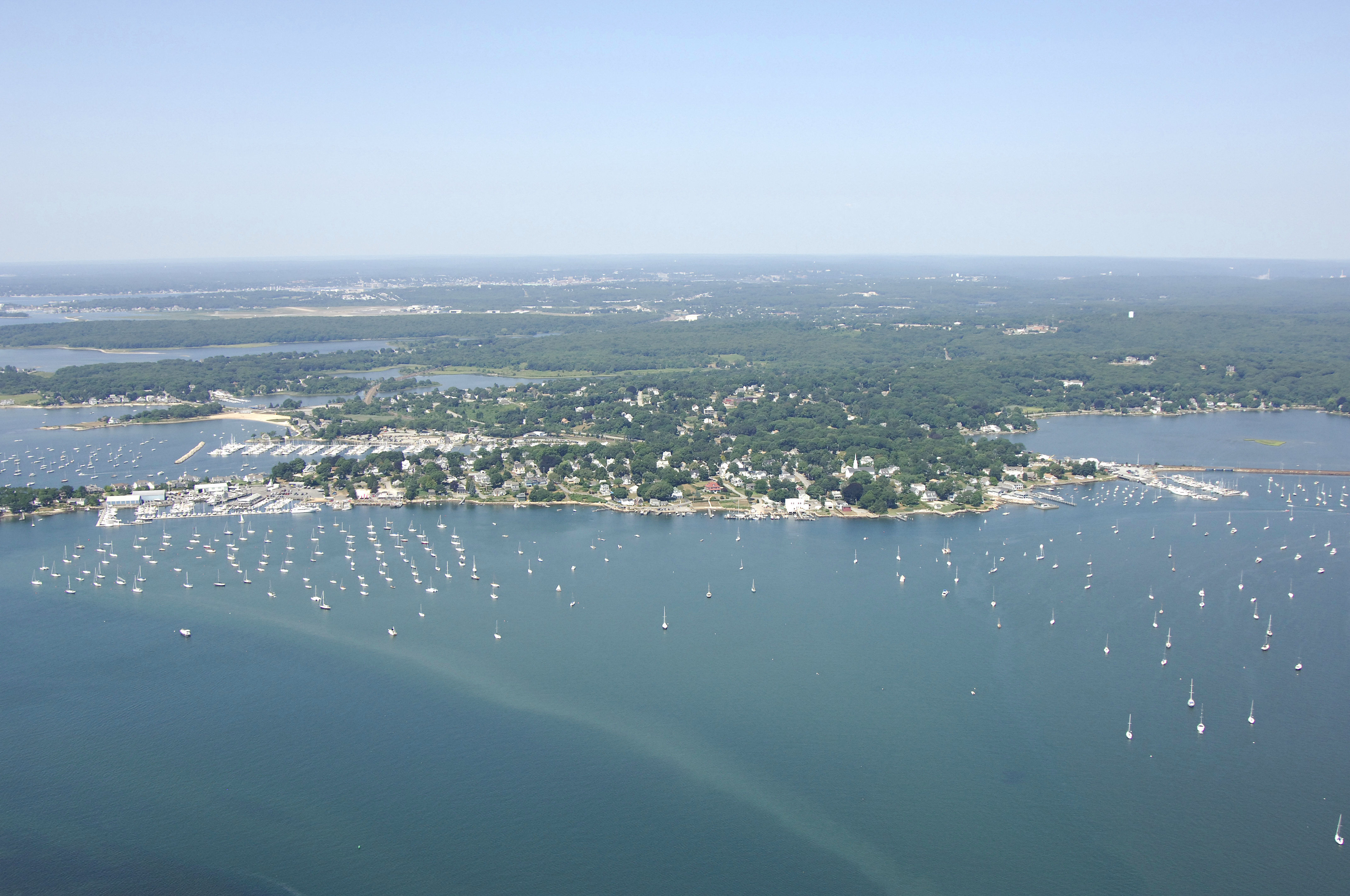
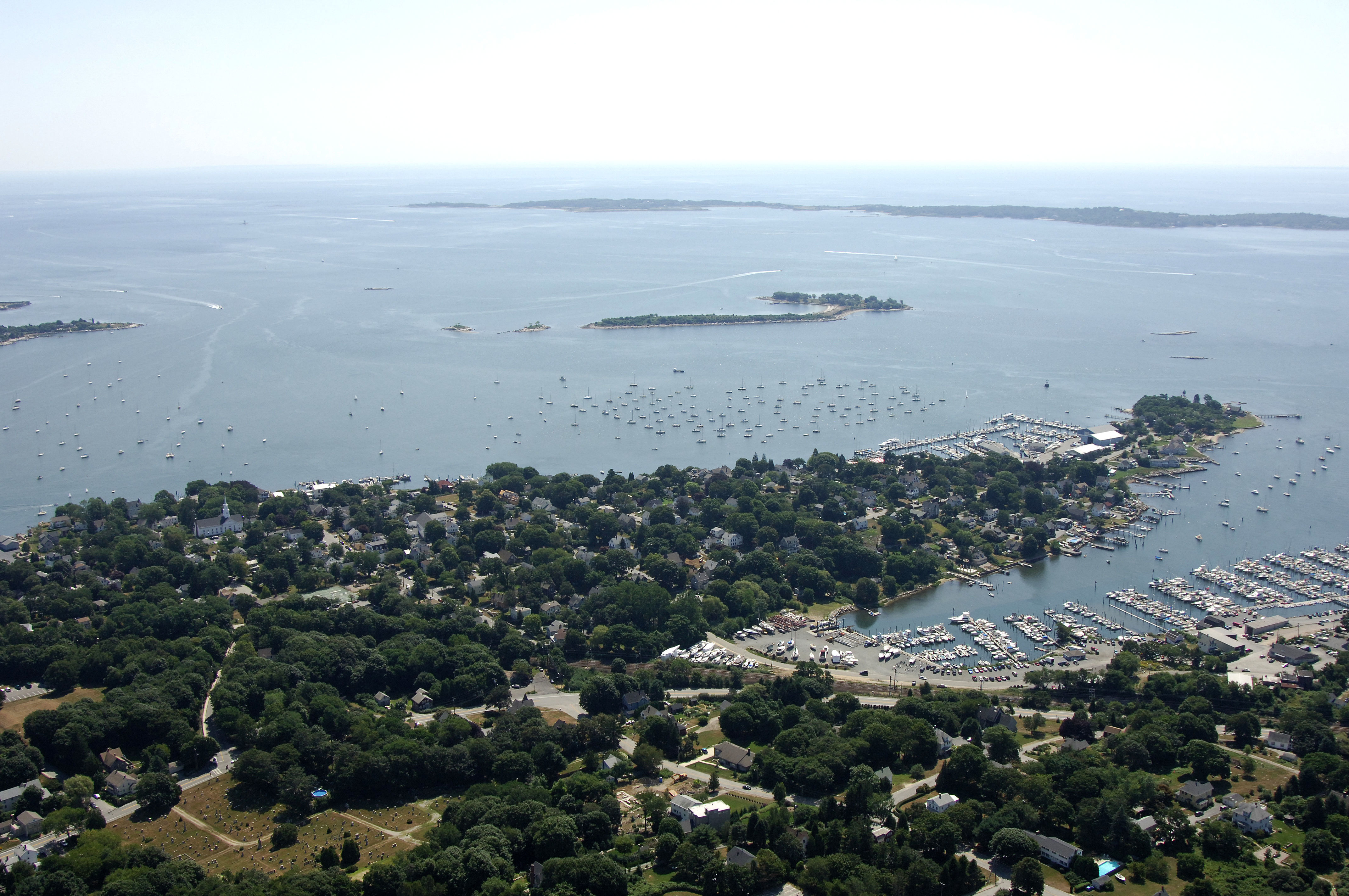
The town of Noank is located on a small peninsula that is bordered by Bebee Cove to the north, Morgan Point to the south, West Cove (fittingly) to the west, and Mystic Harbor to the east. Noanks relatively close location to Fishers Island Sound make it an extremely convenient stopover point for transient cruisers passing through this region of the Connecticut shore who do not want to contend for space in, or travel to, Mystic to the north.
Navigating the Water:
Use NOAA Charts 12372 and 13214.
There are two boating areas in Noank: Mystic Harbor and West Cove. The east side of the Noank Peninsula (Mystic Harbor) has three large marinas with transient space, and a couple of marine repair facilities that offer dockage to customers. The west of the peninsula (West Cove) has two large marina facilities. Both areas have hundreds of moorings, some of which may be available for transient use.
[b]Mystic Harbor Approach:[/b]
Use NOAA Charts 12372 and 13214.
Mystic Harbor is approached form the south via Fishers Island Sound between Ram Island Shoal and Morgan Point. The start of the approach into Mystic Harbor from Fishers Island Sound is marked by green can 1 about a mile southwest of Swimming Rock. From here, head north toward red nun 2 and green can 3 marking Planet and Swimming rocks, respectively.
The rest of the channel up to the town of Mystic hugs the west shore of Mystic Harbor for about a mile, and then it bends back to the east at Mason Island. Picking up from red nun 2 and green can 3, plot a course for quick flashing red buoy 4, and note on the chart that this is a rocky area that requires your attention. Next head toward quick flashing green 5 at the start of the narrow entrance channel to Mystic, and then follow red nuns 6 through 20. The Noank marinas are located just off the west side of the channel al the way up the Noank Peninsula to Bebee Cove.
[b]West Cove Approach:[/b]
Use NOAA Charts 12372 and 13214.
West Cove is mainly unmarked, save for a couple of daybeacons north of Mouse Island. The entire cove has no lighted markers, so any evening approaches should only be attempted with radar and an accurate depth sounder.
From Fishers Island Sound, pick up green can 1 south of Planet and Swimming rocks at the entrance to Mystic Harbor. Once you have cleared green can 1, head northwest to green can 3, and then north to green daybeacon 1 at Mouse Island, making sure to give the island itself good distance on approach to the daybeacon. The channel has six- to eight foot depths among the mooring field up to the semi-breakwatered marina.
Local Notices to Mariners:
Local Notices to Mariners are available online from the U.S. Coast Guard.